Randonnée Vélo électrique Lachamp-Ribennes - promenade momo - Photo
 Romain Dechamboux
Romain Dechamboux

Utilisateur

© OpenStreetMap contributors
Longueur
Longueur
50 km
Altitude max
Altitude max
1373 m
Dénivelé positif
Dénivelé positif
1214 m
Km-Effort
Km-Effort  
67 km
Altitude min
Altitude min
977 m
Dénivelé négatif
Dénivelé négatif
1275 m
Boucle
Boucle
Non
Date de création :
2023-10-15 09:19:02.555
Dernière modification :
2023-10-15 11:04:36.758

(0 Avis)

Vélo électrique
Vélo électrique
1h45
Difficulté : Très facile

Scannez ce code QR pour ouvrir la randonnée dans l'application SityTrail

Application GPS de randonnée GRATUITE

Logo SityTrail SityTrail

IGN / Instituts géographiques

Télécharger SityTrail sur l'App Store Télécharger SityTrail sur Google Play

Logo SityTrail SityTrail World

Le monde est à vous

Télécharger SityTrail sur l'App Store Télécharger SityTrail sur Google Play Télécharger SityTrail sur Huawei AppGallery

À propos

Randonnée Vélo électrique de 50 km à découvrir à Occitanie, Lozère, Lachamp-Ribennes. Cette randonnée est proposée par Romain Dechamboux.

Profil altimétrique

Localisation

Pays :
France
Région :
Occitanie
Département/Province :
Lozère
Commune :
Lachamp-Ribennes
Localité :
Ribennes
Départ:(UTM)
532720 ; 4943935 (31T) N.

Randonnées à proximité

Randonnée V.T.T. Saint-Gal - Grenaldes - Serverette - Javols - Aumont - Grenaldes - Photo
V.T.T.
Couguar5

V.T.T.

Moyen
Saint-Gal, Occitanie, Lozère, France
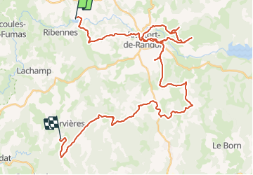
47 km | 60 km-effort
3h 19min
Oui
Randonnée V.T.T. Monts-de-Randon - parcours vers lachamp - Photo
V.T.T.
Quentin48

V.T.T.

Difficile
Monts-de-Randon, Occitanie, Lozère, France
65 km | 82 km-effort
4h 30min
Oui
Randonnée V.T.T. Monts-de-Randon - Aumont 85km - Photo
V.T.T.
Quentin48

V.T.T.

Moyen
Monts-de-Randon, Occitanie, Lozère, France
84 km | 108 km-effort
6h 0min
Oui
Randonnée Autre activité Monts-de-Randon - rieutord- aumont - Photo
Autre activité
celste

Autre activité

Très facile
Monts-de-Randon, Occitanie, Lozère, France
22 km | 28 km-effort
Inconnu
Non
Randonnée Marche Monts-de-Randon - randon - Photo
Marche
tyntyn

Marche

Facile
Monts-de-Randon, Occitanie, Lozère, France
12,2 km | 16,4 km-effort
3h 24min
Oui
Randonnée V.T.T. Monts-de-Randon - Javols - Photo
V.T.T.
maurice.carriere

V.T.T.

Difficile
Monts-de-Randon, Occitanie, Lozère, France
32 km | 41 km-effort
2h 21min
Oui
Randonnée Vélo de route Monts-de-Randon - tour de randon - Photo
Vélo de route
maurice.carriere

Vélo de route

Très difficile
Monts-de-Randon, Occitanie, Lozère, France
56 km | 68 km-effort
4h 8min
Oui
Randonnée Moto Les Laubies - didier - Photo
Moto
pignol

Moto

Très facile
Les Laubies, Occitanie, Lozère, France
31 km | 38 km-effort
1h 46min
Non
Randonnée V.T.T. Monts-de-Randon - Eleoliene - Photo
V.T.T.
maurice.carriere

V.T.T.

Très difficile
Monts-de-Randon, Occitanie, Lozère, France
32 km | 43 km-effort
3h 0min
Oui


Fermer
Mes abonnements