Randonnée Marche Pont-d'Ain - pont d'ain château d'hterive - Photo

pont d'ain château d'hterive

 loca.yves
loca.yves

Utilisateur

© OpenStreetMap contributors
Longueur
Longueur
15,1 km
Altitude max
Altitude max
252 m
Dénivelé positif
Dénivelé positif
72 m
Km-Effort
Km-Effort  
16,1 km
Altitude min
Altitude min
231 m
Dénivelé négatif
Dénivelé négatif
71 m
Boucle
Boucle
Oui
Date de création :
2024-01-23 07:15:23.049
Dernière modification :
2024-01-23 11:10:27.329

(0 Avis)

Marche
Marche
3h54
Difficulté : Difficile

Scannez ce code QR pour ouvrir la randonnée dans l'application SityTrail

Application GPS de randonnée GRATUITE

Logo SityTrail SityTrail

IGN / Instituts géographiques

Télécharger SityTrail sur l'App Store Télécharger SityTrail sur Google Play

Logo SityTrail SityTrail World

Le monde est à vous

Télécharger SityTrail sur l'App Store Télécharger SityTrail sur Google Play Télécharger SityTrail sur Huawei AppGallery

À propos

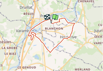
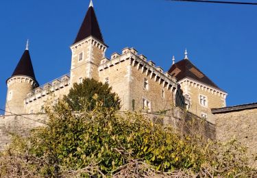
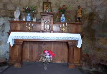
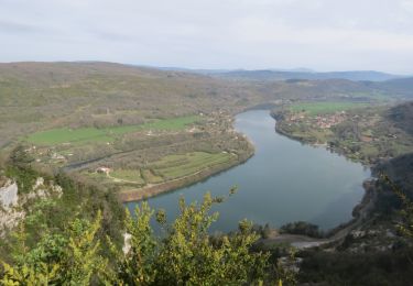
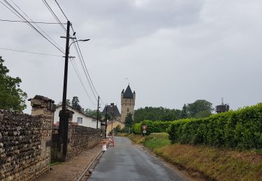
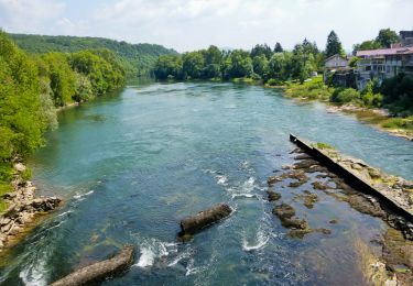
Randonnée Marche de 15,1 km à découvrir à Auvergne-Rhône-Alpes, Ain, Pont-d'Ain. Cette randonnée est proposée par loca.yves.

Profil altimétrique

Photos

Localisation

Pays :
France
Région :
Auvergne-Rhône-Alpes
Département/Province :
Ain
Commune :
Pont-d'Ain
Localité :
Unknown
Départ:(Dec)
Départ:(UTM)
681679 ; 5101802 (31T) N.

Randonnées à proximité

Randonnée V.T.T. Saint-Jean-le-Vieux - rando balcon de l'ain 40km - Photo
V.T.T.
Valery01

V.T.T.

Très facile
(2)
Saint-Jean-le-Vieux, Auvergne-Rhône-Alpes, Ain, France
38 km | 51 km-effort
3h 50min
Oui
Randonnée Marche Poncin - les bords de l ain depart povin - Photo
Marche
colomb24

Marche

Très difficile
Poncin, Auvergne-Rhône-Alpes, Ain, France
23 km | 32 km-effort
6h 25min
Oui
Randonnée Marche Jujurieux - 01-Jujurieux-Neuville-restau-18-7km-440m-fev22 - Photo
Marche
SyMA

Marche

Moyen
Jujurieux, Auvergne-Rhône-Alpes, Ain, France
18,6 km | 25 km-effort
4h 54min
Oui
Randonnée Marche Saint-Jean-le-Vieux - forêt de Saint Jean - Photo
Marche
Frasco01

Marche

Très facile
Saint-Jean-le-Vieux, Auvergne-Rhône-Alpes, Ain, France
5,8 km | 9 km-effort
1h 41min
Non
Randonnée Vélo de route Poncin - Circuit l'Ain à vélo n° 22 - Et au milieu coule une rivière... - Photo
Vélo de route
jpfrobert

Vélo de route

Très difficile
Poncin, Auvergne-Rhône-Alpes, Ain, France
59 km | 72 km-effort
4h 9min
Non
Randonnée Marche Jujurieux - les châteaux de jujurieux  - Photo
Marche
colomb24

Marche

Facile
Jujurieux, Auvergne-Rhône-Alpes, Ain, France
14 km | 18,4 km-effort
4h 29min
Oui
Randonnée Marche Poncin - Le Tour de l'Ain de Poncin à Serrières-sur-Ain et retour - Photo
Marche
vazitonton

Marche

Très difficile
Poncin, Auvergne-Rhône-Alpes, Ain, France
24 km | 35 km-effort
7h 57min
Oui
Randonnée Cyclotourisme Poncin - Poncin - Frontenas - Photo
Cyclotourisme
karawatsj

Cyclotourisme

Très facile
Poncin, Auvergne-Rhône-Alpes, Ain, France
69 km | 75 km-effort
3h 56min
Non
Randonnée Marche Jujurieux - Rando bugiste - Chenavel - Photo
Marche
tracegps

Marche

Difficile
Jujurieux, Auvergne-Rhône-Alpes, Ain, France
23 km | 31 km-effort
5h 0min
Oui


Fermer
Mes abonnements