


rdpr 240130 Illfurth (Matin)

stempfel52
Utilisateur GUIDE
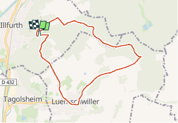

Longueur
8,9 km

Altitude max
404 m

Dénivelé positif
214 m
Km-Effort
11,7 km

Altitude min
294 m

Dénivelé négatif
199 m
Boucle
Oui
Date de création :
2024-01-30 08:08:32.623
Dernière modification :
2024-02-02 15:39:45.471
2h54
Difficulté : Moyen

Application GPS de randonnée GRATUITE
 SityTrail
IGN / Instituts géographiques
SityTrail Plus
Le monde est à vous
À propos
Randonnée Marche de 8,9 km à découvrir à Grand Est, Haut-Rhin, Illfurth. Cette randonnée est proposée par stempfel52.
Localisation
Pays :
France
Région :
Grand Est
Département/Province :
Haut-Rhin
Commune :
Illfurth
Localité :
Unknown
Départ:(Dec)
Départ:(UTM)
370599 ; 5281200 (32T) N.
Commentaires