Randonnée Marche Montgiscard - Montgiscard ÷Villenouvelle - Photo

Montgiscard ÷Villenouvelle

 RR31
RR31

Utilisateur

© OpenStreetMap contributors
Longueur
Longueur
25 km
Altitude max
Altitude max
240 m
Dénivelé positif
Dénivelé positif
267 m
Km-Effort
Km-Effort  
28 km
Altitude min
Altitude min
154 m
Dénivelé négatif
Dénivelé négatif
267 m
Boucle
Boucle
Oui
Date de création :
2015-03-12 00:00:00.0
Dernière modification :
2015-03-12 00:00:00.0

(0 Avis)

Marche
Marche
5h58
Difficulté : Moyen

Scannez ce code QR pour ouvrir la randonnée dans l'application SityTrail

Application GPS de randonnée GRATUITE

Logo SityTrail SityTrail

IGN / Instituts géographiques

Télécharger SityTrail sur l'App Store Télécharger SityTrail sur Google Play

Logo SityTrail SityTrail World

Le monde est à vous

Télécharger SityTrail sur l'App Store Télécharger SityTrail sur Google Play Télécharger SityTrail sur Huawei AppGallery

À propos

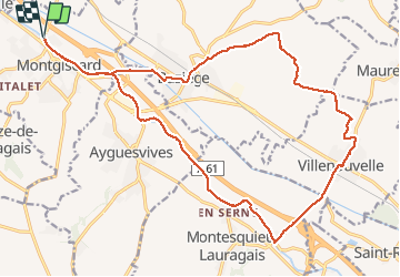
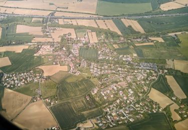
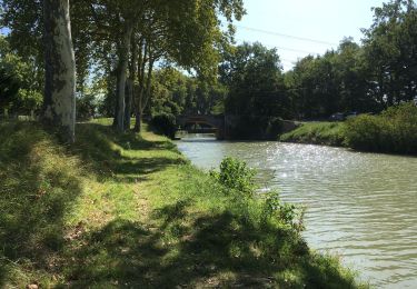
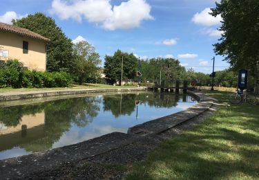
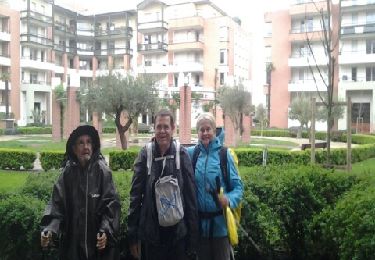
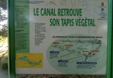
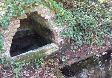
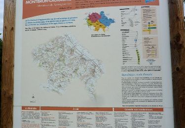
Randonnée Marche de 25 km à découvrir à Occitanie, Haute-Garonne, Montgiscard. Cette randonnée est proposée par RR31.

Profil altimétrique

Photos

Localisation

Pays :
France
Région :
Occitanie
Département/Province :
Haute-Garonne
Commune :
Montgiscard
Localité :
Unknown
Départ:(Dec)
Départ:(UTM)
384341 ; 4813348 (31T) N.

Randonnées à proximité

Randonnée Roller Deyme - Rollers - pont canal Pompertuzat -> Super U Belberaud -> Église Escalquens -> Montlaur-> pont canal Montlaur - Photo
Roller
LoulouteRollers

Roller

Difficile
(1)
Deyme, Occitanie, Haute-Garonne, France
20 km | 23 km-effort
2h 0min
Oui
Randonnée A pied Donneville - Boucle de Saint-Ignace - Photo
A pied
PRO

A pied

Facile
Donneville, Occitanie, Haute-Garonne, France
4,1 km | 5,7 km-effort
1h 17min
Oui
Randonnée Marche Ayguesvives - Montgiscard  - Photo
Marche
richardsimopons

Marche

Ayguesvives, Occitanie, Haute-Garonne, France
7,3 km | 8,3 km-effort
1h 45min
Oui
Randonnée Marche Ayguesvives - Canal du midi 31719 - Photo
Marche
richardsimopons

Marche

Ayguesvives, Occitanie, Haute-Garonne, France
11,4 km | 12,6 km-effort
2h 42min
Non
Randonnée Marche Donneville - Donneville -Toulouse - Photo
Marche
RR31

Marche

Moyen
Donneville, Occitanie, Haute-Garonne, France
31 km | 34 km-effort
Inconnu
Non
Randonnée Marche Castanet-Tolosan - canal-castanetj-070722 - Photo
Marche
arnoultjf

Marche

Très difficile
Castanet-Tolosan, Occitanie, Haute-Garonne, France
19,8 km | 23 km-effort
158h 13min
Non
Randonnée Marche Montlaur - 23 février 2021 - Photo
Marche
arnoultjf

Marche

Très facile
Montlaur, Occitanie, Haute-Garonne, France
10,4 km | 11,8 km-effort
2h 5min
Non
Randonnée Marche Fourquevaux - Fourquevaux court - Photo
Marche
pidjam

Marche

Très facile
Fourquevaux, Occitanie, Haute-Garonne, France
7,6 km | 9 km-effort
1h 58min
Oui
Randonnée Marche Montbrun-Lauragais - De Montbrun Lauragais au Canal du Midi - Photo
Marche
tracegps

Marche

Moyen
Montbrun-Lauragais, Occitanie, Haute-Garonne, France
14 km | 17,8 km-effort
4h 0min
Oui


Fermer
Mes abonnements