Randonnée Marche Dunière-sur-Eyrieux - Duniere reco - Photo
 Ellierim
Ellierim

Utilisateur

© OpenStreetMap contributors
Longueur
Longueur
12,4 km
Altitude max
Altitude max
417 m
Dénivelé positif
Dénivelé positif
522 m
Km-Effort
Km-Effort  
19,3 km
Altitude min
Altitude min
159 m
Dénivelé négatif
Dénivelé négatif
522 m
Boucle
Boucle
Oui
Date de création :
2024-02-20 07:39:31.0
Dernière modification :
2024-02-20 14:10:59.968

(0 Avis)

Marche
Marche
6h30
Difficulté : Moyen

Scannez ce code QR pour ouvrir la randonnée dans l'application SityTrail

Application GPS de randonnée GRATUITE

Logo SityTrail SityTrail

IGN / Instituts géographiques

Télécharger SityTrail sur l'App Store Télécharger SityTrail sur Google Play

Logo SityTrail SityTrail World

Le monde est à vous

Télécharger SityTrail sur l'App Store Télécharger SityTrail sur Google Play Télécharger SityTrail sur Huawei AppGallery

À propos

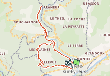
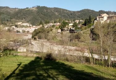
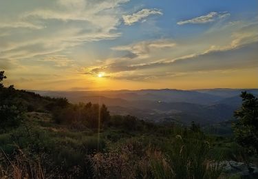
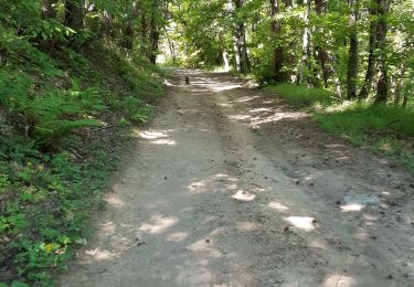
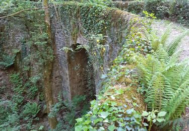
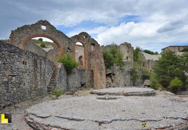
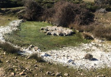
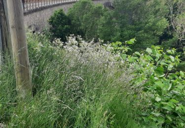
Randonnée Marche de 12,4 km à découvrir à Auvergne-Rhône-Alpes, Ardèche, Dunière-sur-Eyrieux. Cette randonnée est proposée par Ellierim.

Profil altimétrique

Photos

Localisation

Pays :
France
Région :
Auvergne-Rhône-Alpes
Département/Province :
Ardèche
Commune :
Dunière-sur-Eyrieux
Localité :
Unknown
Départ:(Dec)
Départ:(UTM)
631017 ; 4964527 (31T) N.

Randonnées à proximité

Randonnée Marche Saint-Vincent-de-Durfort - croix de grua - Photo
Marche
lucharley

Marche

Très difficile
Saint-Vincent-de-Durfort, Auvergne-Rhône-Alpes, Ardèche, France
16,2 km | 25 km-effort
5h 37min
Non
Randonnée Marche Les Ollières-sur-Eyrieux - Serré de Gruas  - Photo
Marche
ajd26

Marche

Facile
Les Ollières-sur-Eyrieux, Auvergne-Rhône-Alpes, Ardèche, France
16,8 km | 27 km-effort
4h 51min
Oui
Randonnée Marche Les Ollières-sur-Eyrieux - la croix du banc - Photo
Marche
AIGUIER

Marche

Moyen
Les Ollières-sur-Eyrieux, Auvergne-Rhône-Alpes, Ardèche, France
13,6 km | 20 km-effort
4h 27min
Oui
Randonnée Marche Saint-Vincent-de-Durfort - Randonnée nocturne aux Croix de Gruas - Photo
Marche
jome63

Marche

Difficile
Saint-Vincent-de-Durfort, Auvergne-Rhône-Alpes, Ardèche, France
10,3 km | 15,9 km-effort
3h 17min
Oui
Randonnée Marche Saint-Fortunat-sur-Eyrieux - 07 st fortunat dubieres st Vincent dufort - Photo
Marche
himba26100

Marche

Moyen
Saint-Fortunat-sur-Eyrieux, Auvergne-Rhône-Alpes, Ardèche, France
22 km | 33 km-effort
8h 41min
Oui
Randonnée Marche Les Ollières-sur-Eyrieux - 07 ollieres sur eyrieux Gruas - Photo
Marche
himba26100

Marche

Moyen
Les Ollières-sur-Eyrieux, Auvergne-Rhône-Alpes, Ardèche, France
16,5 km | 27 km-effort
7h 0min
Oui
Randonnée Marche Saint-Cierge-la-Serre - St Cierge La Serre 13,5km. - Photo
Marche
chancha

Marche

Difficile
Saint-Cierge-la-Serre, Auvergne-Rhône-Alpes, Ardèche, France
13,7 km | 19,8 km-effort
4h 29min
Oui
Randonnée Marche Saint-Fortunat-sur-Eyrieux - St Fortunat - Photo
Marche
ajd26

Marche

Moyen
Saint-Fortunat-sur-Eyrieux, Auvergne-Rhône-Alpes, Ardèche, France
16,7 km | 25 km-effort
4h 38min
Oui
Randonnée Marche Saint-Fortunat-sur-Eyrieux - LA Caracole. Saint-Fortunat-sur-Eyrieux  - Photo
Marche
bernadette revoux

Marche

Difficile
Saint-Fortunat-sur-Eyrieux, Auvergne-Rhône-Alpes, Ardèche, France
18,8 km | 0 m-effort
4h 44min
Non


Fermer
Mes abonnements