Randonnée Marche Saint-Maximin-la-Sainte-Baume - arche du mont aurelien - Photo
 frederic bruguier
frederic bruguier

Utilisateur

© OpenStreetMap contributors
Longueur
Longueur
19,9 km
Altitude max
Altitude max
853 m
Dénivelé positif
Dénivelé positif
1163 m
Km-Effort
Km-Effort  
35 km
Altitude min
Altitude min
286 m
Dénivelé négatif
Dénivelé négatif
1162 m
Boucle
Boucle
Oui
Date de création :
2024-03-03 07:47:59.766
Dernière modification :
2024-03-03 08:04:49.01

(0 Avis)

Marche
Marche
8h02
Difficulté : Très difficile

Scannez ce code QR pour ouvrir la randonnée dans l'application SityTrail

Application GPS de randonnée GRATUITE

Logo SityTrail SityTrail

IGN / Instituts géographiques

Télécharger SityTrail sur l'App Store Télécharger SityTrail sur Google Play

Logo SityTrail SityTrail World

Le monde est à vous

Télécharger SityTrail sur l'App Store Télécharger SityTrail sur Google Play Télécharger SityTrail sur Huawei AppGallery

À propos

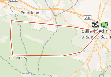
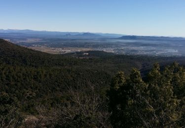
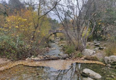
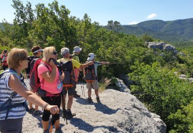
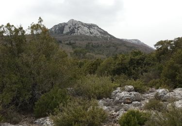
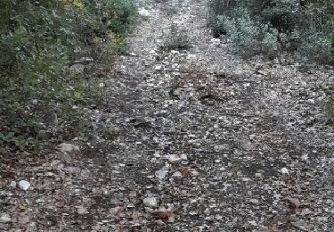
Randonnée Marche de 19,9 km à découvrir à Provence-Alpes-Côte d'Azur, Var, Saint-Maximin-la-Sainte-Baume. Cette randonnée est proposée par frederic bruguier.

Description

a la rercherche du mont aurelien

Profil altimétrique

Localisation

Pays :
France
Région :
Provence-Alpes-Côte d'Azur
Département/Province :
Var
Commune :
Saint-Maximin-la-Sainte-Baume
Localité :
Unknown
Départ:(UTM)
731798 ; 4815232 (31T) N.

Randonnées à proximité

Randonnée A pied Saint-Maximin-la-Sainte-Baume - Via Aurelia - Le Val - St Maximin - Photo
A pied
PRO

A pied

Facile
Saint-Maximin-la-Sainte-Baume, Provence-Alpes-Côte d'Azur, Var, France
14,2 km | 18,3 km-effort
4h 9min
Non
Randonnée Marche Seillons-Source-d'Argens - Rocher des abeilles-02-02-2022 - Photo
Marche
Christiancordin

Marche

Moyen
Seillons-Source-d'Argens, Provence-Alpes-Côte d'Azur, Var, France
23 km | 30 km-effort
5h 56min
Oui
Randonnée Marche Saint-Maximin-la-Sainte-Baume - SAINT MAXIMIN LA SAINTE BAUME - AUTOUR DU DEFENS - Photo
Marche
jean-marie.parachini

Marche

Facile
Saint-Maximin-la-Sainte-Baume, Provence-Alpes-Côte d'Azur, Var, France
13,6 km | 18,4 km-effort
5h 23min
Oui
Randonnée Marche Saint-Maximin-la-Sainte-Baume - M 6 fev mont Aurelien - Photo
Marche
Ninie38MD

Marche

Moyen
Saint-Maximin-la-Sainte-Baume, Provence-Alpes-Côte d'Azur, Var, France
24 km | 34 km-effort
8h 5min
Oui
Randonnée Marche Tourves - Le Caramy - Photo
Marche
Marcsaintcyr

Marche

Moyen
Tourves, Provence-Alpes-Côte d'Azur, Var, France
13,8 km | 18,8 km-effort
6h 50min
Oui
Randonnée Marche Tourves - Tourves-Canfier-Rayol-St Maximin - Photo
Marche
RANDOTOURVES02

Marche

Facile
Tourves, Provence-Alpes-Côte d'Azur, Var, France
7,2 km | 8,3 km-effort
1h 19min
Non
Randonnée Marche Tourves - Les Gueules Rouges - Photo
Marche
RANDOTOURVES01

Marche

Moyen
Tourves, Provence-Alpes-Côte d'Azur, Var, France
18,9 km | 25 km-effort
13h 20min
Non
Randonnée Autre activité Tourves - Le pylône de Fontfrège - Photo
Autre activité
JPC83

Autre activité

Très facile
Tourves, Provence-Alpes-Côte d'Azur, Var, France
41 km | 51 km-effort
2h 3min
Oui
Randonnée Marche Seillons-Source-d'Argens - seillon - Photo
Marche
jo-ba

Marche

Facile
(1)
Seillons-Source-d'Argens, Provence-Alpes-Côte d'Azur, Var, France
15,2 km | 19,2 km-effort
5h 18min
Oui


Fermer
Mes abonnements