


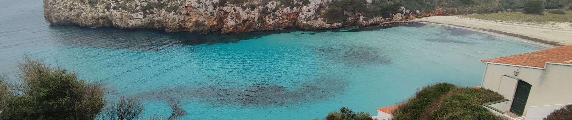
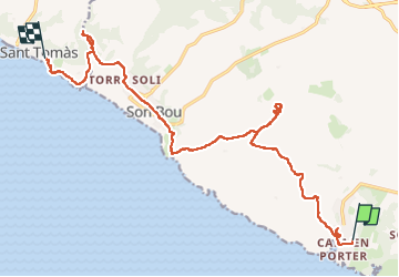
Cala en Porter – Sant Tomàs

Geert H.
Utilisateur


4h42
Difficulté : Très difficile

Application GPS de randonnée GRATUITE
 SityTrail
IGN / Instituts géographiques
SityTrail Plus
Le monde est à vous
À propos
Randonnée Marche de 21 km à découvrir à Îles Baléares, Inconnu, Alaior. Cette randonnée est proposée par Geert H..
Description
Wandeling vanuit Cala en Porter naar Sant Tomàs. Geleidelijk bergop zichten van de kust afdaling tot aan Son Bou, het langste strand van Menorca. Je gaat door duinlandschappen, boomgaarden en de lagune van Ses Canessiesen tot aan Sant Tomàs. Onderweg is er een kleine omweg naar de archelogische site Torre d'en Galmés.
Photos


36 photos au total. Cliquez sur une photo pour les afficher toutes dans la galerie.
Localisation
Commentaires