Randonnée Marche Barbirey-sur-Ouche - barbirey sur Ouche  - Photo
 Montagne71
Montagne71

Utilisateur

© OpenStreetMap contributors
Longueur
Longueur
19,4 km
Altitude max
Altitude max
586 m
Dénivelé positif
Dénivelé positif
678 m
Km-Effort
Km-Effort  
28 km
Altitude min
Altitude min
314 m
Dénivelé négatif
Dénivelé négatif
691 m
Boucle
Boucle
Non
Date de création :
2024-04-21 07:18:53.774
Dernière modification :
2024-04-21 14:19:14.034

(0 Avis)

Marche
Marche
6h59
Difficulté : Moyen

Scannez ce code QR pour ouvrir la randonnée dans l'application SityTrail

Application GPS de randonnée GRATUITE

Logo SityTrail SityTrail

IGN / Instituts géographiques

Télécharger SityTrail sur l'App Store Télécharger SityTrail sur Google Play

Logo SityTrail SityTrail World

Le monde est à vous

Télécharger SityTrail sur l'App Store Télécharger SityTrail sur Google Play Télécharger SityTrail sur Huawei AppGallery

À propos

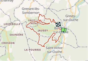
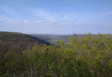
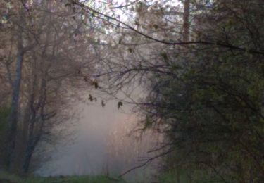
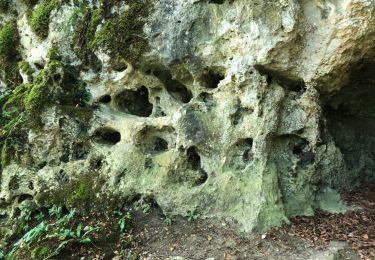
Randonnée Marche de 19,4 km à découvrir à Bourgogne-Franche-Comté, Côte-d'Or, Barbirey-sur-Ouche. Cette randonnée est proposée par Montagne71.

Description

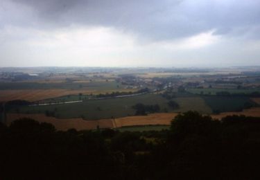
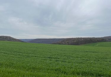
Belle rando, temps à giboulées, grésil
19 avril 2024

Profil altimétrique

Localisation

Pays :
France
Région :
Bourgogne-Franche-Comté
Département/Province :
Côte-d'Or
Commune :
Barbirey-sur-Ouche
Localité :
Unknown
Départ:(UTM)
632709 ; 5234175 (31T) N.

Randonnées à proximité

Randonnée Marche Barbirey-sur-Ouche - Le Tour de Barbiriacum - Barbirey sur Ouche - Photo
Marche
tracegps

Marche

Moyen
(1)
Barbirey-sur-Ouche, Bourgogne-Franche-Comté, Côte-d'Or, France
10,5 km | 15,9 km-effort
2h 45min
Oui
Randonnée Marche La Bussière-sur-Ouche - La Bête de l'Auxois - La Bussière sur Ouche - Photo
Marche
tracegps

Marche

Difficile
(1)
La Bussière-sur-Ouche, Bourgogne-Franche-Comté, Côte-d'Or, France
25 km | 33 km-effort
6h 0min
Oui
Randonnée Marche Grenant-lès-Sombernon - Grenant les sombernon  - Photo
Marche
eric.guyard21

Marche

Grenant-lès-Sombernon, Bourgogne-Franche-Comté, Côte-d'Or, France
14 km | 21 km-effort
3h 35min
Oui
Randonnée Marche La Bussière-sur-Ouche - Pierre du druide , grotte de tebsima - Photo
Marche
eric.guyard21

Marche

Moyen
La Bussière-sur-Ouche, Bourgogne-Franche-Comté, Côte-d'Or, France
15,9 km | 23 km-effort
3h 32min
Oui
Randonnée Marche Saint-Jean-de-Bœuf - Saint JeandeBoeuf-Gissey sur Ouche - Photo
Marche
mpstoop

Marche

Moyen
Saint-Jean-de-Bœuf, Bourgogne-Franche-Comté, Côte-d'Or, France
22 km | 31 km-effort
8h 5min
Oui
Randonnée Marche Gergueil - balcon de l'Ouche - Photo
Marche
mpstoop

Marche

Très difficile
Gergueil, Bourgogne-Franche-Comté, Côte-d'Or, France
38 km | 50 km-effort
9h 28min
Non
Randonnée Marche Barbirey-sur-Ouche - Tebzima - Photo
Marche
dominiq

Marche

Moyen
Barbirey-sur-Ouche, Bourgogne-Franche-Comté, Côte-d'Or, France
13,4 km | 20 km-effort
4h 11min
Oui
Randonnée Marche Fleurey-sur-Ouche - Roche d Anse 23/11/11 - Photo
Marche
ludojiel

Marche

Facile
(1)
Fleurey-sur-Ouche, Bourgogne-Franche-Comté, Côte-d'Or, France
8,8 km | 12,4 km-effort
2h 20min
Oui
Randonnée Marche La Bussière-sur-Ouche - St Victor canal - Photo
Marche
eric.guyard21

Marche

Facile
La Bussière-sur-Ouche, Bourgogne-Franche-Comté, Côte-d'Or, France
12,8 km | 16,5 km-effort
2h 39min
Oui


Fermer
Mes abonnements