Randonnée Marche Mollau - Le rossberg - Photo
 margotte
margotte

Utilisateur

© OpenStreetMap contributors
Longueur
Longueur
14,9 km
Altitude max
Altitude max
1149 m
Dénivelé positif
Dénivelé positif
766 m
Km-Effort
Km-Effort  
25 km
Altitude min
Altitude min
548 m
Dénivelé négatif
Dénivelé négatif
768 m
Boucle
Boucle
Oui
Date de création :
2024-04-30 08:08:14.844
Dernière modification :
2024-05-05 07:49:07.052

(0 Avis)

Marche
Marche
7h41
Difficulté : Moyen

Scannez ce code QR pour ouvrir la randonnée dans l'application SityTrail

Application GPS de randonnée GRATUITE

Logo SityTrail SityTrail

IGN / Instituts géographiques

Télécharger SityTrail sur l'App Store Télécharger SityTrail sur Google Play

Logo SityTrail SityTrail World

Le monde est à vous

Télécharger SityTrail sur l'App Store Télécharger SityTrail sur Google Play Télécharger SityTrail sur Huawei AppGallery

À propos

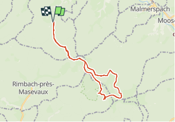
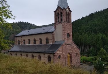
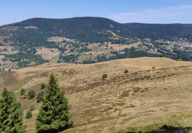
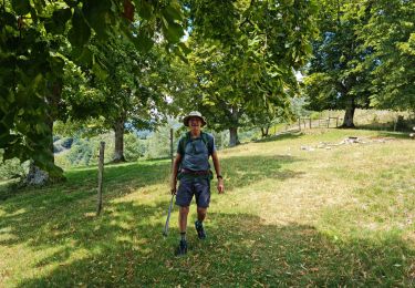
Randonnée Marche de 14,9 km à découvrir à Grand Est, Haut-Rhin, Mollau. Cette randonnée est proposée par margotte.

Description

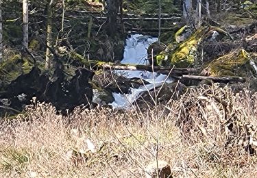
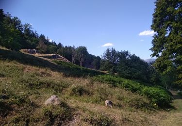
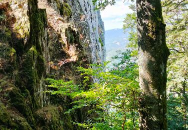
Une belle journée de printemps dans un environnement préservé  dans la joie et la bonne humeur. Parcour varié dans la hêtraie/sapinière avec un passage dans la réserve des volcans et une traversée des chaumes. Je recommande...

Profil altimétrique

Photos

Localisation

Pays :
France
Région :
Grand Est
Département/Province :
Haut-Rhin
Commune :
Mollau
Localité :
Unknown
Départ:(UTM)
347897 ; 5302603 (32T) N.

Randonnées à proximité

Randonnée Marche Rimbach-près-Masevaux - Haute Bers - Photo
Marche
helmut68

Marche

Moyen
(1)
Rimbach-près-Masevaux, Grand Est, Haut-Rhin, France
12 km | 20 km-effort
3h 25min
Oui
Randonnée Marche Storckensohn - lac des perches marchettes - Photo
Marche
lacote

Marche

Moyen
(1)
Storckensohn, Grand Est, Haut-Rhin, France
11,9 km | 20 km-effort
4h 8min
Oui
Randonnée Marche Storckensohn - 2022-07-16 Marche Auberge Gazon Vert Chapelle des Ves - Photo
Marche
GUIDE
holtzv

Marche

Très difficile
Storckensohn, Grand Est, Haut-Rhin, France
21 km | 37 km-effort
6h 11min
Non
Randonnée Marche Rimbach-près-Masevaux - Rimbach - lacs du Neuweiher et des Perches par Rouge Gazon - Photo
Marche
Bart2015

Marche

Très difficile
Rimbach-près-Masevaux, Grand Est, Haut-Rhin, France
17,1 km | 28 km-effort
6h 18min
Oui
Randonnée Marche Ranspach - Rando des Marcheurs 20/07/2023 - Photo
Marche
boubou68

Marche

Très difficile
Ranspach, Grand Est, Haut-Rhin, France
23 km | 38 km-effort
5h 31min
Oui
Randonnée Marche Storckensohn - Storckensohn Gazon Vert - Photo
Marche
helmut68

Marche

Difficile
Storckensohn, Grand Est, Haut-Rhin, France
13 km | 21 km-effort
4h 40min
Oui
Randonnée Marche Saint-Amarin - dimanche - Photo
Marche
Ninie38MD

Marche

Très difficile
(1)
Saint-Amarin, Grand Est, Haut-Rhin, France
19,4 km | 35 km-effort
7h 51min
Oui
Randonnée Marche Wegscheid - wagsheid - Photo
Marche
annamaria

Marche

Moyen
Wegscheid, Grand Est, Haut-Rhin, France
15,4 km | 26 km-effort
7h 37min
Oui
Randonnée Marche Saint-Amarin - Ranspach - Photo
Marche
ruelwitt

Marche

Difficile
(1)
Saint-Amarin, Grand Est, Haut-Rhin, France
11,3 km | 14,3 km-effort
3h 14min
Oui


Fermer
Mes abonnements