


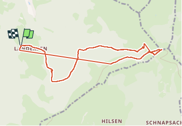
Landersen boucle

ROPPJP
Utilisateur

Longueur
9,5 km

Altitude max
1266 m

Dénivelé positif
572 m
Km-Effort
17,1 km

Altitude min
761 m

Dénivelé négatif
571 m
Boucle
Oui
Date de création :
2024-05-04 11:24:43.967
Dernière modification :
2024-05-04 15:48:22.624
2h41
Difficulté : Difficile

Application GPS de randonnée GRATUITE
 SityTrail
IGN / Instituts géographiques
SityTrail Plus
Le monde est à vous
À propos
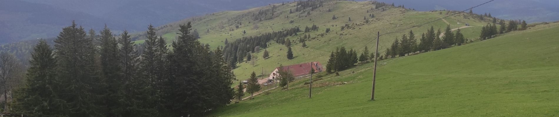
Randonnée Marche de 9,5 km à découvrir à Grand Est, Haut-Rhin, Sondernach. Cette randonnée est proposée par ROPPJP.
Photos


Localisation
Pays :
France
Région :
Grand Est
Département/Province :
Haut-Rhin
Commune :
Sondernach
Localité :
Unknown
Départ:(Dec)
Départ:(UTM)
356623 ; 5316059 (32T) N.
Commentaires