


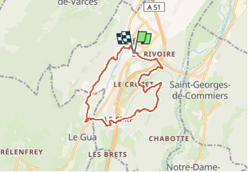
métro rando vif le gua

sabine38
Utilisateur

Longueur
14,8 km

Altitude max
849 m

Dénivelé positif
676 m
Km-Effort
24 km

Altitude min
307 m

Dénivelé négatif
677 m
Boucle
Oui
Date de création :
2024-05-05 05:37:08.783
Dernière modification :
2024-05-05 10:24:56.39
4h47
Difficulté : Facile

Application GPS de randonnée GRATUITE
 SityTrail
IGN / Instituts géographiques
SityTrail Plus
Le monde est à vous
À propos
Randonnée Marche de 14,8 km à découvrir à Auvergne-Rhône-Alpes, Isère, Vif. Cette randonnée est proposée par sabine38.
Localisation
Pays :
France
Région :
Auvergne-Rhône-Alpes
Département/Province :
Isère
Commune :
Vif
Localité :
Unknown
Départ:(Dec)
Départ:(UTM)
710336 ; 4992108 (31T) N.
Commentaires