


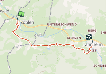
Bus Zöllen Katzensteig - Mühlenweg - Augsburgerhütte- Hofersee - Tannheim

patrickbeyrath
Utilisateur

Longueur
5,6 km

Altitude max
1223 m

Dénivelé positif
179 m
Km-Effort
7,9 km

Altitude min
1075 m

Dénivelé négatif
160 m
Boucle
Non
Date de création :
2024-05-15 07:07:15.294
Dernière modification :
2024-05-16 14:44:41.924
1h47
Difficulté : Moyen

Application GPS de randonnée GRATUITE
 SityTrail
IGN / Instituts géographiques
SityTrail Plus
Le monde est à vous
À propos
Randonnée Marche de 5,6 km à découvrir à Tyrol, Bezirk Reutte, Gemeinde Zöblen. Cette randonnée est proposée par patrickbeyrath.
Localisation
Pays :
Autriche
Région :
Tyrol
Département/Province :
Bezirk Reutte
Commune :
Gemeinde Zöblen
Localité :
Unknown
Départ:(Dec)
Départ:(UTM)
610843 ; 5262761 (32T) N.
Commentaires