![](/images/other/stat-length.png)
![Randonnée Marche Saint-Hilaire-Cusson-la-Valmitte - Saint Hilaire -Cusson la Valmitte - Photo](https://media.geolcdn.com/t/1900/400/ext.pjpeg?maxdim=2&url=https%3A%2F%2Fmedia.geolcdn.com%2Ff%2F39ea7fe6-538d-4ae9-b0c3-668600121859.jpg)
Saint Hilaire -Cusson la Valmitte
dudu42
Utilisateur
![Longueur](/images/other/stat-length.png)
Longueur
12,9 km
![Altitude max](https://static1.geolcdn.com/siteimages/upload/files/1508320355ic_sort_altitude_max_24dp.png)
Altitude max
956 m
![Dénivelé positif](https://static1.geolcdn.com/siteimages/upload/files/1508320355ic_sort_den_pos_24dp.png)
Dénivelé positif
266 m
![Km-Effort](/images/other/stat-length.png)
Km-Effort
16,5 km
![Altitude min](https://static1.geolcdn.com/siteimages/upload/files/1508320355ic_sort_altitude_min_24dp.png)
Altitude min
753 m
![Dénivelé négatif](https://static1.geolcdn.com/siteimages/upload/files/1508320355ic_sort_den_neg_24dp.png)
Dénivelé négatif
272 m
![Boucle](https://static1.geolcdn.com/siteimages/upload/files/16400158638029165_repeat_loop_refresh_sync_direction_icon.png)
Boucle
Oui
Date de création :
2024-05-19 07:04:33.021
Dernière modification :
2024-05-19 10:22:30.0
![Marche](https://static1.geolcdn.com/sitytour/trail-icons/101.png)
3h03
Difficulté : Moyen
![Scannez ce code QR pour ouvrir la randonnée dans l'application SityTrail](https://capi.geolives.com/qq0zvz2zws4bq2lad0pu/sitytour/trails/4059729/qr.png?size=200)
Application GPS de randonnée GRATUITE
À propos
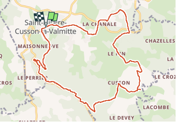
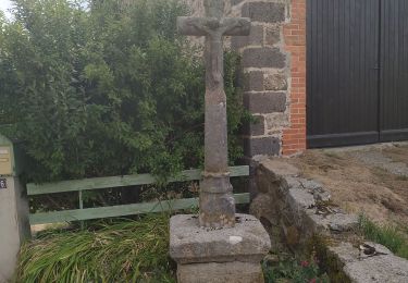
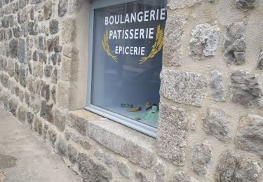
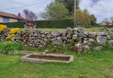
Randonnée Marche de 12,9 km à découvrir à Auvergne-Rhône-Alpes, Loire, Saint-Hilaire-Cusson-la-Valmitte. Cette randonnée est proposée par dudu42.
Description
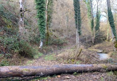
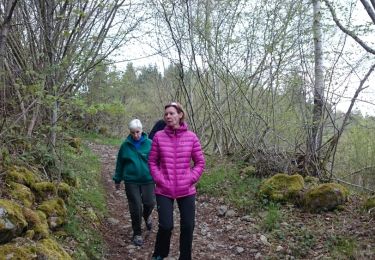
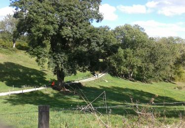
La partie longeant le torrent (beaucoup d'eau grâce aux pluies nombreuses) est superbe !
Sous bois de feuillus, chemin de terre, très peu de bitume.
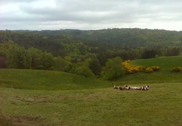
Point de vue depuis le plateau.
Peu de monde.
Localisation
Pays :
France
Région :
Auvergne-Rhône-Alpes
Département/Province :
Loire
Commune :
Saint-Hilaire-Cusson-la-Valmitte
Localité :
Unknown
Départ:(Dec)
Départ:(UTM)
581697 ; 5024495 (31T) N.
Commentaires
Randonnées à proximité
![Randonnée Marche Merle-Leignec - Luriecq](https://media.geolcdn.com/t/375/260/ext.jpg?maxdim=2&url=https%3A%2F%2Fmedia.geolcdn.com%2Ff%2F7214e3e6-0564-4e7d-ab01-7a9f3de1f225.jpg)
![Marche Marche](https://static1.geolcdn.com/sitytour/trail-icons/101.png)
Luriecq "le saut du Bezan"
Marche
Moyen
Merle-Leignec,
Auvergne-Rhône-Alpes,
Loire,
France
![](/images/other/stat-length.png)
14,4 km | 19,2 km-effort
6h 23min
![](https://static1.geolcdn.com/siteimages/upload/files/16400158638029165_repeat_loop_refresh_sync_direction_icon.png)
Oui
![Randonnée V.T.T. Valprivas - L''Aigue Blanche - Chanteloube - Photo](https://media.geolcdn.com/t/375/260/ext.jpg?maxdim=2&url=https%3A%2F%2Fservices.sitytrail.com%2FGeolivesWS%2FDownloadMedia.ashx%3FTrailID%3D215260%26Media%3D15454_6.jpg)
![V.T.T. V.T.T.](https://static1.geolcdn.com/sitytour/trail-icons/202.png)
L''Aigue Blanche - Chanteloube
V.T.T.
Difficile
Valprivas,
Auvergne-Rhône-Alpes,
Haute-Loire,
France
![](/images/other/stat-length.png)
13,9 km | 21 km-effort
1h 30min
![](https://static1.geolcdn.com/siteimages/upload/files/16400158638029165_repeat_loop_refresh_sync_direction_icon.png)
Oui
![Randonnée Marche Valprivas - L''Aigue Blanche - Chanteloube - Photo](https://media.geolcdn.com/t/375/260/ext.jpg?maxdim=2&url=https%3A%2F%2Fservices.sitytrail.com%2FGeolivesWS%2FDownloadMedia.ashx%3FTrailID%3D215259%26Media%3D15454_6.jpg)
![Marche Marche](https://static1.geolcdn.com/sitytour/trail-icons/101.png)
L''Aigue Blanche - Chanteloube
Marche
Difficile
Valprivas,
Auvergne-Rhône-Alpes,
Haute-Loire,
France
![](/images/other/stat-length.png)
13,9 km | 21 km-effort
3h 30min
![](https://static1.geolcdn.com/siteimages/upload/files/16400158638029165_repeat_loop_refresh_sync_direction_icon.png)
Oui
![Randonnée Marche Bas-en-Basset - Morand tour du proprio - Photo](https://media.geolcdn.com/t/375/260/ext.jpg?maxdim=2&url=https%3A%2F%2Fmedia.geolcdn.com%2Ff%2F54dcb866-750c-4485-a205-aa951ef6eb0f.jpg)
![Marche Marche](https://static1.geolcdn.com/sitytour/trail-icons/101.png)
Morand tour du proprio
Marche
Moyen
Bas-en-Basset,
Auvergne-Rhône-Alpes,
Haute-Loire,
France
![](/images/other/stat-length.png)
5,9 km | 10 km-effort
3h 2min
![](https://static1.geolcdn.com/siteimages/upload/files/16400158638029165_repeat_loop_refresh_sync_direction_icon.png)
Oui
![Randonnée Marche Apinac - moulin et chapelles - Photo](https://media.geolcdn.com/t/375/260/ext.jpg?maxdim=2&url=https%3A%2F%2Fmedia.geolcdn.com%2Ff%2F02594510-8219-4ca7-b4b4-5901da37d7ee.jpg)
![Marche Marche](https://static1.geolcdn.com/sitytour/trail-icons/101.png)
moulin et chapelles
Marche
Facile
Apinac,
Auvergne-Rhône-Alpes,
Loire,
France
![](/images/other/stat-length.png)
9,8 km | 13,1 km-effort
3h 11min
![](https://static1.geolcdn.com/siteimages/upload/files/16400158638029165_repeat_loop_refresh_sync_direction_icon.png)
Oui
![Randonnée Marche Rozier-Côtes-d'Aurec - le font des dames - Photo](https://media.geolcdn.com/t/375/260/ext.jpg?maxdim=2&url=https%3A%2F%2Fmedia.geolcdn.com%2Ff%2Fa0822d9b-ee00-4633-b65c-62627b78e2fa.jpg)
![Marche Marche](https://static1.geolcdn.com/sitytour/trail-icons/101.png)
le font des dames
Marche
Facile
Rozier-Côtes-d'Aurec,
Auvergne-Rhône-Alpes,
Loire,
France
![](/images/other/stat-length.png)
13,5 km | 17,9 km-effort
3h 23min
![](https://static1.geolcdn.com/siteimages/upload/files/16400158638029165_repeat_loop_refresh_sync_direction_icon.png)
Oui
![Randonnée Marche Merle-Leignec - le chemin delà poix - Photo](https://media.geolcdn.com/t/375/260/ext.jpg?maxdim=2&url=https%3A%2F%2Fmedia.geolcdn.com%2Ff%2F5eb5fa71-e59a-4c94-9c41-393c4ad0e28d.jpg)
![Marche Marche](https://static1.geolcdn.com/sitytour/trail-icons/101.png)
le chemin delà poix
Marche
Facile
Merle-Leignec,
Auvergne-Rhône-Alpes,
Loire,
France
![](/images/other/stat-length.png)
9,9 km | 12,5 km-effort
2h 50min
![](https://static1.geolcdn.com/siteimages/upload/files/16400158638029165_repeat_loop_refresh_sync_direction_icon.png)
Oui
![Randonnée Marche Apinac - Chemin des pierres - Photo](https://media.geolcdn.com/t/375/260/ext.jpg?maxdim=2&url=https%3A%2F%2Fservices.sitytrail.com%2FGeolivesWS%2FDownloadMedia.ashx%3FTrailID%3D413489%26Media%3Dfix__20150428171949.jpg)
![Marche Marche](https://static1.geolcdn.com/sitytour/trail-icons/101.png)
Chemin des pierres
Marche
Très facile
Apinac,
Auvergne-Rhône-Alpes,
Loire,
France
![](/images/other/stat-length.png)
7,9 km | 9,9 km-effort
2h 19min
![](https://static1.geolcdn.com/siteimages/upload/files/16400158638029165_repeat_loop_refresh_sync_direction_icon.png)
Oui
![Randonnée Marche Merle-Leignec - apinac - Photo](https://media.geolcdn.com/t/375/260/ext.jpg?maxdim=2&url=https%3A%2F%2Fmedia.geolcdn.com%2Ff%2F3da0a8b2-536c-46bf-a5f9-32d2a7e6e5af.jpg)
![Marche Marche](https://static1.geolcdn.com/sitytour/trail-icons/101.png)
apinac
Marche
Facile
Merle-Leignec,
Auvergne-Rhône-Alpes,
Loire,
France
![](/images/other/stat-length.png)
4,7 km | 6 km-effort
1h 22min
![](https://static1.geolcdn.com/siteimages/upload/files/16400158638029165_repeat_loop_refresh_sync_direction_icon.png)
Non