


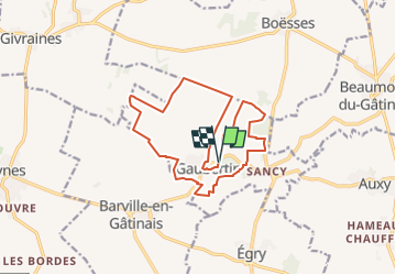
Visite de Gaubertin

mathis01
Utilisateur

Longueur
14,7 km

Altitude max
117 m

Dénivelé positif
65 m
Km-Effort
15,5 km

Altitude min
97 m

Dénivelé négatif
65 m
Boucle
Oui
Date de création :
2024-06-17 16:21:49.086
Dernière modification :
2025-02-17 09:53:41.553
3h31
Difficulté : Facile

Application GPS de randonnée GRATUITE
 SityTrail
IGN / Instituts géographiques
SityTrail Plus
Le monde est à vous
À propos
Randonnée A pied de 14,7 km à découvrir à Centre-Val de Loire, Loiret, Gaubertin. Cette randonnée est proposée par mathis01.
Localisation
Pays :
France
Région :
Centre-Val de Loire
Département/Province :
Loiret
Commune :
Gaubertin
Localité :
Unknown
Départ:(Dec)
Départ:(UTM)
457366 ; 5330068 (31U) N.
Commentaires