Randonnée V.T.T. Audun-le-Tiche - la randodunoise 2010 - Photo
 chinois54220
chinois54220

Utilisateur

© OpenStreetMap contributors
Longueur
Longueur
38 km
Altitude max
Altitude max
451 m
Dénivelé positif
Dénivelé positif
763 m
Km-Effort
Km-Effort  
48 km
Altitude min
Altitude min
303 m
Dénivelé négatif
Dénivelé négatif
757 m
Boucle
Boucle
Non
Date de création :
2014-12-10 00:00:00.0
Dernière modification :
2014-12-10 00:00:00.0

(1 Avis)

V.T.T.
V.T.T.
--
Difficulté : Inconnu

Scannez ce code QR pour ouvrir la randonnée dans l'application SityTrail

Application GPS de randonnée GRATUITE

Logo SityTrail SityTrail

IGN / Instituts géographiques

Télécharger SityTrail sur l'App Store Télécharger SityTrail sur Google Play

Logo SityTrail SityTrail World

Le monde est à vous

Télécharger SityTrail sur l'App Store Télécharger SityTrail sur Google Play Télécharger SityTrail sur Huawei AppGallery

À propos

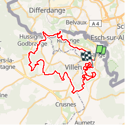
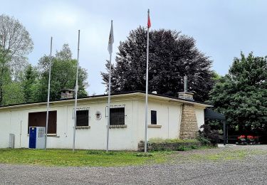
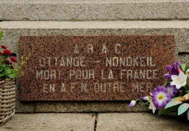
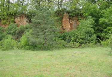
Randonnée V.T.T. de 38 km à découvrir à Grand Est, Moselle, Audun-le-Tiche. Cette randonnée est proposée par chinois54220.

Profil altimétrique

Localisation

Pays :
France
Région :
Grand Est
Département/Province :
Moselle
Commune :
Audun-le-Tiche
Localité :
Unknown
Départ:(Dec)
Départ:(UTM)
714092 ; 5484405 (31U) N.

Commentaires

Veuillez vous connecter pour laisser un commentaire ou une note


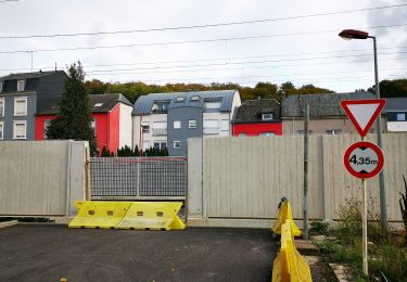
Les chemins proposés sont idéals pour une belle ballade à VTT. Un petit bémol : l'urbanisation a modifié certains tracés. Heureusement, avec les cartes IGN, on arrive sans soucis à retrouver la bonne direction !


Randonnées à proximité

Randonnée A pied Esch-sur-Alzette - Sentier Pierre Wiess - Photo
A pied
PRO

A pied

Facile
Esch-sur-Alzette, Inconnu, Canton Esch-sur-Alzette, Luxembourg
3,9 km | 5,4 km-effort
1h 14min
Non
Randonnée A pied Schifflange - Auto-Pédestre Schifflange - Photo
A pied
PRO

A pied

Facile
Schifflange, Inconnu, Canton Esch-sur-Alzette, Luxembourg
7,8 km | 10,5 km-effort
2h 23min
Oui
Randonnée A pied Esch-sur-Alzette - Auto-Pédestre Esch-sur-Alzette - Photo
A pied
PRO

A pied

Facile
Esch-sur-Alzette, Inconnu, Canton Esch-sur-Alzette, Luxembourg
7,2 km | 9,8 km-effort
2h 13min
Oui
Randonnée A pied Kayl - Auto-Pédestre Kayl - Photo
A pied
PRO

A pied

Facile
Kayl, Inconnu, Canton Esch-sur-Alzette, Luxembourg
5,9 km | 7,6 km-effort
1h 43min
Oui
Randonnée A pied Ottange - Boucle d'Ottange - Photo
A pied
PRO

A pied

Facile
Ottange, Grand Est, Moselle, France
4,1 km | 5,5 km-effort
1h 14min
Oui
Randonnée A pied Rédange - Boucle de Rédange - Photo
A pied
PRO

A pied

Facile
Rédange, Grand Est, Moselle, France
4,6 km | 5,4 km-effort
1h 14min
Non
Randonnée A pied Ottange - Ottange Circuit Schmettebusch - Photo
A pied
PRO

A pied

Facile
Ottange, Grand Est, Moselle, France
5,7 km | 7,9 km-effort
1h 47min
Non
Randonnée A pied Kayl - Circuit Tétange - Photo
A pied
PRO

A pied

Facile
Kayl, Inconnu, Canton Esch-sur-Alzette, Luxembourg
7,1 km | 8,8 km-effort
1h 59min
Non
Randonnée A pied Esch-sur-Alzette - Promenade Architecturale - Photo
A pied
PRO

A pied

Facile
Esch-sur-Alzette, Inconnu, Canton Esch-sur-Alzette, Luxembourg
4 km | 4,3 km-effort
58min
Oui


Fermer
Mes abonnements