


81 km Tchec

LauVan
Utilisateur
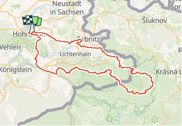

Longueur
84 km

Altitude max
462 m

Dénivelé positif
1892 m
Km-Effort
109 km

Altitude min
119 m

Dénivelé négatif
1866 m
Boucle
Non
Date de création :
2024-07-21 07:59:15.265
Dernière modification :
2024-07-21 15:56:57.81
6h59
Difficulté : Très difficile

Application GPS de randonnée GRATUITE
 SityTrail
IGN / Instituts géographiques
SityTrail Plus
Le monde est à vous
À propos
Randonnée V.T.T. de 84 km à découvrir à Saxe, Sächsische Schweiz-Osterzgebirge, Hohnstein. Cette randonnée est proposée par LauVan.
Localisation
Pays :
Allemagne
Région :
Saxe
Département/Province :
Sächsische Schweiz-Osterzgebirge
Commune :
Hohnstein
Localité :
Unknown
Départ:(Dec)
Départ:(UTM)
437671 ; 5648163 (33U) N.
Commentaires