Randonnée Marche Plateau d'Hauteville - Planachat - Photo
 gael.simon
gael.simon

Utilisateur

© OpenStreetMap contributors
Longueur
Longueur
7,8 km
Altitude max
Altitude max
1243 m
Dénivelé positif
Dénivelé positif
335 m
Km-Effort
Km-Effort  
12,3 km
Altitude min
Altitude min
1037 m
Dénivelé négatif
Dénivelé négatif
335 m
Boucle
Boucle
Oui
Date de création :
2014-12-10 00:00:00.0
Dernière modification :
2014-12-10 00:00:00.0

(1 Avis)

Marche
Marche
1h49
Difficulté : Inconnu

Scannez ce code QR pour ouvrir la randonnée dans l'application SityTrail

Application GPS de randonnée GRATUITE

Logo SityTrail SityTrail

IGN / Instituts géographiques

Télécharger SityTrail sur l'App Store Télécharger SityTrail sur Google Play

Logo SityTrail SityTrail World

Le monde est à vous

Télécharger SityTrail sur l'App Store Télécharger SityTrail sur Google Play Télécharger SityTrail sur Huawei AppGallery

À propos

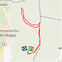
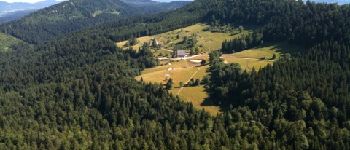
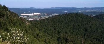
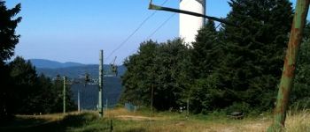
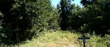
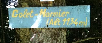
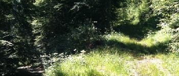
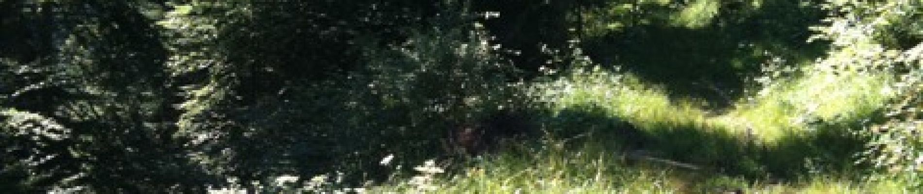
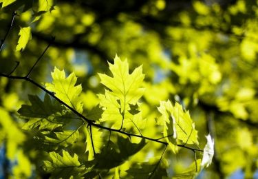
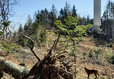
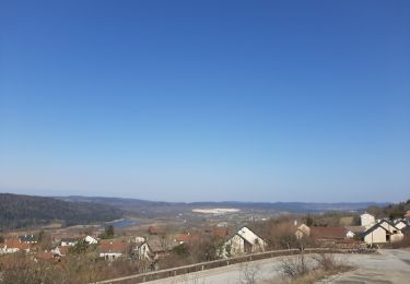
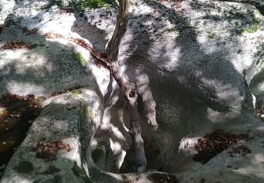
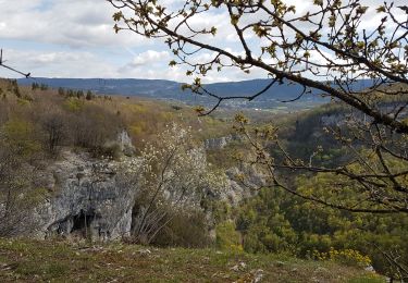
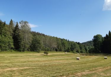
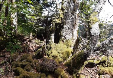
Randonnée Marche de 7,8 km à découvrir à Auvergne-Rhône-Alpes, Ain, Plateau d'Hauteville. Cette randonnée est proposée par gael.simon.

Profil altimétrique

Photos

Points d'intérêt

Point d'intérêt Plateau d'Hauteville - Ferme Guichard - Photo
gael.simon
PLATEAU D'HAUTEVILLE 
Point d'intérêt Plateau d'Hauteville - Hauteville - Photo
gael.simon
PLATEAU D'HAUTEVILLE 
Point d'intérêt Plateau d'Hauteville - Télésli et Tour - Photo
gael.simon
PLATEAU D'HAUTEVILLE 
Point d'intérêt Plateau d'Hauteville - Golet Marmier - Photo
gael.simon
PLATEAU D'HAUTEVILLE 
Point d'intérêt Plateau d'Hauteville - panneau - Photo
gael.simon
PLATEAU D'HAUTEVILLE 
Point d'intérêt Plateau d'Hauteville - Intersection - Photo
gael.simon
PLATEAU D'HAUTEVILLE 

Localisation

Pays :
France
Région :
Auvergne-Rhône-Alpes
Département/Province :
Ain
Commune :
Plateau d'Hauteville
Localité :
Cormaranche-en-Bugey
Départ:(Dec)
Départ:(UTM)
703579 ; 5090865 (31T) N.

Commentaires

Veuillez vous connecter pour laisser un commentaire ou une note


chemin des roches - tireluc


Randonnées à proximité

Randonnée V.T.T. Plateau d'Hauteville - Espace VTT FFC du Bugey - Circuit n° 01 - Photo
V.T.T.
tracegps

V.T.T.

Facile
(1)
Plateau d'Hauteville, Auvergne-Rhône-Alpes, Ain, France
12,5 km | 15,2 km-effort
1h 0min
Oui
Randonnée Marche Plateau d'Hauteville - 01 Hautville Belvédère Planachat - Photo
Marche
ericf64

Marche

Difficile
(1)
Plateau d'Hauteville, Auvergne-Rhône-Alpes, Ain, France
10,8 km | 17,1 km-effort
3h 53min
Oui
Randonnée Marche nordique Plateau d'Hauteville - cormaranche 20220326 - Photo
Marche nordique
demange gerald

Marche nordique

Difficile
Plateau d'Hauteville, Auvergne-Rhône-Alpes, Ain, France
11,4 km | 20 km-effort
2h 23min
Non
Randonnée Marche nordique Plateau d'Hauteville - cormaranche20220321 - Photo
Marche nordique
demange gerald

Marche nordique

Difficile
Plateau d'Hauteville, Auvergne-Rhône-Alpes, Ain, France
7,1 km | 12,9 km-effort
1h 17min
Oui
Randonnée Marche Valromey-sur-Séran - lompnieu - Photo
Marche
colomb24

Marche

Facile
Valromey-sur-Séran, Auvergne-Rhône-Alpes, Ain, France
14,1 km | 19,3 km-effort
4h 58min
Oui
Randonnée Marche Valromey-sur-Séran - LA LEBE - Photo
Marche
Bernardroland

Marche

Très facile
(1)
Valromey-sur-Séran, Auvergne-Rhône-Alpes, Ain, France
12,9 km | 19,1 km-effort
3h 44min
Oui
Randonnée Marche Plateau d'Hauteville - Nantuy La Berche - Photo
Marche
HB01

Marche

Moyen
Plateau d'Hauteville, Auvergne-Rhône-Alpes, Ain, France
15,3 km | 21 km-effort
4h 31min
Oui
Randonnée Marche Plateau d'Hauteville - Chemin de crête de Valorse - Photo
Marche
runarlejou

Marche

Moyen
Plateau d'Hauteville, Auvergne-Rhône-Alpes, Ain, France
4,7 km | 6,2 km-effort
1h 41min
Oui
Randonnée Marche Plateau d'Hauteville - Chemin des Crêtes La Praille - Photo
Marche
runarlejou

Marche

Moyen
Plateau d'Hauteville, Auvergne-Rhône-Alpes, Ain, France
5,6 km | 7,8 km-effort
2h 1min
Oui


Fermer
Mes abonnements