


Baillif

sameja
Utilisateur
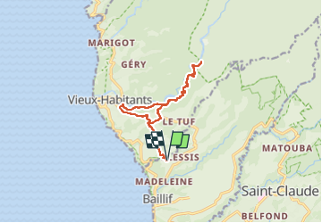

Longueur
17,4 km

Altitude max
260 m

Dénivelé positif
683 m
Km-Effort
26 km

Altitude min
35 m

Dénivelé négatif
683 m
Boucle
Oui
Date de création :
2025-01-01 11:45:22.0
Dernière modification :
2025-01-07 09:17:13.074
2h56
Difficulté : Facile

Application GPS de randonnée GRATUITE
 SityTrail
IGN / Instituts géographiques
SityTrail Plus
Le monde est à vous
À propos
Randonnée Trail de 17,4 km à découvrir à Guadeloupe, Inconnu, Baillif. Cette randonnée est proposée par sameja.
Description
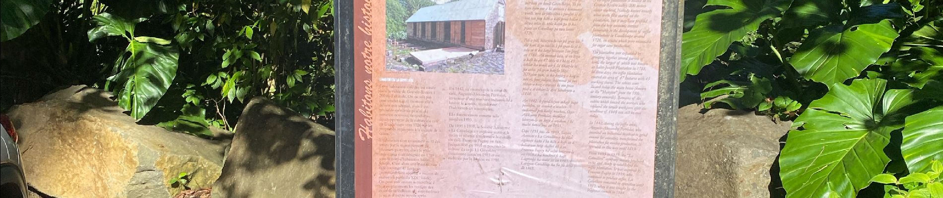
Grand rivière
Photos

Localisation
Pays :
France
Région :
Guadeloupe
Département/Province :
Inconnu
Commune :
Baillif
Localité :
Unknown
Départ:(Dec)
Départ:(UTM)
634635 ; 1773416 (20Q) N.
Commentaires