


mosern - brunshkoft

OxygenLT
Utilisateur
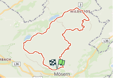

Longueur
10,8 km

Altitude max
1505 m

Dénivelé positif
359 m
Km-Effort
15,6 km

Altitude min
1243 m

Dénivelé négatif
372 m
Boucle
Oui
Date de création :
2025-01-27 08:31:47.818
Dernière modification :
2025-01-27 12:27:14.345
3h54
Difficulté : Moyen

Application GPS de randonnée GRATUITE
 SityTrail
IGN / Instituts géographiques
SityTrail Plus
Le monde est à vous
À propos
Randonnée Marche de 10,8 km à découvrir à Tyrol, Bezirk Innsbruck-Land, Marktgemeinde Telfs. Cette randonnée est proposée par OxygenLT.
Localisation
Pays :
Autriche
Région :
Tyrol
Département/Province :
Bezirk Innsbruck-Land
Commune :
Marktgemeinde Telfs
Localité :
Unknown
Départ:(Dec)
Départ:(UTM)
662211 ; 5242228 (32T) N.
Commentaires