Randonnée Marche Espalion - Compostelle 08 - Espalion -> Estaing - Photo

Compostelle 08 - Espalion -> Estaing

 uru2010
uru2010

Utilisateur

© OpenStreetMap contributors
Longueur
Longueur
13,8 km
Altitude max
Altitude max
491 m
Dénivelé positif
Dénivelé positif
303 m
Km-Effort
Km-Effort  
17,9 km
Altitude min
Altitude min
312 m
Dénivelé négatif
Dénivelé négatif
327 m
Boucle
Boucle
Non
Date de création :
2018-06-12 00:00:00.0
Dernière modification :
2018-06-12 00:00:00.0

(1 Avis)

Marche
Marche
3h53
Difficulté : Facile

Scannez ce code QR pour ouvrir la randonnée dans l'application SityTrail

Application GPS de randonnée GRATUITE

Logo SityTrail SityTrail

IGN / Instituts géographiques

Télécharger SityTrail sur l'App Store Télécharger SityTrail sur Google Play

Logo SityTrail SityTrail World

Le monde est à vous

Télécharger SityTrail sur l'App Store Télécharger SityTrail sur Google Play Télécharger SityTrail sur Huawei AppGallery

À propos

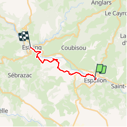
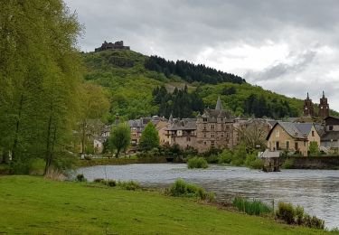
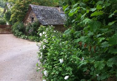
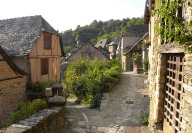
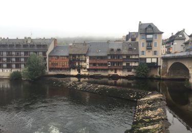
Randonnée Marche de 13,8 km à découvrir à Occitanie, Aveyron, Espalion. Cette randonnée est proposée par uru2010.

Description

Chemin de St Jacques de Compostelle
Espalion -> Estaing

Profil altimétrique

Photos

Localisation

Pays :
France
Région :
Occitanie
Département/Province :
Aveyron
Commune :
Espalion
Localité :
Unknown
Départ:(Dec)
Départ:(UTM)
480951 ; 4929780 (31T) N.

Commentaires

Veuillez vous connecter pour laisser un commentaire ou une note


Randonnées à proximité

Randonnée Marche Espalion - Espalion Massip Avril 2018 - Photo
Marche
GUIDE
Kargil

Marche

Difficile
Espalion, Occitanie, Aveyron, France
25 km | 35 km-effort
7h 13min
Non
Randonnée Marche Saint-Côme-d'Olt - étape st Jacques st come sur d olt-estaing - Photo
Marche
fab0202

Marche

Moyen
Saint-Côme-d'Olt, Occitanie, Aveyron, France
25 km | 32 km-effort
5h 54min
Non
Randonnée Marche Saint-Côme-d'Olt - saint Come d'Olt Estaing - Photo
Marche
PhilDomDoxa

Marche

Moyen
Saint-Côme-d'Olt, Occitanie, Aveyron, France
14,5 km | 20 km-effort
5h 54min
Non
Randonnée A pied Espalion - La Voie du Rail - Photo
A pied
PRO

A pied

Facile
Espalion, Occitanie, Aveyron, France
10,2 km | 14,7 km-effort
3h 20min
Non
Randonnée Marche Espalion - CC_Velay_BD_08_Espalion_Golinhac_20070823 - Photo
Marche
patrickdanilo

Marche

Difficile
Espalion, Occitanie, Aveyron, France
28 km | 39 km-effort
7h 30min
Non
Randonnée Marche Saint-Côme-d'Olt - saint Côme d'olt- Estaing - Photo
Marche
guariso

Marche

Difficile
Saint-Côme-d'Olt, Occitanie, Aveyron, France
23 km | 31 km-effort
6h 17min
Non
Randonnée Marche Saint-Côme-d'Olt - Saint Côme d'Olt vers Estaing - Photo
Marche
choubaka77

Marche

Moyen
Saint-Côme-d'Olt, Occitanie, Aveyron, France
20 km | 28 km-effort
7h 1min
Non
Randonnée Marche Espalion - Mon Compostelle, quatrième étape - Photo
Marche
Ardeiserois

Marche

Très difficile
Espalion, Occitanie, Aveyron, France
47 km | 65 km-effort
10h 0min
Non
Randonnée Marche Espalion - espalion - golinhac - Photo
Marche
jib971

Marche

Difficile
Espalion, Occitanie, Aveyron, France
29 km | 39 km-effort
8h 42min
Non


Fermer
Mes abonnements