Randonnée Vélo Tarascon - Via Rhôna de Tarascon à bourg-saint-andéol  - Photo

Via Rhôna de Tarascon à bourg-saint-andéol

 destras
destras

Utilisateur

© OpenStreetMap contributors
Longueur
Longueur
108 km
Altitude max
Altitude max
79 m
Dénivelé positif
Dénivelé positif
786 m
Km-Effort
Km-Effort  
118 km
Altitude min
Altitude min
8 m
Dénivelé négatif
Dénivelé négatif
737 m
Boucle
Boucle
Non
Date de création :
2016-03-09 00:00:00.0
Dernière modification :
2016-03-09 00:00:00.0

(0 Avis)

Vélo
Vélo
6h46
Difficulté : Facile

Scannez ce code QR pour ouvrir la randonnée dans l'application SityTrail

Application GPS de randonnée GRATUITE

Logo SityTrail SityTrail

IGN / Instituts géographiques

Télécharger SityTrail sur l'App Store Télécharger SityTrail sur Google Play

Logo SityTrail SityTrail World

Le monde est à vous

Télécharger SityTrail sur l'App Store Télécharger SityTrail sur Google Play Télécharger SityTrail sur Huawei AppGallery

À propos

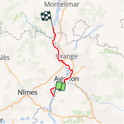
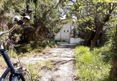
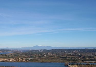
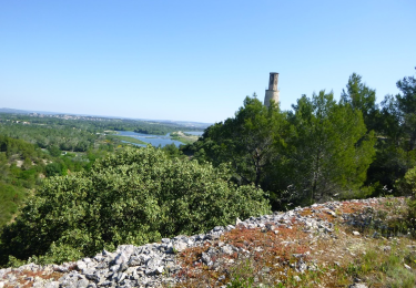
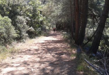
Randonnée Vélo de 108 km à découvrir à Provence-Alpes-Côte d'Azur, Bouches-du-Rhône, Tarascon. Cette randonnée est proposée par destras.

Description

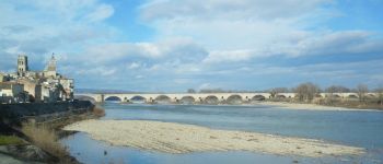
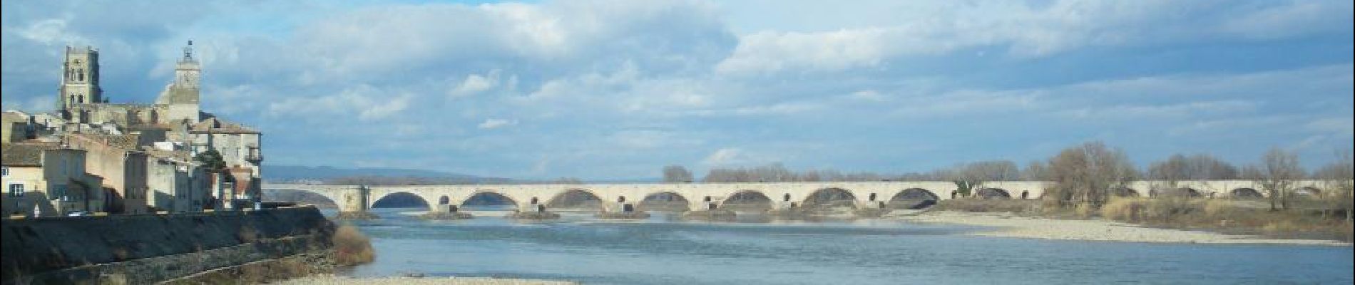
de Tarascon à bourg Saint Andéol
en vélo à assistance électrique VAE par la ViaRhôna

Profil altimétrique

Photos

Points d'intérêt

Point d'intérêt Tarascon - Statue de Tartarin - Photo
destras
Point d'intérêt Avignon - Palais de papes - Photo
destras
Point d'intérêt Avignon - Notre dame des doms  - Photo
destras
Point d'intérêt Châteauneuf-du-Pape - Chateauneuf du pape - Photo
destras
CHÂTEAUNEUF-DU-PAPE 
Point d'intérêt Châteauneuf-du-Pape - Chateau Chateauneuf du pape - Photo
destras
CHÂTEAUNEUF-DU-PAPE 
Point d'intérêt Pont-Saint-Esprit - Pont saint-esprit - Photo
destras
PONT-SAINT-ESPRIT 

Localisation

Pays :
France
Région :
Provence-Alpes-Côte d'Azur
Département/Province :
Bouches-du-Rhône
Commune :
Tarascon
Localité :
Unknown
Départ:(Dec)
Départ:(UTM)
633565 ; 4851181 (31T) N.

Randonnées à proximité

Randonnée Marche Comps - Abbaye de St-Roman - Photo
Marche
Amaralain

Marche

Facile
(1)
Comps, Occitanie, Gard, France
5 km | 6,8 km-effort
1h 27min
Oui
Randonnée Marche Tarascon - Chapelle Saint Gabriel - Photo
Marche
GUIDE
Roger Philippe Wallez

Marche

Très difficile
Tarascon, Provence-Alpes-Côte d'Azur, Bouches-du-Rhône, France
18,6 km | 25 km-effort
5h 23min
Oui
Randonnée Marche Tarascon - CR_Domitia_BA_23_Tarascon_St-Remy-Provence_20220404 - Photo
Marche
patrickdanilo

Marche

Moyen
Tarascon, Provence-Alpes-Côte d'Azur, Bouches-du-Rhône, France
17 km | 22 km-effort
4h 42min
Non
Randonnée V.T.C. Comps - Voie verte depuis barrage de Vallabrègues Intersport Marguillier Saint Félix et fin au château de Beaucaire  - Photo
V.T.C.
jacqk

V.T.C.

Facile
Comps, Occitanie, Gard, France
9,1 km | 10,4 km-effort
1h 0min
Non
Randonnée Marche Beaucaire - Beaucaire/ St Roman - Photo
Marche
GUIDE
nadinebondoux

Marche

Facile
Beaucaire, Occitanie, Gard, France
14,7 km | 18,6 km-effort
3h 42min
Oui
Randonnée A pied Beaucaire - La Bouteille - Photo
A pied
Michele.nigri

A pied

Facile
Beaucaire, Occitanie, Gard, France
14,6 km | 18,1 km-effort
Inconnu
Oui
Randonnée Marche Tarascon - Alpilles Ouest - St-Gabriel - Photo
Marche
tracegps

Marche

Moyen
Tarascon, Provence-Alpes-Côte d'Azur, Bouches-du-Rhône, France
8,2 km | 11 km-effort
2h 30min
Oui
Randonnée Marche Tarascon - alpilles chapelle saint gabriel - Photo
Marche
Dan30

Marche

Facile
Tarascon, Provence-Alpes-Côte d'Azur, Bouches-du-Rhône, France
13,1 km | 18,2 km-effort
3h 26min
Oui
Randonnée A pied Beaucaire - L'Aiguille - 30 BEAUCAIRE - Photo
A pied
Michele.nigri

A pied

Moyen
Beaucaire, Occitanie, Gard, France
19 km | 25 km-effort
Inconnu
Oui


Fermer
Mes abonnements