


Col Rouge

geoffrayLayeux
Utilisateur
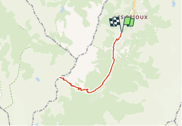

Longueur
14,6 km

Altitude max
2739 m

Dénivelé positif
993 m
Km-Effort
28 km

Altitude min
1746 m

Dénivelé négatif
993 m
Boucle
Oui
Date de création :
2025-07-21 16:16:39.33
Dernière modification :
2025-07-21 16:22:26.348
6h19
Difficulté : Très difficile

Application GPS de randonnée GRATUITE
 SityTrail
IGN / Instituts géographiques
SityTrail Plus
Le monde est à vous
À propos
Randonnée Marche de 14,6 km à découvrir à Auvergne-Rhône-Alpes, Savoie, Pralognan-la-Vanoise. Cette randonnée est proposée par geoffrayLayeux.
Localisation
Pays :
France
Région :
Auvergne-Rhône-Alpes
Département/Province :
Savoie
Commune :
Pralognan-la-Vanoise
Localité :
Unknown
Départ:(Dec)
Départ:(UTM)
319474 ; 5023330 (32T) N.
Commentaires