


sure and co

JLRando
Utilisateur
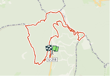

Longueur
15,2 km

Altitude max
1634 m

Dénivelé positif
895 m
Km-Effort
27 km

Altitude min
1273 m

Dénivelé négatif
907 m
Boucle
Oui
Date de création :
2025-07-29 07:52:26.599
Dernière modification :
2025-07-29 19:23:00.997
6h25
Difficulté : Très difficile

Application GPS de randonnée GRATUITE
 SityTrail
IGN / Instituts géographiques
SityTrail Plus
Le monde est à vous
À propos
Randonnée Marche de 15,2 km à découvrir à Auvergne-Rhône-Alpes, Isère, Autrans-Méaudre en Vercors. Cette randonnée est proposée par JLRando.
Photos


Localisation
Pays :
France
Région :
Auvergne-Rhône-Alpes
Département/Province :
Isère
Commune :
Autrans-Méaudre en Vercors
Localité :
Autrans
Départ:(Dec)
Départ:(UTM)
702518 ; 5011330 (31T) N.
Commentaires