


mm

JLRando
Utilisateur
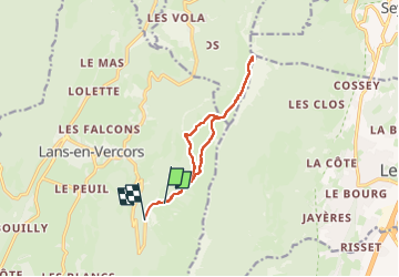

Longueur
10,8 km

Altitude max
1885 m

Dénivelé positif
454 m
Km-Effort
17,1 km

Altitude min
1360 m

Dénivelé négatif
519 m
Boucle
Non
Date de création :
2025-08-02 11:07:36.611
Dernière modification :
2025-08-10 10:06:25.706
3h24
Difficulté : Facile

Application GPS de randonnée GRATUITE
 SityTrail
IGN / Instituts géographiques
SityTrail Plus
Le monde est à vous
À propos
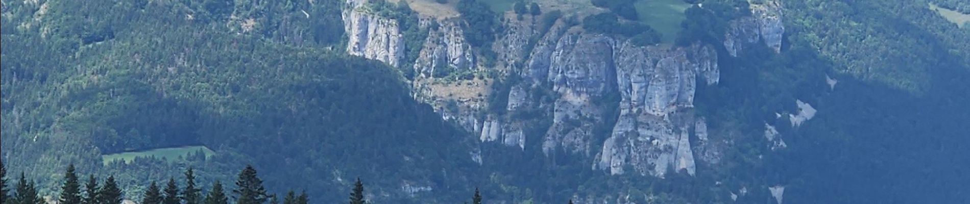
Randonnée Marche de 10,8 km à découvrir à Auvergne-Rhône-Alpes, Isère, Lans-en-Vercors. Cette randonnée est proposée par JLRando.
Photos


Localisation
Pays :
France
Région :
Auvergne-Rhône-Alpes
Département/Province :
Isère
Commune :
Lans-en-Vercors
Localité :
Unknown
Départ:(Dec)
Départ:(UTM)
705437 ; 4999219 (31T) N.
Commentaires