Randonnée Marche Issendolus - La randonnée du Causse - Photo

La randonnée du Causse

 alain2306
alain2306

Utilisateur

© OpenStreetMap contributors
Longueur
Longueur
16,6 km
Altitude max
Altitude max
352 m
Dénivelé positif
Dénivelé positif
230 m
Km-Effort
Km-Effort  
19,7 km
Altitude min
Altitude min
302 m
Dénivelé négatif
Dénivelé négatif
239 m
Boucle
Boucle
Oui
Date de création :
2015-09-07 00:00:00.0
Dernière modification :
2015-09-07 00:00:00.0

(0 Avis)

Marche
Marche
4h15
Difficulté : Difficile

Scannez ce code QR pour ouvrir la randonnée dans l'application SityTrail

Application GPS de randonnée GRATUITE

Logo SityTrail SityTrail

IGN / Instituts géographiques

Télécharger SityTrail sur l'App Store Télécharger SityTrail sur Google Play

Logo SityTrail SityTrail World

Le monde est à vous

Télécharger SityTrail sur l'App Store Télécharger SityTrail sur Google Play Télécharger SityTrail sur Huawei AppGallery

À propos

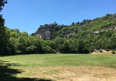
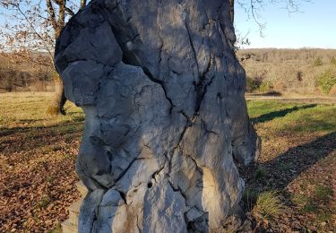
Randonnée Marche de 16,6 km à découvrir à Occitanie, Lot, Issendolus. Cette randonnée est proposée par alain2306.

Description

Issue du TopoGuides "Le Lot....à pied"
Randonnée PR13

Profil altimétrique

Photos

Localisation

Pays :
France
Région :
Occitanie
Département/Province :
Lot
Commune :
Issendolus
Localité :
Unknown
Départ:(Dec)
Départ:(UTM)
403963 ; 4954948 (31T) N.

Randonnées à proximité

Randonnée Marche Issendolus - pr issendolus - Photo
Marche
lafage

Marche

Facile
(3)
Issendolus, Occitanie, Lot, France
15,9 km | 19 km-effort
4h 6min
Oui
Randonnée Marche Gramat - Gramat vers Rocamadour  - Photo
Marche
choubaka77

Marche

Facile
Gramat, Occitanie, Lot, France
11,6 km | 15,7 km-effort
3h 34min
Non
Randonnée Marche Gramat - Gramat - Rocamadour  - Photo
Marche
mathieubrulais

Marche

Très facile
Gramat, Occitanie, Lot, France
12,7 km | 15,1 km-effort
2h 57min
Non
Randonnée Marche Thémines - Themines Rueyres 11km - Photo
Marche
houbart

Marche

Difficile
Thémines, Occitanie, Lot, France
10,8 km | 14 km-effort
3h 10min
Oui
Randonnée Marche Thémines - themine - Photo
Marche
thomas.o.vert

Marche

Facile
Thémines, Occitanie, Lot, France
10,6 km | 13,2 km-effort
2h 47min
Oui
Randonnée Randonnée équestre Gramat - ouarzazate - Photo
Randonnée équestre
claude Mabit

Randonnée équestre

Très facile
Gramat, Occitanie, Lot, France
1757 km | 0 m-effort
17h 8min
Non
Randonnée Marche Gramat - Saint chignes issendolus - Photo
Marche
neleda

Marche

Difficile
Gramat, Occitanie, Lot, France
10,7 km | 12,7 km-effort
20h 46min
Oui
Randonnée Marche Gramat - vaillac nrzt sous la pluie - Photo
Marche
viem46

Marche

Facile
Gramat, Occitanie, Lot, France
75 km | 93 km-effort
6h 17min
Non
Randonnée Marche Rueyres - rueyes  rudelle - Photo
Marche
gcournac

Marche

Difficile
Rueyres, Occitanie, Lot, France
14,4 km | 18,1 km-effort
3h 32min
Non


Fermer
Mes abonnements