


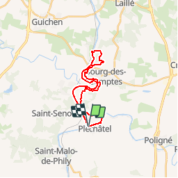
Pléchatel/ Bourg des Comptes

chasle
Utilisateur

Longueur
22 km

Altitude max
76 m

Dénivelé positif
303 m
Km-Effort
26 km

Altitude min
8 m

Dénivelé négatif
313 m
Boucle
Oui
Date de création :
2015-11-13 00:00:00.0
Dernière modification :
2019-03-20 20:29:02.419
--
Difficulté : Facile

Application GPS de randonnée GRATUITE
 SityTrail
IGN / Instituts géographiques
SityTrail Plus
Le monde est à vous
À propos
Randonnée Marche de 22 km à découvrir à Bretagne, Ille-et-Vilaine, Pléchâtel. Cette randonnée est proposée par chasle.
Localisation
Pays :
France
Région :
Bretagne
Département/Province :
Ille-et-Vilaine
Commune :
Pléchâtel
Localité :
Unknown
Départ:(Dec)
Départ:(UTM)
593018 ; 5305488 (30T) N.
Commentaires