


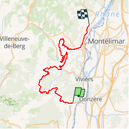

17,4 km | 25 km-effort


Utilisateur


Application GPS de randonnée GRATUITE
 SityTrail
IGN / Instituts géographiques
SityTrail World
Le monde est à vous
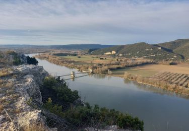
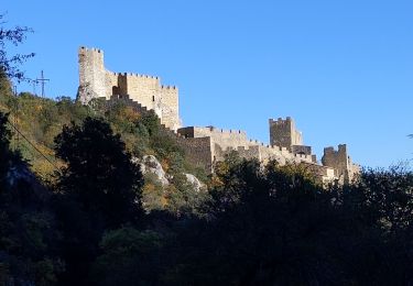
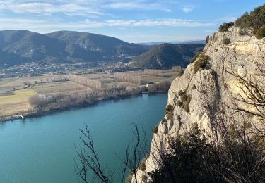
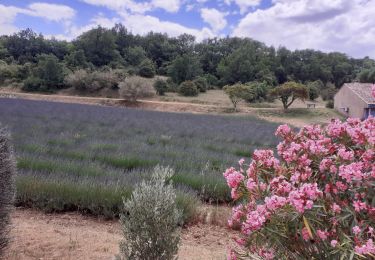
Randonnée Moteur de 55 km à découvrir à Auvergne-Rhône-Alpes, Ardèche, Saint-Montan. Cette randonnée est proposée par rodo6269.
sortie 4x4
Marche
Marche
Marche
Marche

V.T.T.

Marche
Marche
Marche
Marche
balade en 4x4 tranquille penser à bien remettre les barrières des clôture électrique après le passage du véhicule