Randonnée Marche Rosnoën - Seillou - Photo
 neoroll44
neoroll44

Utilisateur

© OpenStreetMap contributors
Longueur
Longueur
15,9 km
Altitude max
Altitude max
143 m
Dénivelé positif
Dénivelé positif
379 m
Km-Effort
Km-Effort  
21 km
Altitude min
Altitude min
-3 m
Dénivelé négatif
Dénivelé négatif
374 m
Boucle
Boucle
Oui
Date de création :
2016-05-09 00:00:00.0
Dernière modification :
2016-05-09 00:00:00.0

(0 Avis)

Marche
Marche
4h00
Difficulté : Difficile

Scannez ce code QR pour ouvrir la randonnée dans l'application SityTrail

Application GPS de randonnée GRATUITE

Logo SityTrail SityTrail

IGN / Instituts géographiques

Télécharger SityTrail sur l'App Store Télécharger SityTrail sur Google Play

Logo SityTrail SityTrail World

Le monde est à vous

Télécharger SityTrail sur l'App Store Télécharger SityTrail sur Google Play Télécharger SityTrail sur Huawei AppGallery

À propos

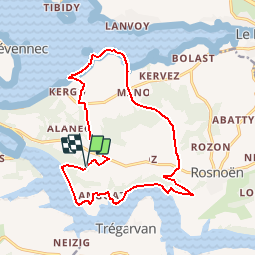
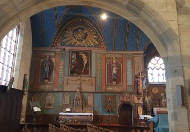
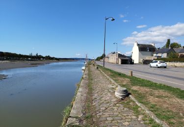
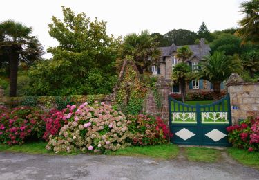
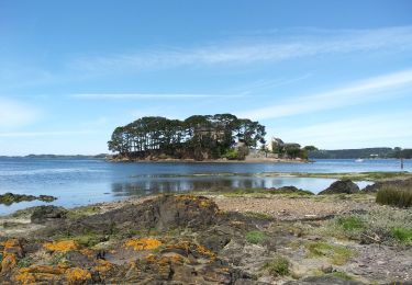
Randonnée Marche de 15,9 km à découvrir à Bretagne, Finistère, Rosnoën. Cette randonnée est proposée par neoroll44.

Description

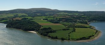
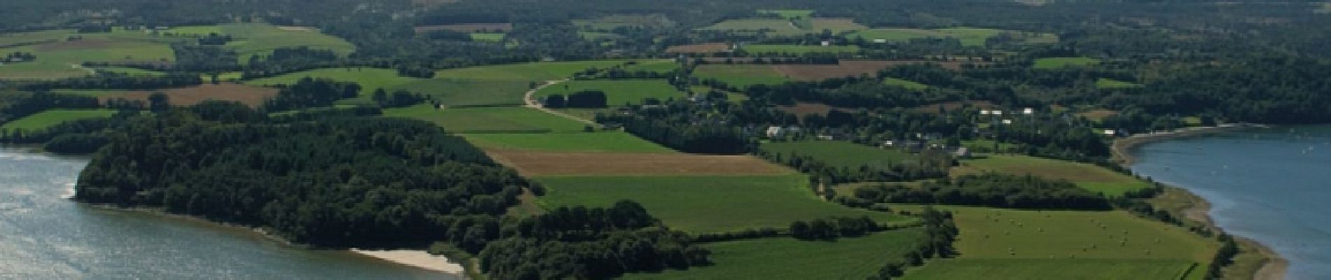
Les bords de l'Aulne près de Rosnoën et face à la pointe de Landévennec. De belles vues sur l'Aulne. Des parties difficiles le long de la berge et en forêt. Des parties impraticables à marée haute. Attention aux horaires et coefficients de marée.

Profil altimétrique

Photos

Points d'intérêt

Point d'intérêt Rosnoën - Les bords de l'Aulne - Photo
neoroll44

Localisation

Pays :
France
Région :
Bretagne
Département/Province :
Finistère
Commune :
Rosnoën
Localité :
Unknown
Départ:(Dec)
Départ:(UTM)
407943 ; 5346520 (30U) N.

Randonnées à proximité

Randonnée Marche Trégarvan - Menez Hom_10,3km_Trace GPS - Photo
Marche
Pousscailleux

Marche

Moyen
(1)
Trégarvan, Bretagne, Finistère, France
10,2 km | 14 km-effort
3h 0min
Oui
Randonnée Marche Trégarvan - TREGARVAN_6,7km_Trace GPS - Photo
Marche
Pousscailleux

Marche

Facile
(1)
Trégarvan, Bretagne, Finistère, France
6,7 km | 8,4 km-effort
1h 50min
Oui
Randonnée Marche Landévennec - LANDÉVENNEC  - Photo
Marche
RonanDAGORN

Marche

Difficile
Landévennec, Bretagne, Finistère, France
19,4 km | 25 km-effort
4h 41min
Non
Randonnée Marche Le Faou - GRP_Crozon_CB_01_Le-Faou_Argol_20200919 - Photo
Marche
patrickdanilo

Marche

Moyen
Le Faou, Bretagne, Finistère, France
15,9 km | 21 km-effort
4h 31min
Non
Randonnée Marche Le Faou - La randonnée du Faou - Photo
Marche
alainjoseph6

Marche

Moyen
Le Faou, Bretagne, Finistère, France
9,4 km | 11,6 km-effort
3h 37min
Oui
Randonnée Marche Le Faou - GR_37_FC_14_Le-Faou_Argol_20200919 - Photo
Marche
patrickdanilo

Marche

Moyen
Le Faou, Bretagne, Finistère, France
15,9 km | 21 km-effort
4h 31min
Non
Randonnée Marche Landévennec - Landévennec - boucles locales et GR34 - 13.8km 250m 4h10 (35mn) - 2019 09 12 - Photo
Marche
Orcal37

Marche

Facile
Landévennec, Bretagne, Finistère, France
13,8 km | 17,2 km-effort
4h 10min
Oui
Randonnée Marche Rosnoën - ROSNOËN - Photo
Marche
RonanDAGORN

Marche

Moyen
(1)
Rosnoën, Bretagne, Finistère, France
18,5 km | 24 km-effort
4h 47min
Oui
Randonnée Marche Argol - Térénez - Kerivin - Photo
Marche
cron

Marche

Très facile
(1)
Argol, Bretagne, Finistère, France
11,9 km | 15 km-effort
3h 15min
Oui


Fermer
Mes abonnements