Randonnée Marche Villeneuve-la-Dondagre - Villages du Gâtinais en Bourgogne - Photo
 micheljannot
micheljannot

Utilisateur

© OpenStreetMap contributors
Longueur
Longueur
14,7 km
Altitude max
Altitude max
189 m
Dénivelé positif
Dénivelé positif
101 m
Km-Effort
Km-Effort  
16,1 km
Altitude min
Altitude min
151 m
Dénivelé négatif
Dénivelé négatif
102 m
Boucle
Boucle
Oui
Date de création :
2018-04-12 04:36:29.255
Dernière modification :
2018-04-12 04:36:29.255

(0 Avis)

Marche
Marche
3h34
Difficulté : Facile

Scannez ce code QR pour ouvrir la randonnée dans l'application SityTrail

Application GPS de randonnée GRATUITE

Logo SityTrail SityTrail

IGN / Instituts géographiques

Télécharger SityTrail sur l'App Store Télécharger SityTrail sur Google Play

Logo SityTrail SityTrail World

Le monde est à vous

Télécharger SityTrail sur l'App Store Télécharger SityTrail sur Google Play Télécharger SityTrail sur Huawei AppGallery

À propos

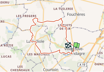
Randonnée Marche de 14,7 km à découvrir à Bourgogne-Franche-Comté, Yonne, Villeneuve-la-Dondagre. Cette randonnée est proposée par micheljannot.

Description

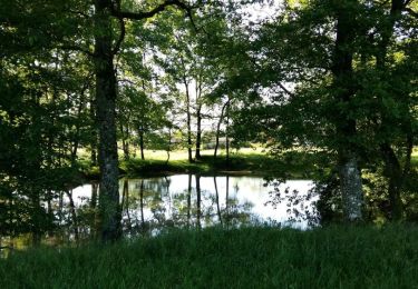
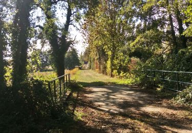
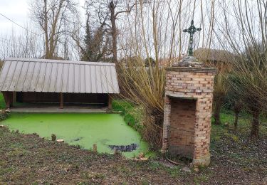
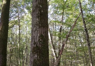
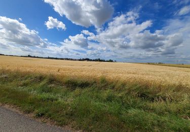
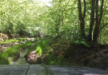
Ce circuit traverse hameaux tranquilles et villages paisibles du Gâtinais en Bourgogne

Profil altimétrique

Points d'intérêt

Point d'intérêt Fouchères - le puits de fer - Photo
micheljannot
FOUCHÈRES 
Point d'intérêt Saint-Valérien - puits des Mirons - Photo
micheljannot
SAINT-VALÉRIEN 
Point d'intérêt Saint-Valérien - pont sur le Lunain - Photo
micheljannot
SAINT-VALÉRIEN 
Point d'intérêt Villeneuve-la-Dondagre - étangs - Photo
micheljannot
VILLENEUVE-LA-DONDAGRE 
Point d'intérêt La Belliole - croix - Photo
micheljannot
LA BELLIOLE 
Point d'intérêt La Belliole - église - Photo
micheljannot
LA BELLIOLE 
Point d'intérêt La Belliole - parachutage - Photo
micheljannot
LA BELLIOLE 

Localisation

Pays :
France
Région :
Bourgogne-Franche-Comté
Département/Province :
Yonne
Commune :
Villeneuve-la-Dondagre
Localité :
Unknown
Départ:(Dec)
Départ:(UTM)
510017 ; 5331661 (31U) N.

Randonnées à proximité

Randonnée Marche Villeneuve-la-Dondagre - Villages du Gâtinais en Bourgogne - Photo
Marche
micheljannot

Marche

Facile
Villeneuve-la-Dondagre, Bourgogne-Franche-Comté, Yonne, France
14,8 km | 16,1 km-effort
3h 47min
Oui
Randonnée V.T.T. Saint-Valérien - Vallée de l'Orvane 1 - Photo
V.T.T.
Yannick89

V.T.T.

Très facile
Saint-Valérien, Bourgogne-Franche-Comté, Yonne, France
35 km | 38 km-effort
3h 14min
Non
Randonnée Marche Saint-Valérien - Saint-Valerien 230219 - Photo
Marche
Specialized77

Marche

Très facile
Saint-Valérien, Bourgogne-Franche-Comté, Yonne, France
10,7 km | 11,7 km-effort
3h 0min
Oui
Randonnée Geocaching Villeneuve-la-Dondagre - 221112 Villeneuve la Dondagre-02 (geocaching) - Photo
Geocaching
Specialized77

Geocaching

Facile
Villeneuve-la-Dondagre, Bourgogne-Franche-Comté, Yonne, France
8,3 km | 9,1 km-effort
3h 19min
Oui
Randonnée Geocaching Villeneuve-la-Dondagre - 221026 Villeneuve la D geocaching - Photo
Geocaching
Specialized77

Geocaching

Facile
Villeneuve-la-Dondagre, Bourgogne-Franche-Comté, Yonne, France
10,3 km | 11,4 km-effort
5h 43min
Oui
Randonnée Vélo de route Subligny - 220920 Subligny 7,7 km - Photo
Vélo de route
Specialized77

Vélo de route

Facile
Subligny, Bourgogne-Franche-Comté, Yonne, France
7,7 km | 9 km-effort
2h 5min
Oui
Randonnée Marche Villeneuve-la-Dondagre - 220609 Villeneuve la Dondagre - Photo
Marche
Specialized77

Marche

Très facile
Villeneuve-la-Dondagre, Bourgogne-Franche-Comté, Yonne, France
8,3 km | 9,3 km-effort
2h 38min
Oui
Randonnée Autre activité Villeneuve-la-Dondagre - 15 mai suite - Photo
Autre activité
nono.gr89

Autre activité

Très facile
Villeneuve-la-Dondagre, Bourgogne-Franche-Comté, Yonne, France
40 km | 48 km-effort
4h 40min
Non
Randonnée Marche Saint-Valérien - Source de l'Orvanne - Photo
Marche
micheljannot

Marche

Facile
Saint-Valérien, Bourgogne-Franche-Comté, Yonne, France
11,3 km | 12,5 km-effort
2h 47min
Oui


Fermer
Mes abonnements