


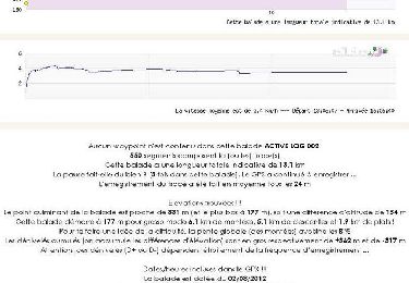
10,1 km | 14,3 km-effort


Utilisateur


Application GPS de randonnée GRATUITE
 SityTrail
IGN / Instituts géographiques
SityTrail World
Le monde est à vous
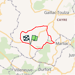
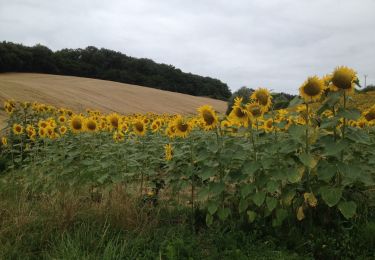
Randonnée Marche de 9,4 km à découvrir à Occitanie, Haute-Garonne, Gaillac-Toulza. Cette randonnée est proposée par pidjam.
petite marche agréable en campagne. Un passage délicat s'il a plu récemment (boue et gué à passer)
Marche
Marche
Cheval

A pied
Marche

V.T.T.

Marche
Marche