Randonnée Vélo Unknown - Etape 6 SAGRES LAGOS - Photo

Etape 6 SAGRES LAGOS

 paul49
paul49

Utilisateur

© OpenStreetMap contributors
Longueur
Longueur
42 km
Altitude max
Altitude max
106 m
Dénivelé positif
Dénivelé positif
659 m
Km-Effort
Km-Effort  
51 km
Altitude min
Altitude min
-2 m
Dénivelé négatif
Dénivelé négatif
686 m
Boucle
Boucle
Non
Date de création :
2018-04-17 13:05:32.176
Dernière modification :
2018-04-17 13:05:32.176

(0 Avis)

Vélo
Vélo
2h38
Difficulté : Inconnu

Scannez ce code QR pour ouvrir la randonnée dans l'application SityTrail

Application GPS de randonnée GRATUITE

Logo SityTrail SityTrail

IGN / Instituts géographiques

Télécharger SityTrail sur l'App Store Télécharger SityTrail sur Google Play

Logo SityTrail SityTrail World

Le monde est à vous

Télécharger SityTrail sur l'App Store Télécharger SityTrail sur Google Play Télécharger SityTrail sur Huawei AppGallery

À propos

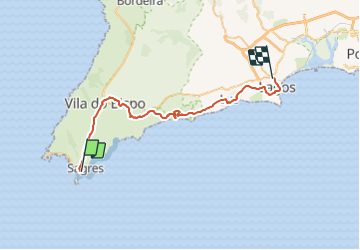
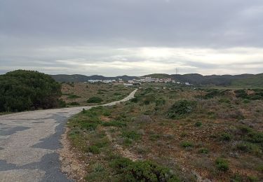
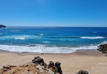
Randonnée Vélo de 42 km à découvrir à Algarve, Faro. Cette randonnée est proposée par paul49.

Description

Lisbonne Séville

Profil altimétrique

Localisation

Pays :
Portugal
Région :
Algarve
Département/Province :
Faro
Commune :
Unknown
Localité :
Unknown
Départ:(Dec)
Départ:(UTM)
505191 ; 4095686 (29S) N.

Randonnées à proximité

Randonnée Marche  - Sagres cap St VINCENT Carrapateria - Photo
Marche
jeff2

Marche

Moyen
, Algarve, Faro, Portugal
40 km | 50 km-effort
12h 35min
Non
Randonnée Marche Sagres - ALGARVE - Grande boucle près du Cabo de São Vicente - Photo
Marche
Michel1963

Marche

Moyen
Sagres, Algarve, Faro, Portugal
15,5 km | 18,7 km-effort
4h 41min
Oui
Randonnée Marche Sagres - Sagres 20230919 - Photo
Marche
lbu

Marche

Moyen
Sagres, Algarve, Faro, Portugal
7,1 km | 8,6 km-effort
3h 15min
Oui
Randonnée Marche Sagres - Sages - Cabo de São Vincent 9-10-2019 - Photo
Marche
fredetpascale

Marche

Facile
Sagres, Algarve, Faro, Portugal
9,5 km | 12 km-effort
2h 44min
Oui


Fermer
Mes abonnements