Randonnée Marche Ledro - Along the traces of the Great War - Photo

Along the traces of the Great War

 Dhendrickx71
Dhendrickx71

Utilisateur

© OpenStreetMap contributors
Longueur
Longueur
6,6 km
Altitude max
Altitude max
1052 m
Dénivelé positif
Dénivelé positif
672 m
Km-Effort
Km-Effort  
15,6 km
Altitude min
Altitude min
397 m
Dénivelé négatif
Dénivelé négatif
672 m
Boucle
Boucle
Oui
Date de création :
2018-04-17 13:54:17.64
Dernière modification :
2018-04-17 13:54:17.64

(0 Avis)

Marche
Marche
3h12
Difficulté : Difficile

Scannez ce code QR pour ouvrir la randonnée dans l'application SityTrail

Application GPS de randonnée GRATUITE

Logo SityTrail SityTrail

IGN / Instituts géographiques

Télécharger SityTrail sur l'App Store Télécharger SityTrail sur Google Play

Logo SityTrail SityTrail World

Le monde est à vous

Télécharger SityTrail sur l'App Store Télécharger SityTrail sur Google Play Télécharger SityTrail sur Huawei AppGallery

À propos

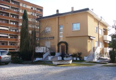
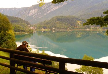
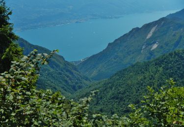
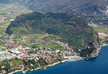
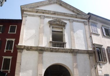
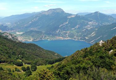
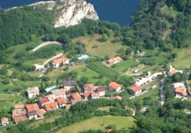
Randonnée Marche de 6,6 km à découvrir à Trentin-Haut-Adige, Provincia di Trento, Ledro. Cette randonnée est proposée par Dhendrickx71.

Description

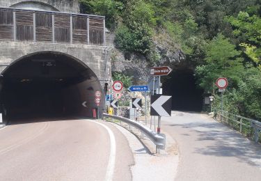
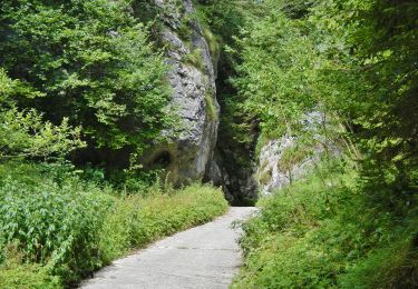
From BIacesa go up to theSan Giovanni Church through the 'Sentiero dei Bech' (Goat path) and the nr. 471. From there continue climbing to Cima Rocca (top of the walk). Go down till Boca Pasumer. Follow there the 405B for a while and a non marked path till Bocet dei Concoli. You'll find there the path 417. It will you bring down till the start. LOOK OUT. Parts of the walk are ± easy via ferrata (ladders). You also need a flashlight to pass through war tunnels.

Profil altimétrique

Localisation

Pays :
Italie
Région :
Trentin-Haut-Adige
Département/Province :
Provincia di Trento
Commune :
Ledro
Localité :
Unknown
Départ:(Dec)
Départ:(UTM)
640261 ; 5080689 (32T) N.

Randonnées à proximité

Randonnée A pied Riva del Garda - Sentiero delle Laste basse - Berghem
A pied
PRO

A pied

Facile
Riva del Garda, Trentin-Haut-Adige, Provincia di Trento, Italie
4,7 km | 11,3 km-effort
2h 34min
Non
Randonnée A pied Ledro - Sentiero Austroungarico 1915-1918 - Photo
A pied
PRO

A pied

Facile
Ledro, Trentin-Haut-Adige, Provincia di Trento, Italie
7,2 km | 15 km-effort
3h 23min
Non
Randonnée A pied Limone sul Garda - Agostino Tosi - Photo
A pied
PRO

A pied

Facile
Limone sul Garda, Lombardie, Brescia, Italie
3,2 km | 7,6 km-effort
1h 43min
Non
Randonnée A pied Riva del Garda - Via ferrata
A pied
PRO

A pied

Facile
Riva del Garda, Trentin-Haut-Adige, Provincia di Trento, Italie
5,4 km | 15,3 km-effort
3h 28min
Non
Randonnée A pied Ledro - Via ferrata del Bastione e della Rocchetta - Photo
A pied
PRO

A pied

Facile
Ledro, Trentin-Haut-Adige, Provincia di Trento, Italie
4,9 km | 8,5 km-effort
1h 56min
Non
Randonnée A pied Ledro - Via de Ari e sentiero Rino Zanotti - Photo
A pied
PRO

A pied

Facile
Ledro, Trentin-Haut-Adige, Provincia di Trento, Italie
6,1 km | 11,6 km-effort
2h 38min
Non
Randonnée A pied Riva del Garda - Sentér di Cima Nara - Photo
A pied
PRO

A pied

Facile
Riva del Garda, Trentin-Haut-Adige, Provincia di Trento, Italie
4,7 km | 11 km-effort
2h 30min
Non
Randonnée A pied Riva del Garda - Sentér de Palaer - Photo
A pied
PRO

A pied

Facile
Riva del Garda, Trentin-Haut-Adige, Provincia di Trento, Italie
4 km | 10,3 km-effort
2h 20min
Non
Randonnée A pied Riva del Garda - IT-O422 - Photo
A pied
PRO

A pied

Facile
Riva del Garda, Trentin-Haut-Adige, Provincia di Trento, Italie
5,2 km | 12,7 km-effort
2h 53min
Non


Fermer
Mes abonnements