Randonnée Marche Anhée - Warnant  Montaigle Haut-le-Wastia Warnant - Photo

Warnant Montaigle Haut-le-Wastia Warnant

 Michel.G.
Michel.G.

Utilisateur

© OpenStreetMap contributors
Longueur
Longueur
16,3 km
Altitude max
Altitude max
267 m
Dénivelé positif
Dénivelé positif
381 m
Km-Effort
Km-Effort  
21 km
Altitude min
Altitude min
99 m
Dénivelé négatif
Dénivelé négatif
384 m
Boucle
Boucle
Oui
Date de création :
2018-04-17 16:44:05.912
Dernière modification :
2018-04-17 16:44:05.912

(0 Avis)

Marche
Marche
4h02
Difficulté : Moyen

Scannez ce code QR pour ouvrir la randonnée dans l'application SityTrail

Application GPS de randonnée GRATUITE

Logo SityTrail SityTrail

IGN / Instituts géographiques

Télécharger SityTrail sur l'App Store Télécharger SityTrail sur Google Play

Logo SityTrail SityTrail World

Le monde est à vous

Télécharger SityTrail sur l'App Store Télécharger SityTrail sur Google Play Télécharger SityTrail sur Huawei AppGallery

À propos

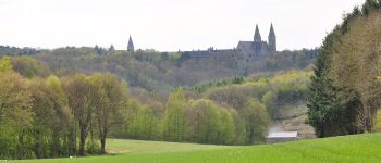
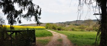
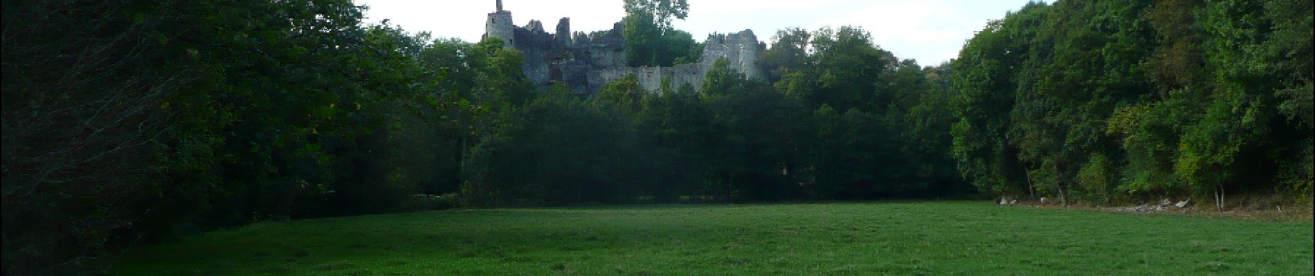
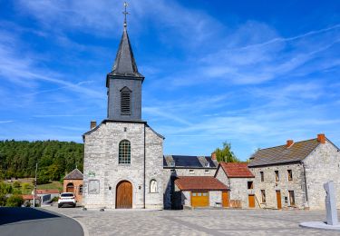
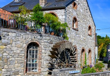
Randonnée Marche de 16,3 km à découvrir à Wallonie, Namur, Anhée. Cette randonnée est proposée par Michel.G..

Description

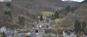
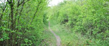
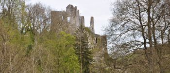
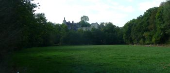
Parking aisé à Warnant près de l'école. Très belle balade majoritairement sur des sentiers. Au retour, après la descente de Haut-le-Wastia vers la N971, il faut normalement continuer à gauche sur celle-ci jusqu'au départ des draisines et tourner à droite sur le RAVel. C'est un passage désagréable le long de cette route fréquentée sans accotement, en hiver il est possible de couper pour rejoindre le RAVel.

Profil altimétrique

Photos

Points d'intérêt

Point d'intérêt Onhaye - Chapelle St Hubert - Photo
Michel.G.
Point d'intérêt Anhée - Sosoye - Photo
Michel.G.
ANHÉE 
Point d'intérêt Onhaye - Foy - Photo
Michel.G.
ONHAYE 
Point d'intérêt Anhée - Au dessus de Warnant - Photo
Michel.G.
Point d'intérêt Onhaye - Château de Montaigle - Photo
Michel.G.
Point d'intérêt Anhée - Château de Montaigle - Photo
Michel.G.

Localisation

Pays :
Belgique
Région :
Wallonie
Département/Province :
Namur
Commune :
Anhée
Localité :
Warnant
Départ:(Dec)
Départ:(UTM)
630457 ; 5575856 (31U) N.

Randonnées à proximité

Randonnée Marche Anhée - RB-Na-22_Bioul_via-racc - Photo
Marche
PRO

Marche

Très difficile
(5)
Anhée, Wallonie, Namur, Belgique
16,7 km | 21 km-effort
4h 52min
Oui
Randonnée Marche Anhée - RB-Na-22_Bioul - Photo
Marche
PRO

Marche

Très difficile
(11)
Anhée, Wallonie, Namur, Belgique
19,5 km | 25 km-effort
5h 46min
Oui
Randonnée Marche Yvoir - RB-Na-21_Mont - Photo
Marche
PRO

Marche

Très difficile
(6)
Yvoir, Wallonie, Namur, Belgique
22 km | 30 km-effort
6h 51min
Oui
Randonnée Marche Anhée - RB-Na-16_Maredsous - Photo
Marche
PRO

Marche

Moyen
(16)
Anhée, Wallonie, Namur, Belgique
18,3 km | 24 km-effort
5h 13min
Oui
Randonnée Marche Yvoir - RB-Na-03_Houx - Photo
Marche
PRO

Marche

Difficile
(10)
Yvoir, Wallonie, Namur, Belgique
22 km | 30 km-effort
7h 1min
Oui
Randonnée Marche Yvoir - RL-GG-38_Godinne_Dinant - Photo
Marche
PRO

Marche

Très difficile
(6)
Yvoir, Wallonie, Namur, Belgique
19,5 km | 27 km-effort
6h 13min
Non
Randonnée Marche Anhée - RF-Na-05 Annevoie, côté Jardins_Grande-boucle - Photo
Marche
PRO

Marche

Moyen
(11)
Anhée, Wallonie, Namur, Belgique
11,3 km | 14,5 km-effort
3h 6min
Oui
Randonnée Marche Anhée - RF-Na-05 Annevoie, côté Jardins_Petite-boucle - Photo
Marche
PRO

Marche

Facile
(7)
Anhée, Wallonie, Namur, Belgique
7,4 km | 10 km-effort
2h 7min
Oui
Randonnée Marche Anhée - RB-Na-16_Maredsous_via-racc - Photo
Marche
PRO

Marche

Facile
(15)
Anhée, Wallonie, Namur, Belgique
13 km | 16,6 km-effort
3h 40min
Oui


Fermer
Mes abonnements