Randonnée Marche Beauvoir - Digue du mont St Michel_01 - Photo

Digue du mont St Michel_01

 mimi53
mimi53

Utilisateur

© OpenStreetMap contributors
Longueur
Longueur
4,5 km
Altitude max
Altitude max
10 m
Dénivelé positif
Dénivelé positif
13 m
Km-Effort
Km-Effort  
4,7 km
Altitude min
Altitude min
4 m
Dénivelé négatif
Dénivelé négatif
12 m
Boucle
Boucle
Oui
Date de création :
2019-02-23 20:41:59.121
Dernière modification :
2019-02-23 20:41:59.141

(0 Avis)

Marche
Marche
1h09
Difficulté : Très facile

Scannez ce code QR pour ouvrir la randonnée dans l'application SityTrail

Application GPS de randonnée GRATUITE

Logo SityTrail SityTrail

IGN / Instituts géographiques

Télécharger SityTrail sur l'App Store Télécharger SityTrail sur Google Play

Logo SityTrail SityTrail World

Le monde est à vous

Télécharger SityTrail sur l'App Store Télécharger SityTrail sur Google Play Télécharger SityTrail sur Huawei AppGallery

À propos

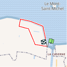
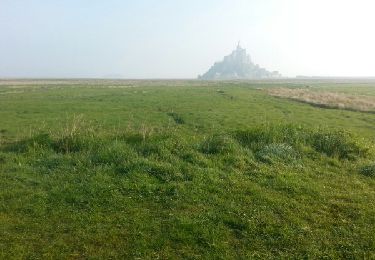
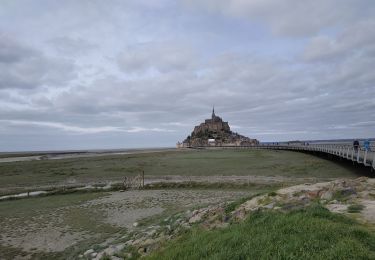
Randonnée Marche de 4,5 km à découvrir à Normandie, Manche, Beauvoir. Cette randonnée est proposée par mimi53.

Description

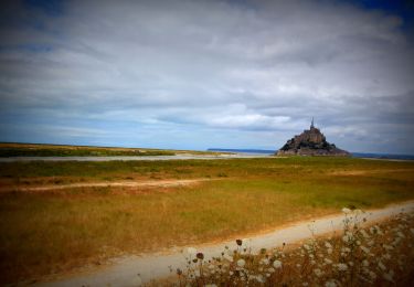
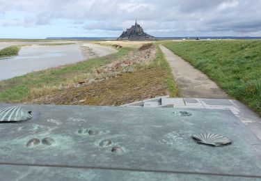
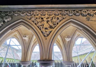
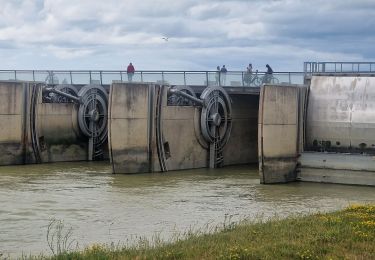
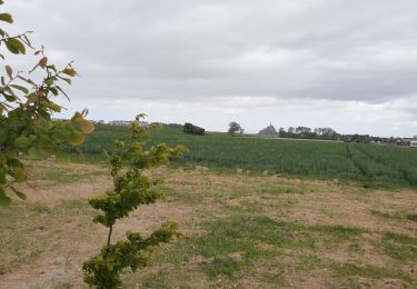
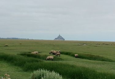
Le 31 octobre 2011 Petit tour sur la digue du Mont St Michel, balade sympa et vue sur l'arrière du mont

Profil altimétrique

Localisation

Pays :
France
Région :
Normandie
Département/Province :
Manche
Commune :
Beauvoir
Localité :
Unknown
Départ:(Dec)
Départ:(UTM)
609380 ; 5386063 (30U) N.

Randonnées à proximité

Randonnée A pied Saint-Georges-de-Gréhaigne - Découverte des polders - Photo
A pied
PRO

A pied

Facile
Saint-Georges-de-Gréhaigne, Bretagne, Ille-et-Vilaine, France
14,6 km | 15,3 km-effort
3h 27min
Oui
Randonnée V.T.T. Beauvoir - VTT autour du Mont Saint Michel - Photo
V.T.T.
GUIDE
pascalou73

V.T.T.

Moyen
Beauvoir, Normandie, Manche, France
29 km | 32 km-effort
Inconnu
Oui
Randonnée Marche Le Mont-Saint-Michel - GR_34_AA_01_Mt-St-Michel_St-Marcan_20230318 - Photo
Marche
patrickdanilo

Marche

Très facile
Le Mont-Saint-Michel, Normandie, Manche, France
16,7 km | 18,7 km-effort
4h 1min
Non
Randonnée Marche Le Mont-Saint-Michel - Mont St Michel J2 - Photo
Marche
chessyca

Marche

Très facile
Le Mont-Saint-Michel, Normandie, Manche, France
17,4 km | 21 km-effort
4h 22min
Oui
Randonnée Marche Le Mont-Saint-Michel - Mont St Michel J1 - Photo
Marche
chessyca

Marche

Difficile
Le Mont-Saint-Michel, Normandie, Manche, France
12,1 km | 14 km-effort
2h 46min
Oui
Randonnée Marche Beauvoir - GR_37_AA_15_Beauvoir_Pleine-Fougeres_20210521 - Photo
Marche
patrickdanilo

Marche

Très facile
Beauvoir, Normandie, Manche, France
14,2 km | 15,5 km-effort
3h 8min
Non
Randonnée Marche Huisnes-sur-Mer - Huisnes-sur-Mer - vue Mont-St-Michel - Pointe de Roche Torin - 14km 75m 4h30 (45mn) - 2017 06 26 - Photo
Marche
Orcal37

Marche

Facile
Huisnes-sur-Mer, Normandie, Manche, France
14 km | 15 km-effort
4h 30min
Oui
Randonnée Marche Pontorson - GR34 étape 6 - Photo
Marche
lagardienne

Marche

Facile
Pontorson, Normandie, Manche, France
23 km | 25 km-effort
5h 30min
Non
Randonnée Marche Pontorson - 2020-03-19 mont saint Michel  - Photo
Marche
jacq58

Marche

Moyen
Pontorson, Normandie, Manche, France
6,5 km | 7,5 km-effort
1h 2min
Non


Fermer
Mes abonnements