Randonnée Marche Carennac - Carrenac - Mezels (Boucle) - Photo

Carrenac - Mezels (Boucle)

 neitag61
neitag61

Utilisateur

© OpenStreetMap contributors
Longueur
Longueur
9,1 km
Altitude max
Altitude max
303 m
Dénivelé positif
Dénivelé positif
257 m
Km-Effort
Km-Effort  
12,6 km
Altitude min
Altitude min
129 m
Dénivelé négatif
Dénivelé négatif
259 m
Boucle
Boucle
Oui
Date de création :
2018-04-17 19:21:35.675
Dernière modification :
2019-01-15 22:11:11.105

(0 Avis)

Marche
Marche
2h46
Difficulté : Moyen

Scannez ce code QR pour ouvrir la randonnée dans l'application SityTrail

Application GPS de randonnée GRATUITE

Logo SityTrail SityTrail

IGN / Instituts géographiques

Télécharger SityTrail sur l'App Store Télécharger SityTrail sur Google Play

Logo SityTrail SityTrail World

Le monde est à vous

Télécharger SityTrail sur l'App Store Télécharger SityTrail sur Google Play Télécharger SityTrail sur Huawei AppGallery

À propos

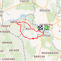
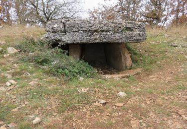
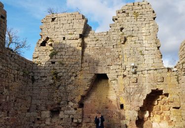
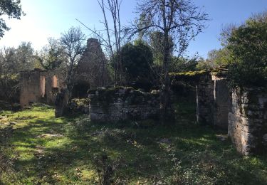
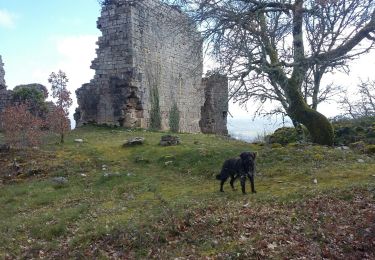
Randonnée Marche de 9,1 km à découvrir à Occitanie, Lot, Carennac. Cette randonnée est proposée par neitag61.

Description

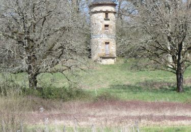
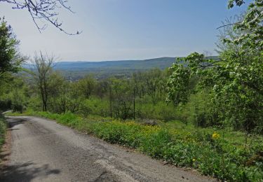
From carennac gite trail goes above river through woods. Some parts steep. We didn't take the side trip to mezels. Upper part, middle of route less interesting, but last part has views and voie romane.

Profil altimétrique

Localisation

Pays :
France
Région :
Occitanie
Département/Province :
Lot
Commune :
Carennac
Localité :
Unknown
Départ:(Dec)
Départ:(UTM)
399876 ; 4974798 (31T) N.

Randonnées à proximité

Randonnée Marche Bilhac - BILHAC- Du château au moulin - Photo
Marche
houbart

Marche

Difficile
(1)
Bilhac, Nouvelle-Aquitaine, Corrèze, France
10,3 km | 13,3 km-effort
3h 0min
Oui
Randonnée Marche Vayrac - Vayrac- Puy d'Issolud - Photo
Marche
houbart

Marche

Difficile
Vayrac, Occitanie, Lot, France
12,9 km | 17,8 km-effort
4h 1min
Oui
Randonnée Marche Carennac - Magnagues - Photo
Marche
Gaillard Isabelle

Marche

Très facile
Carennac, Occitanie, Lot, France
16,8 km | 21 km-effort
4h 51min
Oui
Randonnée Marche Miers - Miers- Les dolmens - Photo
Marche
houbart

Marche

Moyen
(1)
Miers, Occitanie, Lot, France
9,6 km | 11,9 km-effort
2h 42min
Oui
Randonnée Marche Carennac - Ruines de Taillefer - Photo
Marche
neleda

Marche

Très facile
Carennac, Occitanie, Lot, France
6,4 km | 8,2 km-effort
1h 54min
Non
Randonnée A pied Vayrac - Mezels - Photo
A pied
Gaillard Isabelle

A pied

Facile
Vayrac, Occitanie, Lot, France
16,4 km | 21 km-effort
4h 47min
Oui
Randonnée Marche Loubressac - Laguizayrie - Photo
Marche
Gaillard Isabelle

Marche

Facile
Loubressac, Occitanie, Lot, France
15,9 km | 20 km-effort
3h 59min
Oui
Randonnée Marche Carennac - ruiné de taillefer - Photo
Marche
bellouelo46

Marche

Facile
Carennac, Occitanie, Lot, France
10,9 km | 15,2 km-effort
2h 39min
Oui
Randonnée Marche Bilhac - mas del pouch par moulin de la force - Photo
Marche
pmuet

Marche

Très facile
(2)
Bilhac, Nouvelle-Aquitaine, Corrèze, France
8,4 km | 10,7 km-effort
2h 18min
Oui


Fermer
Mes abonnements