Randonnée Marche Saint-Chély-d'Aubrac - Saint Chely Espalion Avril 2018 - Photo

Saint Chely Espalion Avril 2018

 Kargil
Kargil

Utilisateur GUIDE

© OpenStreetMap contributors
Longueur
Longueur
25 km
Altitude max
Altitude max
924 m
Dénivelé positif
Dénivelé positif
555 m
Km-Effort
Km-Effort  
34 km
Altitude min
Altitude min
333 m
Dénivelé négatif
Dénivelé négatif
1029 m
Boucle
Boucle
Non
Date de création :
2018-06-18 20:29:26.014
Dernière modification :
2018-06-18 20:29:26.014

(0 Avis)

Marche
Marche
7h26
Difficulté : Difficile

Scannez ce code QR pour ouvrir la randonnée dans l'application SityTrail

Application GPS de randonnée GRATUITE

Logo SityTrail SityTrail

IGN / Instituts géographiques

Télécharger SityTrail sur l'App Store Télécharger SityTrail sur Google Play

Logo SityTrail SityTrail World

Le monde est à vous

Télécharger SityTrail sur l'App Store Télécharger SityTrail sur Google Play Télécharger SityTrail sur Huawei AppGallery

À propos

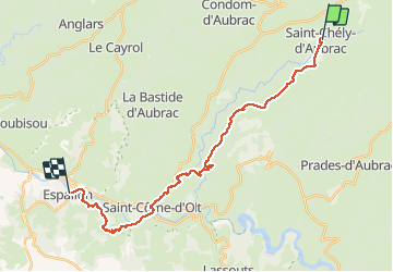
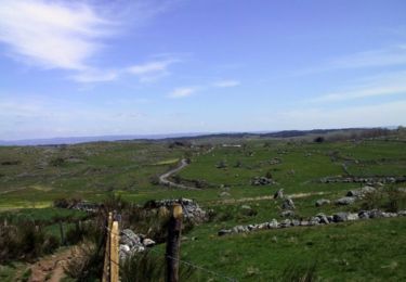
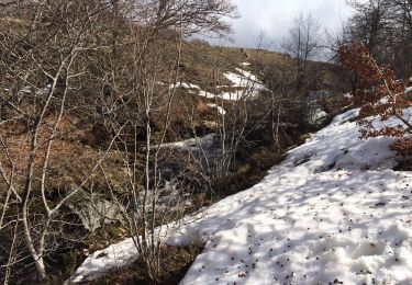
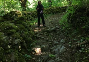
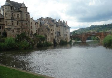
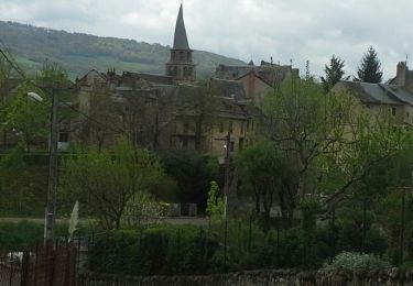
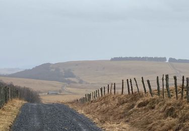
Randonnée Marche de 25 km à découvrir à Occitanie, Aveyron, Saint-Chély-d'Aubrac. Cette randonnée est proposée par Kargil.

Description

7ème Etape depuis Le Puy
Un très bel acceuil au gite "Au fil de l'eau"

Profil altimétrique

Photos

Localisation

Pays :
France
Région :
Occitanie
Département/Province :
Aveyron
Commune :
Saint-Chély-d'Aubrac
Localité :
Unknown
Départ:(Dec)
Départ:(UTM)
493841 ; 4937484 (31T) N.

Randonnées à proximité

Randonnée Marche Saint-Chély-d'Aubrac - La voie romaine - Saint Chély d'Aubrac - Photo
Marche
tracegps

Marche

Moyen
(2)
Saint-Chély-d'Aubrac, Occitanie, Aveyron, France
19 km | 28 km-effort
5h 30min
Oui
Randonnée Marche Saint-Chély-d'Aubrac - S’y chely  - Photo
Marche
GUIDE
antignacs

Marche

Difficile
Saint-Chély-d'Aubrac, Occitanie, Aveyron, France
22 km | 31 km-effort
6h 16min
Oui
Randonnée Marche Saint-Chély-d'Aubrac - St chely Aubrac  - Photo
Marche
GUIDE
antignacs

Marche

Difficile
Saint-Chély-d'Aubrac, Occitanie, Aveyron, France
21 km | 30 km-effort
6h 34min
Oui
Randonnée Marche Saint-Chély-d'Aubrac - CC_Velay_BC_07_St-Chely-Aubrac_Espalion_20070822 - Photo
Marche
patrickdanilo

Marche

Moyen
Saint-Chély-d'Aubrac, Occitanie, Aveyron, France
23 km | 31 km-effort
7h 30min
Non
Randonnée Marche Saint-Chély-d'Aubrac - St chely d'aubrac - laguiole - Photo
Marche
prv

Marche

Très facile
Saint-Chély-d'Aubrac, Occitanie, Aveyron, France
26 km | 37 km-effort
7h 48min
Non
Randonnée Marche Saint-Chély-d'Aubrac - Saint Chely d'Aubrac - Saint Côme d'Olt - Photo
Marche
RR31

Marche

Moyen
Saint-Chély-d'Aubrac, Occitanie, Aveyron, France
18,1 km | 24 km-effort
5h 17min
Non
Randonnée Marche Saint-Chély-d'Aubrac - St CHELY les tremailles - Photo
Marche
CANON2

Marche

Moyen
(2)
Saint-Chély-d'Aubrac, Occitanie, Aveyron, France
8,4 km | 12,9 km-effort
3h 0min
Oui
Randonnée V.T.T. Saint-Chély-d'Aubrac - Site VTT FFC Aubrac - Vallée du Lot - Circuit n°4 - La Voie Romaine - Photo
V.T.T.
tracegps

V.T.T.

Très difficile
Saint-Chély-d'Aubrac, Occitanie, Aveyron, France
8,5 km | 12,9 km-effort
1h 0min
Oui
Randonnée Marche Condom-d'Aubrac - Enguilhens - Photo
Marche
GUIDE
antignacs

Marche

Très facile
Condom-d'Aubrac, Occitanie, Aveyron, France
11,3 km | 15,3 km-effort
2h 57min
Oui


Fermer
Mes abonnements