


via rhona j2

ericf64
Utilisateur
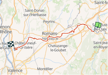

Longueur
47 km

Altitude max
205 m

Dénivelé positif
371 m
Km-Effort
52 km

Altitude min
113 m

Dénivelé négatif
419 m
Boucle
Non
Date de création :
2018-06-26 15:15:47.902
Dernière modification :
2019-08-30 10:12:17.686
--
Difficulté : Facile

Application GPS de randonnée GRATUITE
 SityTrail
IGN / Instituts géographiques
SityTrail Plus
Le monde est à vous
À propos
Randonnée Cyclotourisme de 47 km à découvrir à Auvergne-Rhône-Alpes, Drôme, Saint-Nazaire-en-Royans. Cette randonnée est proposée par ericf64.
Description
50km. visite roman sur Isère
Localisation
Pays :
France
Région :
Auvergne-Rhône-Alpes
Département/Province :
Drôme
Commune :
Saint-Nazaire-en-Royans
Localité :
Unknown
Départ:(Dec)
Départ:(UTM)
677476 ; 4992005 (31T) N.
Commentaires