![](/images/other/stat-length.png)
Liegi, Wallonie, Cavallo : I migliori sentieri, percorsi e passeggiate
Liegi: Scopri i migliori percorsi: 221 cavallo, 246 equitazione, 5 carrozza e 7 trekking con gli asini. Tutti questi percorsi, itinerari e attività outdoor sono disponibili nelle nostre app SityTrail per smartphone e tablet.
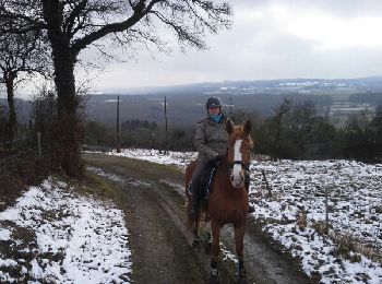
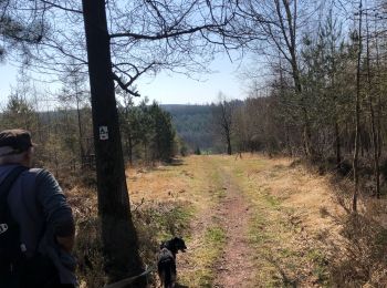
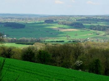
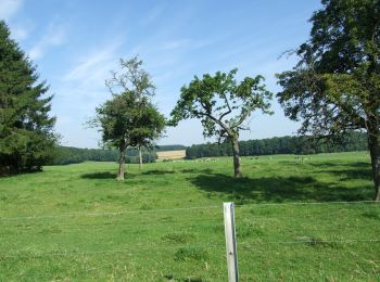
I percorsi migliori (0})
![Percorso Cavallo Hamoir - balade tranquille littlecreek - Photo](https://media.geolcdn.com/t/350/260/ext.jpg?maxdim=2&url=https%3A%2F%2Fservices.sitytrail.com%2FGeolivesWS%2FDownloadMedia.ashx%3FTrailID%3D389119%26Media%3Dfix__20150222111924.jpg)
![Cavallo Cavallo](https://static1.geolcdn.com/sitytour/trail-icons/300.png)
Km
Cavallo
![](/images/other/stat-length.png)
![](https://static1.geolcdn.com/siteimages/upload/files/1508320355ic_sort_den_pos_24dp.png)
![](https://static1.geolcdn.com/siteimages/upload/files/1508320355ic_sort_den_neg_24dp.png)
![](https://static1.geolcdn.com/siteimages/upload/files/16400158638029165_repeat_loop_refresh_sync_direction_icon.png)
• terrain tres vallonné
![Percorso Cavallo Fléron - sur les traces du GR 573 - Photo](https://media.geolcdn.com/t/350/260/ext.jpg?maxdim=2&url=https%3A%2F%2Fservices.sitytrail.com%2FGeolivesWS%2FDownloadMedia.ashx%3FTrailID%3D606095%26Media%3D07aaa9be-0878-49fd-9d92-cc4788c6b8de.jpg)
![Cavallo Cavallo](https://static1.geolcdn.com/sitytour/trail-icons/300.png)
Km
Cavallo
![](/images/other/stat-length.png)
![](https://static1.geolcdn.com/siteimages/upload/files/1508320355ic_sort_den_pos_24dp.png)
![](https://static1.geolcdn.com/siteimages/upload/files/1508320355ic_sort_den_neg_24dp.png)
![](https://static1.geolcdn.com/siteimages/upload/files/16400158638029165_repeat_loop_refresh_sync_direction_icon.png)
![Percorso Cavallo Aywaille - Deigne (Bergerie) 16 km - Photo](https://media.geolcdn.com/t/350/260/ext.jpg?maxdim=2&url=https%3A%2F%2Fmedia.geolcdn.com%2Ff%2F52d9aaaf-2093-418e-b7e3-c746b8de6794.jpg)
![Cavallo Cavallo](https://static1.geolcdn.com/sitytour/trail-icons/300.png)
Km
Cavallo
![](/images/other/stat-length.png)
![](https://static1.geolcdn.com/siteimages/upload/files/1508320355ic_sort_den_pos_24dp.png)
![](https://static1.geolcdn.com/siteimages/upload/files/1508320355ic_sort_den_neg_24dp.png)
![](https://static1.geolcdn.com/siteimages/upload/files/16400158638029165_repeat_loop_refresh_sync_direction_icon.png)
![Percorso Cavallo Ouffet - Ouffet - Balade des Fermes - Photo](https://media.geolcdn.com/t/350/260/ext.jpg?maxdim=2&url=https%3A%2F%2Fpivotmedia.tourismewallonie.be%2FANX-0W-000PCX%2FANX-0W-000PCX.jpg)
![Cavallo Cavallo](https://static1.geolcdn.com/sitytour/trail-icons/300.png)
Km
Cavallo
![](/images/other/stat-length.png)
![](https://static1.geolcdn.com/siteimages/upload/files/1508320355ic_sort_den_pos_24dp.png)
![](https://static1.geolcdn.com/siteimages/upload/files/1508320355ic_sort_den_neg_24dp.png)
![](https://static1.geolcdn.com/siteimages/upload/files/16400158638029165_repeat_loop_refresh_sync_direction_icon.png)
![Percorso Cavallo Ouffet - Ouffet - Balade de l'Herberin - Photo](https://media.geolcdn.com/t/350/260/ext.jpg?maxdim=2&url=https%3A%2F%2Fpivotmedia.tourismewallonie.be%2FANX-0W-00Y1-000O%2FANX-0W-00Y1-000O.jpg)
![Cavallo Cavallo](https://static1.geolcdn.com/sitytour/trail-icons/300.png)
Km
Cavallo
![](/images/other/stat-length.png)
![](https://static1.geolcdn.com/siteimages/upload/files/1508320355ic_sort_den_pos_24dp.png)
![](https://static1.geolcdn.com/siteimages/upload/files/1508320355ic_sort_den_neg_24dp.png)
![](https://static1.geolcdn.com/siteimages/upload/files/16400158638029165_repeat_loop_refresh_sync_direction_icon.png)
![Percorso Cavallo Ouffet - Ouffet - Balade de Béemont - Photo](https://media.geolcdn.com/t/350/260/ext.jpg?maxdim=2&url=https%3A%2F%2Fpivotmedia.tourismewallonie.be%2FANX-0W-01NQ-0001%2FANX-0W-01NQ-0001.jpg)
![Cavallo Cavallo](https://static1.geolcdn.com/sitytour/trail-icons/300.png)
Km
Cavallo
![](/images/other/stat-length.png)
![](https://static1.geolcdn.com/siteimages/upload/files/1508320355ic_sort_den_pos_24dp.png)
![](https://static1.geolcdn.com/siteimages/upload/files/1508320355ic_sort_den_neg_24dp.png)
![](https://static1.geolcdn.com/siteimages/upload/files/16400158638029165_repeat_loop_refresh_sync_direction_icon.png)
![Percorso Cavallo Ouffet - Ouffet - Balade de Raou - Photo](https://media.geolcdn.com/t/350/260/ext.jpg?maxdim=2&url=https%3A%2F%2Fpivotmedia.tourismewallonie.be%2FANX-0W-000PC8%2FANX-0W-000PC8.jpg)
![Cavallo Cavallo](https://static1.geolcdn.com/sitytour/trail-icons/300.png)
Km
Cavallo
![](/images/other/stat-length.png)
![](https://static1.geolcdn.com/siteimages/upload/files/1508320355ic_sort_den_pos_24dp.png)
![](https://static1.geolcdn.com/siteimages/upload/files/1508320355ic_sort_den_neg_24dp.png)
![](https://static1.geolcdn.com/siteimages/upload/files/16400158638029165_repeat_loop_refresh_sync_direction_icon.png)
![Percorso Cavallo Ouffet - Ouffet - Balade du Neblon - Photo](https://media.geolcdn.com/t/350/260/ext.jpg?maxdim=2&url=https%3A%2F%2Fpivotmedia.tourismewallonie.be%2FANX-0W-000PC5%2FANX-0W-000PC5.jpg)
![Cavallo Cavallo](https://static1.geolcdn.com/sitytour/trail-icons/300.png)
Km
Cavallo
![](/images/other/stat-length.png)
![](https://static1.geolcdn.com/siteimages/upload/files/1508320355ic_sort_den_pos_24dp.png)
![](https://static1.geolcdn.com/siteimages/upload/files/1508320355ic_sort_den_neg_24dp.png)
![](https://static1.geolcdn.com/siteimages/upload/files/16400158638029165_repeat_loop_refresh_sync_direction_icon.png)
![Percorso Cavallo Ouffet - Ouffet - Balade des Sarrasins - Photo](https://media.geolcdn.com/t/350/260/ext.jpg?maxdim=2&url=https%3A%2F%2Fpivotmedia.tourismewallonie.be%2FANX-0W-000PC0%2FANX-0W-000PC0.JPG)
![Cavallo Cavallo](https://static1.geolcdn.com/sitytour/trail-icons/300.png)
Km
Cavallo
![](/images/other/stat-length.png)
![](https://static1.geolcdn.com/siteimages/upload/files/1508320355ic_sort_den_pos_24dp.png)
![](https://static1.geolcdn.com/siteimages/upload/files/1508320355ic_sort_den_neg_24dp.png)
![](https://static1.geolcdn.com/siteimages/upload/files/16400158638029165_repeat_loop_refresh_sync_direction_icon.png)
![Percorso Cavallo Ferrières - Ferrières - Circuit des Croix et des Chapelles - Photo](https://media.geolcdn.com/t/350/260/ext.jpg?maxdim=2&url=https%3A%2F%2Fpivotmedia.tourismewallonie.be%2FANX-0W-01RS-0025%2FANX-0W-01RS-0025.JPG)
![Cavallo Cavallo](https://static1.geolcdn.com/sitytour/trail-icons/300.png)
Km
Cavallo
![](/images/other/stat-length.png)
![](https://static1.geolcdn.com/siteimages/upload/files/1508320355ic_sort_den_pos_24dp.png)
![](https://static1.geolcdn.com/siteimages/upload/files/1508320355ic_sort_den_neg_24dp.png)
![](https://static1.geolcdn.com/siteimages/upload/files/16400158638029165_repeat_loop_refresh_sync_direction_icon.png)
![Percorso Cavallo Ferrières - Ferrières - Promenade des Ecureuils - Photo](https://media.geolcdn.com/t/350/260/ext.jpg?maxdim=2&url=https%3A%2F%2Fpivotmedia.tourismewallonie.be%2FANX-0W-01RS-0001%2FANX-0W-01RS-0001.jpg)
![Cavallo Cavallo](https://static1.geolcdn.com/sitytour/trail-icons/300.png)
Km
Cavallo
![](/images/other/stat-length.png)
![](https://static1.geolcdn.com/siteimages/upload/files/1508320355ic_sort_den_pos_24dp.png)
![](https://static1.geolcdn.com/siteimages/upload/files/1508320355ic_sort_den_neg_24dp.png)
![](https://static1.geolcdn.com/siteimages/upload/files/16400158638029165_repeat_loop_refresh_sync_direction_icon.png)
![Percorso Cavallo Stoumont - Promenade de Lorcé - Photo](https://media.geolcdn.com/t/350/260/ext.jpg?maxdim=2&url=https%3A%2F%2Fpivotmedia.tourismewallonie.be%2FANX-0W-01F9-008V%2FANX-0W-01F9-008V.jpg)
![Cavallo Cavallo](https://static1.geolcdn.com/sitytour/trail-icons/300.png)
Km
Cavallo
![](/images/other/stat-length.png)
![](https://static1.geolcdn.com/siteimages/upload/files/1508320355ic_sort_den_pos_24dp.png)
![](https://static1.geolcdn.com/siteimages/upload/files/1508320355ic_sort_den_neg_24dp.png)
![](https://static1.geolcdn.com/siteimages/upload/files/16400158638029165_repeat_loop_refresh_sync_direction_icon.png)
![Percorso Cavallo Marchin - Val d'Ereffe - Photo](https://media.geolcdn.com/t/350/260/ext.jpg?maxdim=2&url=https%3A%2F%2Fpivotmedia.tourismewallonie.be%2FOTH-A0-0061-0PT0%2FOTH-A0-0061-0PT0.jpg)
![Cavallo Cavallo](https://static1.geolcdn.com/sitytour/trail-icons/300.png)
Km
Cavallo
![](/images/other/stat-length.png)
![](https://static1.geolcdn.com/siteimages/upload/files/1508320355ic_sort_den_pos_24dp.png)
![](https://static1.geolcdn.com/siteimages/upload/files/1508320355ic_sort_den_neg_24dp.png)
![](https://static1.geolcdn.com/siteimages/upload/files/16400158638029165_repeat_loop_refresh_sync_direction_icon.png)
![Percorso Cavallo Modave - Circuit de Froide Fontaine - Photo](https://media.geolcdn.com/t/350/260/ext.jpg?maxdim=2&url=https%3A%2F%2Fpivotmedia.tourismewallonie.be%2FOTH-A0-004Z-1J7U%2FOTH-A0-004Z-1J7U.jpg)
![Cavallo Cavallo](https://static1.geolcdn.com/sitytour/trail-icons/300.png)
Km
Cavallo
![](/images/other/stat-length.png)
![](https://static1.geolcdn.com/siteimages/upload/files/1508320355ic_sort_den_pos_24dp.png)
![](https://static1.geolcdn.com/siteimages/upload/files/1508320355ic_sort_den_neg_24dp.png)
![](https://static1.geolcdn.com/siteimages/upload/files/16400158638029165_repeat_loop_refresh_sync_direction_icon.png)
![Percorso Cavallo Modave - Circuit de Hégereuse - Photo](https://media.geolcdn.com/t/350/260/ext.jpg?maxdim=2&url=https%3A%2F%2Fpivotmedia.tourismewallonie.be%2FOTH-A0-004Z-1CE5%2FOTH-A0-004Z-1CE5.jpg)
![Cavallo Cavallo](https://static1.geolcdn.com/sitytour/trail-icons/300.png)
Km
Cavallo
![](/images/other/stat-length.png)
![](https://static1.geolcdn.com/siteimages/upload/files/1508320355ic_sort_den_pos_24dp.png)
![](https://static1.geolcdn.com/siteimages/upload/files/1508320355ic_sort_den_neg_24dp.png)
![](https://static1.geolcdn.com/siteimages/upload/files/16400158638029165_repeat_loop_refresh_sync_direction_icon.png)
![Percorso Cavallo Héron - Balade de Saint Hubert - Photo](https://media.geolcdn.com/t/350/260/ext.jpg?maxdim=2&url=https%3A%2F%2Fpivotmedia.tourismewallonie.be%2FOTH-A0-004Z-1A3L%2FOTH-A0-004Z-1A3L.jpg)
![Cavallo Cavallo](https://static1.geolcdn.com/sitytour/trail-icons/300.png)
Km
Cavallo
![](/images/other/stat-length.png)
![](https://static1.geolcdn.com/siteimages/upload/files/1508320355ic_sort_den_pos_24dp.png)
![](https://static1.geolcdn.com/siteimages/upload/files/1508320355ic_sort_den_neg_24dp.png)
![](https://static1.geolcdn.com/siteimages/upload/files/16400158638029165_repeat_loop_refresh_sync_direction_icon.png)
![Percorso Equitazione Theux - Ninglinspo - Photo](https://media.geolcdn.com/t/350/260/ext.jpg?maxdim=2&url=https%3A%2F%2Fmedia.geolcdn.com%2Ff%2Fea87da00-759b-42e2-bb12-794aa0f0922a.jpg)
![Equitazione Equitazione](https://static1.geolcdn.com/sitytour/trail-icons/301.png)
Km
Equitazione
![](/images/other/stat-length.png)
![](https://static1.geolcdn.com/siteimages/upload/files/1508320355ic_sort_den_pos_24dp.png)
![](https://static1.geolcdn.com/siteimages/upload/files/1508320355ic_sort_den_neg_24dp.png)
![](https://static1.geolcdn.com/siteimages/upload/files/16400158638029165_repeat_loop_refresh_sync_direction_icon.png)
![Percorso Cavallo Sprimont - Tour de bois d'arlon a Banneux 9Km - Photo](https://media.geolcdn.com/t/350/260/ext.jpg?maxdim=2&url=https%3A%2F%2Fmedia.geolcdn.com%2Ff%2Fe2a0114b-3d09-497c-bd28-961292b0a068.jpg)
![Cavallo Cavallo](https://static1.geolcdn.com/sitytour/trail-icons/300.png)
Km
Cavallo
![](/images/other/stat-length.png)
![](https://static1.geolcdn.com/siteimages/upload/files/1508320355ic_sort_den_pos_24dp.png)
![](https://static1.geolcdn.com/siteimages/upload/files/1508320355ic_sort_den_neg_24dp.png)
![](https://static1.geolcdn.com/siteimages/upload/files/16400158638029165_repeat_loop_refresh_sync_direction_icon.png)
![Percorso Equitazione Sprimont - Cornemont-Playe-Deigne 11Km - Photo](https://media.geolcdn.com/t/350/260/ext.jpg?maxdim=2&url=https%3A%2F%2Fmedia.geolcdn.com%2Ff%2Fcfdfb7ba-caea-4b5e-85bb-f7cbd3a58a9b.jpg)
![Equitazione Equitazione](https://static1.geolcdn.com/sitytour/trail-icons/301.png)
Km
Equitazione
![](/images/other/stat-length.png)
![](https://static1.geolcdn.com/siteimages/upload/files/1508320355ic_sort_den_pos_24dp.png)
![](https://static1.geolcdn.com/siteimages/upload/files/1508320355ic_sort_den_neg_24dp.png)
![](https://static1.geolcdn.com/siteimages/upload/files/16400158638029165_repeat_loop_refresh_sync_direction_icon.png)
![Percorso Equitazione Theux - La Reid Les Cours - Photo](https://media.geolcdn.com/t/350/260/ext.jpg?maxdim=2&url=https%3A%2F%2Fmedia.geolcdn.com%2Ff%2F0a4bfdfd-733a-4bd5-b9c5-70d786293e4d.jpg)
![Equitazione Equitazione](https://static1.geolcdn.com/sitytour/trail-icons/301.png)
Km
Equitazione
![](/images/other/stat-length.png)
![](https://static1.geolcdn.com/siteimages/upload/files/1508320355ic_sort_den_pos_24dp.png)
![](https://static1.geolcdn.com/siteimages/upload/files/1508320355ic_sort_den_neg_24dp.png)
![](https://static1.geolcdn.com/siteimages/upload/files/16400158638029165_repeat_loop_refresh_sync_direction_icon.png)
20 percorsi visualizzati su 477
Applicazione GPS da escursionismo GRATUITA
Attività
Regioni vicine
- Amay
- Amel
- Ans
- Anthisnes
- Aubel
- Awans
- Aywaille
- Baelen
- Bassenge
- Berloz
- Beyne-Heusay
- Blegny
- Braives
- Büllingen
- Burdinne
- Burg-Reuland
- Bütgenbach
- Chaudfontaine
- Clavier
- Comblain-au-Pont
- Crisnée
- Dalhem
- Dison
- Donceel
- Engis
- Esneux
- Eupen
- Faimes
- Ferrières
- Fexhe-le-Haut-Clocher
- Flémalle
- Fléron
- Geer
- Grâce-Hollogne
- Hamoir
- Hannut
- Héron
- Herstal
- Herve
- Huy
- Jalhay
- Juprelle
- Kelmis
- Liegi
- Lierneux
- Limburgo
- Lincent
- Lontzen
- Malmedy
- Marchin
- Modave
- Nandrin
- Neupré
- Olne
- Oreye
- Ouffet
- Oupeye
- Pepinster
- Plombières
- Raeren
- Remicourt
- Saint-Georges-sur-Meuse
- Saint-Nicolas
- Sankt Vith
- Seraing
- Soumagne
- Spa
- Sprimont
- Stavelot
- Stoumont
- Theux
- Thimister-Clermont
- Tinlot
- Trois-Ponts
- Trooz
- Verlaine
- Verviers
- Villers-le-Bouillet
- Visé
- Waimes
- Wanze
- Waremme
- Wasseiges
- Welkenraedt