Mon Compostelle huitième étape
Ardeiserois
Utente
Lunghezza
51 km
Altitudine massima
318 m
Dislivello positivo
1015 m
Km-Effort
65 km
Altitudine minima
101 m
Dislivello negativo
1131 m
Boucle
No
Data di creazione :
2017-01-14 00:00:00.0
Ultima modifica :
2017-01-14 00:00:00.0
10h40
Difficoltà : Difficile
Applicazione GPS da escursionismo GRATUITA
Chi siamo
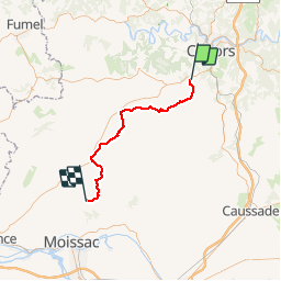
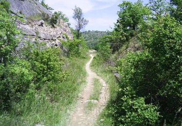
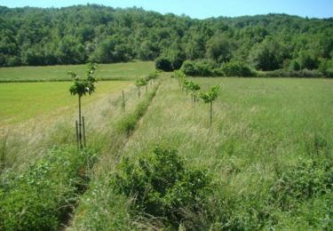
Percorso Marcia di 51 km da scoprire a Occitania, Lot, Labastide-Marnhac. Questo percorso è proposto da Ardeiserois.
Descrizione
Huitième étape : La Bastide Marnhac (Saint Remy) / Saint Martin de Durfort mercredi 30 septembre 2009.
Départ :8h10
Arrivée :18h50
Localizzazione
Paese:
France
Regione :
Occitania
Dipartimento/Provincia :
Lot
Comune :
Labastide-Marnhac
Località :
Unknown
Partenza:(Dec)
Partenza:(UTM)
371595 ; 4917289 (31T) N.
Commenti
Percorsi nelle vicinanze
Cahors-La Rozière 2005
Mountainbike
Molto difficile
(1)
Cahors,
Occitania,
Lot,
France
62 km | 81 km-effort
5h 0min
Sì
Circuit ouest de Trespoux Rassiels
Mountainbike
Molto difficile
Trespoux-Rassiels,
Occitania,
Lot,
France
38 km | 51 km-effort
4h 15min
Sì
Cahors - Lascabanes - Chemin de Compostelle
Marcia
Molto difficile
(1)
Cahors,
Occitania,
Lot,
France
24 km | 31 km-effort
9h 30min
No
Raid Cahors La Rozière 2006
Mountainbike
Molto difficile
Cahors,
Occitania,
Lot,
France
59 km | 78 km-effort
4h 40min
Sì
Cluzel au temps des bleuets
Marcia
Molto facile
Labastide-Marnhac,
Occitania,
Lot,
France
10,2 km | 11,7 km-effort
2h 9min
Sì
trail Trèspoux
Corsa a piedi
Molto facile
Trespoux-Rassiels,
Occitania,
Lot,
France
10 km | 13,1 km-effort
1h 14min
Sì
De la Rozière à Labastide-Marnhac
Mountainbike
Medio
Cahors,
Occitania,
Lot,
France
17,2 km | 22 km-effort
1h 30min
Sì
De la Rozière à Labastide-Marnhac
Marcia
Difficile
Cahors,
Occitania,
Lot,
France
17,2 km | 22 km-effort
3h 30min
Sì