![](/images/other/stat-length.png)
![Percorso Marcia Heuvelland - Rando RCM du 26 mars 2018 - Photo](https://media.geolcdn.com/t/1900/400/ext.pjpeg?maxdim=2&url=https%3A%2F%2Fservices.sitytrail.com%2FGeolivesWS%2FDownloadMedia.ashx%3FTrailID%3D922937%26Media%3D20180314155013.jpg)
Rando RCM du 26 mars 2018
dautriche
Utente
![Lunghezza](/images/other/stat-length.png)
Lunghezza
25 km
![Altitudine massima](https://static1.geolcdn.com/siteimages/upload/files/1508320355ic_sort_altitude_max_24dp.png)
Altitudine massima
161 m
![Dislivello positivo](https://static1.geolcdn.com/siteimages/upload/files/1508320355ic_sort_den_pos_24dp.png)
Dislivello positivo
427 m
![Km-Effort](/images/other/stat-length.png)
Km-Effort
31 km
![Altitudine minima](https://static1.geolcdn.com/siteimages/upload/files/1508320355ic_sort_altitude_min_24dp.png)
Altitudine minima
29 m
![Dislivello negativo](https://static1.geolcdn.com/siteimages/upload/files/1508320355ic_sort_den_neg_24dp.png)
Dislivello negativo
427 m
![Boucle](https://static1.geolcdn.com/siteimages/upload/files/16400158638029165_repeat_loop_refresh_sync_direction_icon.png)
Boucle
Sì
Data di creazione :
2018-04-17 21:47:24.104
Ultima modifica :
2018-04-17 21:47:24.104
![Marcia](https://static1.geolcdn.com/sitytour/trail-icons/101.png)
6h45
Difficoltà : Facile
![Scannerizza questo codice QR per aprire il percorso nell'applicazione SityTrail](https://capi.geolives.com/qq0zvz2zws4bq2lad0pu/sitytour/trails/922937/qr.png?size=200)
Applicazione GPS da escursionismo GRATUITA
Chi siamo
Percorso Marcia di 25 km da scoprire a Vlaanderen, West-Vlaanderen, Heuvelland. Questo percorso è proposto da dautriche.
Descrizione
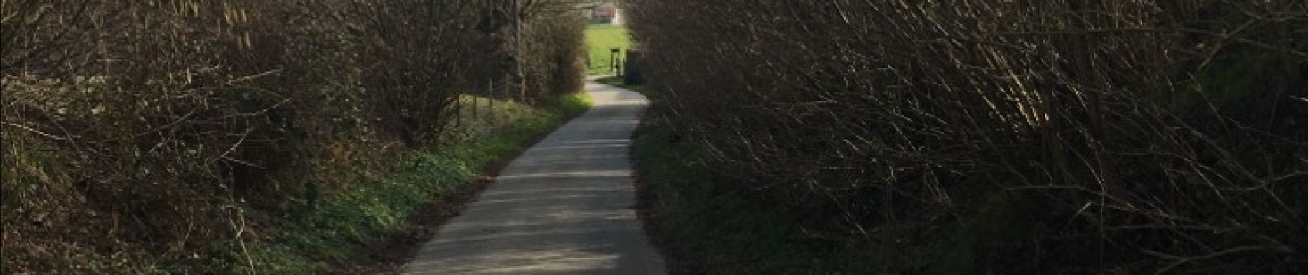
Bouclre depuis Kemmel, autour de Dranouter en suivant les sentes vallonnées des Monts de Flandres, boisées, herbeuses et un peu bitumées. Passage par le Conservatoire botanique de Bailleul et halte au truculent café Half Moon.
Localizzazione
Paese:
Belgium
Regione :
Vlaanderen
Dipartimento/Provincia :
West-Vlaanderen
Comune :
Heuvelland
Località :
Kemmel
Partenza:(Dec)
Partenza:(UTM)
487692 ; 5625674 (31U) N.
Commenti
Percorsi nelle vicinanze
![Percorso Marcia Heuvelland - Loker - Le Mont Rouge - Photo](https://media.geolcdn.com/t/375/260/ext.jpg?maxdim=2&url=https%3A%2F%2Fservices.sitytrail.com%2FGeolivesWS%2FDownloadMedia.ashx%3FTrailID%3D106138%26Media%3D10379_6.jpg)
![Marcia Marcia](https://static1.geolcdn.com/sitytour/trail-icons/101.png)
Loker - Le Mont Rouge
Marcia
Medio
(3)
Heuvelland,
Vlaanderen,
West-Vlaanderen,
Belgium
![](/images/other/stat-length.png)
8,7 km | 10,8 km-effort
2h 19min
![](https://static1.geolcdn.com/siteimages/upload/files/16400158638029165_repeat_loop_refresh_sync_direction_icon.png)
Sì
![Percorso A piedi Heuvelland - Kraters en Mijnen - Photo](https://media.geolcdn.com/t/375/260/ext.jpg?maxdim=2&url=https%3A%2F%2Fmedia.geolcdn.com%2Ff%2Faaf8f233-f3c6-4670-9899-0548e3a6df10.jpeg)
![A piedi A piedi](https://static1.geolcdn.com/sitytour/trail-icons/100.png)
Kraters en Mijnen
A piedi
Facile
Heuvelland,
Vlaanderen,
West-Vlaanderen,
Belgium
![](/images/other/stat-length.png)
6,7 km | 7,9 km-effort
1h 47min
![](https://static1.geolcdn.com/siteimages/upload/files/16400158638029165_repeat_loop_refresh_sync_direction_icon.png)
Sì
![Percorso A piedi Heuvelland - Geuzen wandelroute - Photo](https://media.geolcdn.com/t/375/260/ext.jpg?maxdim=2&url=https%3A%2F%2Fmedia.geolcdn.com%2Ff%2Fa748d58f-6dfe-4ad8-b887-8505015b63cc.jpeg)
![A piedi A piedi](https://static1.geolcdn.com/sitytour/trail-icons/100.png)
Geuzen wandelroute
A piedi
Facile
Heuvelland,
Vlaanderen,
West-Vlaanderen,
Belgium
![](/images/other/stat-length.png)
9,7 km | 11,4 km-effort
2h 35min
![](https://static1.geolcdn.com/siteimages/upload/files/16400158638029165_repeat_loop_refresh_sync_direction_icon.png)
Sì
![Percorso A piedi Heuvelland - Kemmelberg wandelroute - Photo](https://media.geolcdn.com/t/375/260/ext.jpg?maxdim=2&url=https%3A%2F%2Fmedia.geolcdn.com%2Ff%2Fe1bcc212-763f-4467-b0b8-b765654be94a.jpeg)
![A piedi A piedi](https://static1.geolcdn.com/sitytour/trail-icons/100.png)
Kemmelberg wandelroute
A piedi
Facile
Heuvelland,
Vlaanderen,
West-Vlaanderen,
Belgium
![](/images/other/stat-length.png)
8,9 km | 11,4 km-effort
2h 36min
![](https://static1.geolcdn.com/siteimages/upload/files/16400158638029165_repeat_loop_refresh_sync_direction_icon.png)
Sì
![Percorso Marcia Heuvelland - Dranouter 12,3 km - Photo](https://media.geolcdn.com/t/375/260/ext.jpg?maxdim=2&url=https%3A%2F%2Fmedia.geolcdn.com%2Ff%2Fab62849d-d2cc-4c63-a20f-7ad369b5fc0f.jpg)
![Marcia Marcia](https://static1.geolcdn.com/sitytour/trail-icons/101.png)
Dranouter 12,3 km
Marcia
Facile
Heuvelland,
Vlaanderen,
West-Vlaanderen,
Belgium
![](/images/other/stat-length.png)
12,4 km | 14,5 km-effort
3h 32min
![](https://static1.geolcdn.com/siteimages/upload/files/16400158638029165_repeat_loop_refresh_sync_direction_icon.png)
Sì
![Percorso Marcia Heuvelland - Kemmel 16,8 km - Photo](https://media.geolcdn.com/t/375/260/ext.jpg?maxdim=2&url=https%3A%2F%2Fmedia.geolcdn.com%2Ff%2F35efd325-6d2d-445a-be71-1af85c252386.jpg)
![Marcia Marcia](https://static1.geolcdn.com/sitytour/trail-icons/101.png)
Kemmel 16,8 km
Marcia
Medio
(1)
Heuvelland,
Vlaanderen,
West-Vlaanderen,
Belgium
![](/images/other/stat-length.png)
16,8 km | 20 km-effort
4h 37min
![](https://static1.geolcdn.com/siteimages/upload/files/16400158638029165_repeat_loop_refresh_sync_direction_icon.png)
Sì
![Percorso A piedi Poperinge - Zevekotepad Reningelst - Photo](https://media.geolcdn.com/t/375/260/ext.jpg?maxdim=2&url=https%3A%2F%2Fmedia.geolcdn.com%2Ff%2Fe710de02-cc8e-495b-9106-bd054237c804.jpeg)
![A piedi A piedi](https://static1.geolcdn.com/sitytour/trail-icons/100.png)
Zevekotepad Reningelst
A piedi
Facile
Poperinge,
Vlaanderen,
West-Vlaanderen,
Belgium
![](/images/other/stat-length.png)
6,9 km | 7,9 km-effort
1h 47min
![](https://static1.geolcdn.com/siteimages/upload/files/16400158638029165_repeat_loop_refresh_sync_direction_icon.png)
Sì
![Percorso Marcia Heuvelland - Loker 18,2 km - Photo](https://media.geolcdn.com/t/375/260/ext.jpg?maxdim=2&url=https%3A%2F%2Fmedia.geolcdn.com%2Ff%2F95fcaf9d-4059-4e0a-91b3-686074f6c894.jpg)
![Marcia Marcia](https://static1.geolcdn.com/sitytour/trail-icons/101.png)
Loker 18,2 km
Marcia
Medio
Heuvelland,
Vlaanderen,
West-Vlaanderen,
Belgium
![](/images/other/stat-length.png)
18,3 km | 23 km-effort
5h 14min
![](https://static1.geolcdn.com/siteimages/upload/files/16400158638029165_repeat_loop_refresh_sync_direction_icon.png)
Sì
![Percorso Marcia Heuvelland - Nieuwekerke Bailleul 17,5 km - Photo](https://media.geolcdn.com/t/375/260/ext.jpg?maxdim=2&url=https%3A%2F%2Fmedia.geolcdn.com%2Ff%2F9e8e5b67-08f2-434d-8359-01cf5462426a.jpg)
![Marcia Marcia](https://static1.geolcdn.com/sitytour/trail-icons/101.png)
Nieuwekerke Bailleul 17,5 km
Marcia
Medio
Heuvelland,
Vlaanderen,
West-Vlaanderen,
Belgium
![](/images/other/stat-length.png)
18,7 km | 21 km-effort
4h 53min
![](https://static1.geolcdn.com/siteimages/upload/files/16400158638029165_repeat_loop_refresh_sync_direction_icon.png)
Sì