Randonnée Marche Bucey-en-Othe - Bucey 19032019 bis - Photo
 FPortier
FPortier

Utilisateur

© OpenStreetMap contributors
Longueur
Longueur
10,2 km
Altitude max
Altitude max
244 m
Dénivelé positif
Dénivelé positif
205 m
Km-Effort
Km-Effort  
13 km
Altitude min
Altitude min
141 m
Dénivelé négatif
Dénivelé négatif
205 m
Boucle
Boucle
Oui
Date de création :
2019-05-06 22:52:26.789
Dernière modification :
2019-05-06 22:52:26.789

(0 Avis)

Marche
Marche
2h21
Difficulté : Moyen

Scannez ce code QR pour ouvrir la randonnée dans l'application SityTrail

Application GPS de randonnée GRATUITE

Logo SityTrail SityTrail

IGN / Instituts géographiques

Télécharger SityTrail sur l'App Store Télécharger SityTrail sur Google Play

Logo SityTrail SityTrail World

Le monde est à vous

Télécharger SityTrail sur l'App Store Télécharger SityTrail sur Google Play Télécharger SityTrail sur Huawei AppGallery

À propos

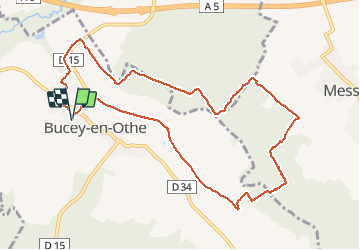
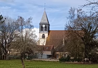
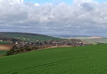
Randonnée Marche de 10,2 km à découvrir à Grand Est, Aube, Bucey-en-Othe. Cette randonnée est proposée par FPortier.

Description

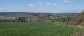
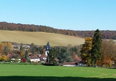
Balade Bucey en Othe
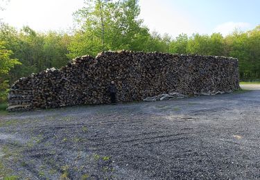
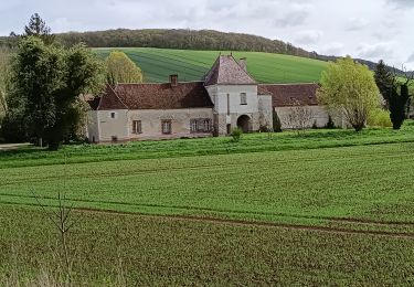
Quelques cotes ...

Profil altimétrique

Photos

Points d'intérêt

Point d'intérêt Bercenay-en-Othe - Point 1essai - Photo
FPortier
BERCENAY-EN-OTHE 
Point d'intérêt Bercenay-en-Othe - Point 2 - Photo
FPortier
BERCENAY-EN-OTHE 
Point d'intérêt Bucey-en-Othe - Croix St Rock - Photo
FPortier
BUCEY-EN-OTHE 
Point d'intérêt Bucey-en-Othe - Petit étang  - Photo
FPortier
BUCEY-EN-OTHE 
Point d'intérêt Bucey-en-Othe - Le Dindon Blanc - Photo
FPortier
BUCEY-EN-OTHE 
Point d'intérêt Messon - Bois de Vieux - Photo
FPortier
Point d'intérêt Messon - Cabane de Messon - Photo
FPortier
Point d'intérêt Messon - Messon - Photo
FPortier
MESSON 
Point d'intérêt Bucey-en-Othe - Vue sur Bucey - Photo
FPortier
BUCEY-EN-OTHE 
Point d'intérêt Bucey-en-Othe - Vue sur Bucey - Photo
FPortier
BUCEY-EN-OTHE 
Point d'intérêt Bucey-en-Othe - Fonvannes - Photo
FPortier
BUCEY-EN-OTHE 
Point d'intérêt Bucey-en-Othe - Lavoir de Bucey - Photo
FPortier
BUCEY-EN-OTHE 

Localisation

Pays :
France
Région :
Grand Est
Département/Province :
Aube
Commune :
Bucey-en-Othe
Localité :
Unknown
Départ:(Dec)
Départ:(UTM)
563843 ; 5345556 (31U) N.

Randonnées à proximité

Randonnée Marche Chennegy - Le chemin du patrimoine du Valdreux - Photo
Marche
gildascb

Marche

Très facile
(1)
Chennegy, Grand Est, Aube, France
8,6 km | 10,5 km-effort
1h 57min
Oui
Randonnée Marche Vauchassis - Randonnée Bucey 23 04 2024 - Photo
Marche
FPortier

Marche

Difficile
Vauchassis, Grand Est, Aube, France
10,5 km | 13,4 km-effort
3h 5min
Oui
Randonnée Marche Bucey-en-Othe - Bucey en Othe - Photo
Marche
FPortier

Marche

Difficile
Bucey-en-Othe, Grand Est, Aube, France
10 km | 12,6 km-effort
3h 0min
Oui
Randonnée Marche Vauchassis - Balade Forêt communale de Vauchassis - Photo
Marche
FPortier

Marche

Moyen
Vauchassis, Grand Est, Aube, France
7,5 km | 9,1 km-effort
2h 26min
Oui
Randonnée Marche Vauchassis - Vauchassis Bercenay Vauchassis - Photo
Marche
FPortier

Marche

Difficile
Vauchassis, Grand Est, Aube, France
10,3 km | 13 km-effort
3h 2min
Oui
Randonnée Marche Vauchassis - Randonnée Grands Bois Vauchassis - Photo
Marche
FPortier

Marche

Moyen
Vauchassis, Grand Est, Aube, France
9,7 km | 12 km-effort
2h 51min
Oui
Randonnée Marche Chennegy - Randonnée à Chennegy - Photo
Marche
FPortier

Marche

Difficile
Chennegy, Grand Est, Aube, France
10,6 km | 12,4 km-effort
3h 5min
Oui
Randonnée Marche Vauchassis - Mars072024 - Photo
Marche
FPortier

Marche

Moyen
(1)
Vauchassis, Grand Est, Aube, France
7,1 km | 9,3 km-effort
2h 7min
Oui
Randonnée Marche Bucey-en-Othe - Balade autour de Bicey - Photo
Marche
FPortier

Marche

Difficile
Bucey-en-Othe, Grand Est, Aube, France
9,6 km | 12,5 km-effort
2h 50min
Oui


Fermer
Mes abonnements