Randonnée V.T.T. Aurillac - Aurillac- st jean de done-Naucelle - Photo

Aurillac- st jean de done-Naucelle

 millot15
millot15

Utilisateur

© OpenStreetMap contributors
Longueur
Longueur
18,8 km
Altitude max
Altitude max
839 m
Dénivelé positif
Dénivelé positif
431 m
Km-Effort
Km-Effort  
25 km
Altitude min
Altitude min
619 m
Dénivelé négatif
Dénivelé négatif
422 m
Boucle
Boucle
Oui
Date de création :
2018-04-16 23:22:35.824
Dernière modification :
2018-04-16 23:22:35.824

(0 Avis)

V.T.T.
V.T.T.
1h56
Difficulté : Facile

Scannez ce code QR pour ouvrir la randonnée dans l'application SityTrail

Application GPS de randonnée GRATUITE

Logo SityTrail SityTrail

IGN / Instituts géographiques

Télécharger SityTrail sur l'App Store Télécharger SityTrail sur Google Play

Logo SityTrail SityTrail World

Le monde est à vous

Télécharger SityTrail sur l'App Store Télécharger SityTrail sur Google Play Télécharger SityTrail sur Huawei AppGallery

À propos

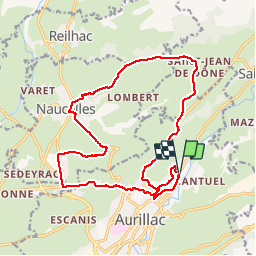
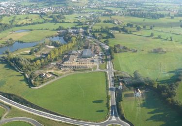
Randonnée V.T.T. de 18,8 km à découvrir à Auvergne-Rhône-Alpes, Cantal, Aurillac. Cette randonnée est proposée par millot15.

Description

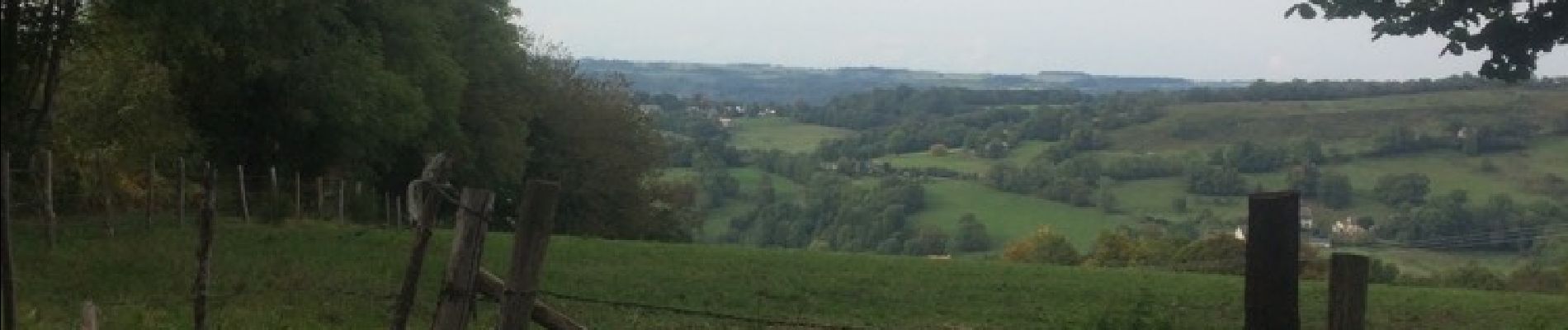
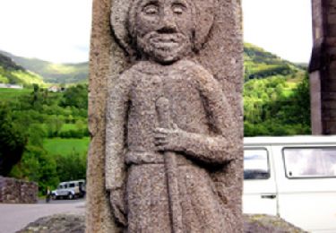
Ballade très sympa . Vue sur les monts du Cantal . Descente sympa sur Naucelle

Profil altimétrique

Photos

Localisation

Pays :
France
Région :
Auvergne-Rhône-Alpes
Département/Province :
Cantal
Commune :
Aurillac
Localité :
Unknown
Départ:(Dec)
Départ:(UTM)
457167 ; 4976450 (31T) N.

Randonnées à proximité

Randonnée A pied Arpajon-sur-Cère - Puy de Vaurs - Photo
A pied
PRO

A pied

Facile
Arpajon-sur-Cère, Auvergne-Rhône-Alpes, Cantal, France
8 km | 11,7 km-effort
2h 40min
Non
Randonnée Marche Reilhac - Don du sang Reilhac - Photo
Marche
alexecolo15

Marche

Très facile
(1)
Reilhac, Auvergne-Rhône-Alpes, Cantal, France
6,7 km | 9,1 km-effort
1h 19min
Oui
Randonnée Marche Aurillac - Aurillac Cueille Saint Jean de Done - Photo
Marche
alainlissac

Marche

Moyen
(1)
Aurillac, Auvergne-Rhône-Alpes, Cantal, France
20 km | 27 km-effort
6h 22min
Non
Randonnée V.T.T. Naucelles - VTT au départ de Naucelles - Photo
V.T.T.
tracegps

V.T.T.

Difficile
(2)
Naucelles, Auvergne-Rhône-Alpes, Cantal, France
41 km | 54 km-effort
4h 30min
Oui
Randonnée Course à pied Aurillac - Marathon de Berganty 2012 - Aurillac - Photo
Course à pied
tracegps

Course à pied

Très difficile
Aurillac, Auvergne-Rhône-Alpes, Cantal, France
46 km | 69 km-effort
5h 30min
Oui
Randonnée Course à pied Aurillac - Au départ d'Aurillac - Photo
Course à pied
tracegps

Course à pied

Moyen
(1)
Aurillac, Auvergne-Rhône-Alpes, Cantal, France
15,9 km | 18,6 km-effort
1h 30min
Oui
Randonnée Marche Aurillac - Au départ d'Aurillac - Photo
Marche
tracegps

Marche

Difficile
Aurillac, Auvergne-Rhône-Alpes, Cantal, France
15,9 km | 18,6 km-effort
4h 0min
Oui
Randonnée Marche Aurillac - La Via Arverna (Aurillac -  Laroquebrou)  - Photo
Marche
tracegps

Marche

Difficile
Aurillac, Auvergne-Rhône-Alpes, Cantal, France
35 km | 42 km-effort
9h 15min
Non
Randonnée V.T.T. Aurillac - Autour de Vézac par le Pont de Couffin - Aurillac - Photo
V.T.T.
tracegps

V.T.T.

Difficile
Aurillac, Auvergne-Rhône-Alpes, Cantal, France
35 km | 48 km-effort
3h 30min
Oui


Fermer
Mes abonnements