Tocht Stappen Villers-la-Ville - VILLERS-LA-VILLE (Les Crèkions) - Photo

VILLERS-LA-VILLE (Les Crèkions)

 GerardBouche
GerardBouche

Gebruiker

© OpenStreetMap contributors
Lengte
Lengte
10,6 km
Max. hoogte
Max. hoogte
160 m
Positief hoogteverschil
195 m
Km-Effort
Km-Effort  
13,2 km
Min. hoogte
Min. hoogte
78 m
Negatief hoogteverschil
197 m
Boucle
Boucle
Ja
Datum van aanmaak :
2018-04-17 12:57:38.06
Laatste wijziging :
2018-04-17 12:57:38.06

(0 Bericht)

Stappen
Stappen
2h51
Moeilijkheid : Gemakkelijk

Scan deze QR-code om de tocht te openen in de SityTrail-applicatie

Gratisgps-wandelapplicatie

Logo SityTrail SityTrail

IGN / Geografische instituten

SityTrail uit de App Store downloaden SityTrail uit Google Play downloaden

Logo SityTrail SityTrail World

De wereld gaat voor u open

SityTrail uit de App Store downloaden SityTrail uit Google Play downloaden SityTrail op Huawei AppGallery downloaden

Over ons

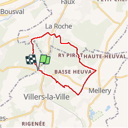
Tocht Stappen van 10,6 km beschikbaar op Wallonië, Waals-Brabant, Villers-la-Ville. Deze tocht wordt voorgesteld door GerardBouche.

Beschrijving

Très belle randonnée au départ des ruines par le Bois Ste-Catherine, le hameau de Tangissart et le Bois d'Hé.
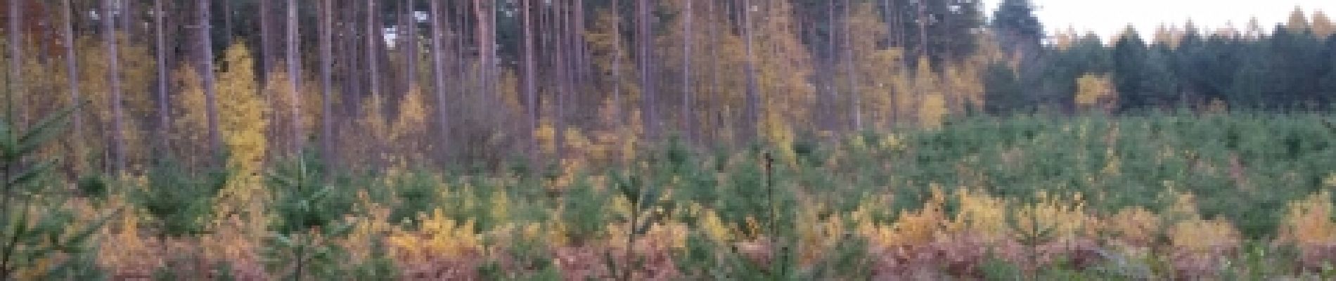
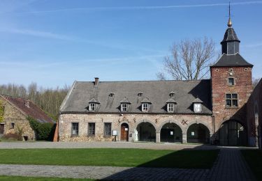
Hoogteprofiel

Foto's

Plaatsbepaling

Land:
Belgium
Regio :
Wallonië
Departement/Provincie :
Waals-Brabant
Gemeente :
Villers-la-Ville
Locatie:
Villers-la-Ville
Vertrek:(Dec)
Vertrek:(UTM)
608072 ; 5605407 (31U) N.

Wandeltochten in de omgeving

Tocht Stappen Villers-la-Ville - RB-Bw-10-raccourci 2 - À travers campagnes et forêts, autour des ruines d’une prestigieuse abbaye - Photo
Stappen
PRO

Stappen

Moeilijk
(25)
Villers-la-Ville, Wallonië, Waals-Brabant, Belgium
13,3 km | 16,4 km-effort
3h 44min
Ja
Tocht Stappen Villers-la-Ville - RB-Bw-10-raccourci 1 - À travers campagnes et forêts, autour des ruines d’une prestigieuse abbaye  - Photo
Stappen
PRO

Stappen

Zeer moeilijk
(12)
Villers-la-Ville, Wallonië, Waals-Brabant, Belgium
24 km | 30 km-effort
6h 43min
Ja
Tocht Stappen Genepiën - RB-Bw-09 Raccourci 1 & 2 - Autour de la jeune Dyle et de ses affluents - Photo
Stappen
PRO

Stappen

Moeilijk
(11)
Genepiën, Wallonië, Waals-Brabant, Belgium
9,7 km | 12,5 km-effort
2h 50min
Ja
Tocht Stappen Genepiën - RB-Bw-09 Raccourci 1 - Autour de la jeune Dyle et de ses affluents - Photo
Stappen
PRO

Stappen

Moeilijk
(11)
Genepiën, Wallonië, Waals-Brabant, Belgium
13,2 km | 16,9 km-effort
3h 49min
Ja
Tocht Stappen Villers-la-Ville - RB-Bw-10 -À travers campagnes et forêts, autour des ruines d’une prestigieuse abbaye  - Photo
Stappen
PRO

Stappen

Zeer moeilijk
(6)
Villers-la-Ville, Wallonië, Waals-Brabant, Belgium
26 km | 32 km-effort
7h 15min
Ja
Tocht Stappen Genepiën - RB-Bw-09 - Autour de la jeune Dyle et de ses affluents - Photo
Stappen
PRO

Stappen

Medium
(9)
Genepiën, Wallonië, Waals-Brabant, Belgium
22 km | 28 km-effort
5h 59min
Ja
Tocht Stappen Genepiën - Genappe - Circuit Natura 2000, des sites qui valent le détour ! - Bw03 - Photo
Stappen
GUIDE+

Stappen

Medium
(6)
Genepiën, Wallonië, Waals-Brabant, Belgium
7,9 km | 9,7 km-effort
2h 6min
Ja
Tocht Stappen Court-Saint-Étienne - GG2-Bw-22_La-Roche-Blanmont_2021-11-04 - Photo
Stappen
PRO

Stappen

Medium
(2)
Court-Saint-Étienne, Wallonië, Waals-Brabant, Belgium
21 km | 26 km-effort
5h 51min
Neen
Tocht Stappen Villers-la-Ville - Balade forestière à Villers la Ville - Photo
Stappen
GUIDE
Desrumaux

Stappen

Gemakkelijk
(5)
Villers-la-Ville, Wallonië, Waals-Brabant, Belgium
11,5 km | 14,1 km-effort
3h 0min
Ja


Sluiten
Mijn abonnementen