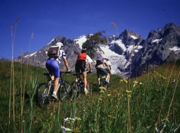
Freissinières, Hautes-Alpes, Fiets: Top van de beste wandelroutes, trajecten, tochten en wandelingen

12 opmerkingen

Freissinières: Ontdek de beste tochten: 14 mountainbike. Al deze tochten, trajecten, routes en outdoor activiteiten zijn beschikbaar in onze SityTrail-apps voor smartphones en tablets.


De beste trajecten (14)
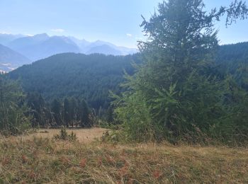
Tocht Mountainbike Freissinières - traversée fressiniere reotier - Photo
Mountainbike 35.723
Km

Mountainbike

Moeilijk
Freissinières, Provence-Alpes-Côte d'Azur, Hautes-Alpes, France
36 km | 52 km-effort
3h 32min
1214 m
1214 m
Ja
tchoua

Tocht Mountainbike Freissinières - Espace VTT FFC Pays des Ecrins - Circuit n°09 - Le Col des Combes - Photo
Mountainbike 13.925
Km

Mountainbike

Moeilijk
Freissinières, Provence-Alpes-Côte d'Azur, Hautes-Alpes, France
13,9 km | 22 km-effort
1h 30min
587 m
588 m
Ja
tracegps

Tocht Mountainbike Freissinières - Espace VTT FFC Pays des Ecrins - Circuit n°08 - La Plaine de Freissinières - Photo
Mountainbike 7.076
Km

Mountainbike

Medium
Freissinières, Provence-Alpes-Côte d'Azur, Hautes-Alpes, France
7,1 km | 8,6 km-effort
30min
117 m
118 m
Ja
tracegps

Tocht Mountainbike Freissinières - Bois De Monsieur - Photo
Mountainbike 55.05
Km

Mountainbike

Medium
Freissinières, Provence-Alpes-Côte d'Azur, Hautes-Alpes, France
55 km | 84 km-effort
1h 42min
2209 m
2113 m
Neen
markford

Tocht Mountainbike Freissinières - Bois De Monsieur - Photo
Mountainbike 17.311
Km

Mountainbike

Medium
Freissinières, Provence-Alpes-Côte d'Azur, Hautes-Alpes, France
17,3 km | 26 km-effort
1h 41min
640 m
639 m
Ja
markford

Tocht Mountainbike Freissinières - Valley Freissinieres - Photo
Mountainbike 11.721
Km

Mountainbike

Gemakkelijk
Freissinières, Provence-Alpes-Côte d'Azur, Hautes-Alpes, France
11,7 km | 14,5 km-effort
58min
204 m
212 m
Ja
markford

Tocht Mountainbike Freissinières - Bois Du Bouchet - Photo
Mountainbike 18.974
Km

Mountainbike

Medium
Freissinières, Provence-Alpes-Côte d'Azur, Hautes-Alpes, France
19 km | 29 km-effort
1h 53min
766 m
770 m
Neen
markford

Tocht Mountainbike Freissinières - Col  d'Anon - Photo
Mountainbike 26.302
Km

Mountainbike

Moeilijk
Freissinières, Provence-Alpes-Côte d'Azur, Hautes-Alpes, France
26 km | 44 km-effort
2h 47min
1351 m
1264 m
Neen
markford

Tocht Mountainbike Freissinières - Clot du puy/Cret du Rortie - Photo
Mountainbike 14.014
Km

Mountainbike

Zeer moeilijk
Freissinières, Provence-Alpes-Côte d'Azur, Hautes-Alpes, France
14 km | 23 km-effort
1h 30min
703 m
709 m
Ja
markford

Tocht Mountainbike Freissinières - Col des Combes - Photo
Mountainbike 10.076
Km

Mountainbike

Gemakkelijk
Freissinières, Provence-Alpes-Côte d'Azur, Hautes-Alpes, France
10,1 km | 15,4 km-effort
54min
259 m
816 m
Neen
vieuxcochonsseillonnais

Tocht Mountainbike Freissinières -  Val haut - Photo
Mountainbike 11.212
Km

Mountainbike

Medium
Freissinières, Provence-Alpes-Côte d'Azur, Hautes-Alpes, France
11,2 km | 20 km-effort
1h 56min
872 m
111 m
Neen
vieuxcochonsseillonnais

Tocht Mountainbike Freissinières - Les Ali rands - Photo
Mountainbike 6.705
Km

Mountainbike

Moeilijk
Freissinières, Provence-Alpes-Côte d'Azur, Hautes-Alpes, France
6,7 km | 15,4 km-effort
1h 42min
649 m
647 m
Ja
vieuxcochonsseillonnais

Tocht Mountainbike Freissinières - jour2 - Photo
Mountainbike 18.857
Km

Mountainbike

Freissinières, Provence-Alpes-Côte d'Azur, Hautes-Alpes, France
18,9 km | 28 km-effort
2h 55min
625 m
941 m
Neen
remydg

Tocht Mountainbike Freissinières - Bois De Monsieur - Photo
Mountainbike 55.049
Km

Mountainbike

Medium
Freissinières, Provence-Alpes-Côte d'Azur, Hautes-Alpes, France
55 km | 84 km-effort
1h 42min
2208 m
2112 m
Neen
markford

14 tochten weergegeven op 14

Gratisgps-wandelapplicatie

Logo SityTrail SityTrail

IGN / Geografische instituten

SityTrail uit de App Store downloaden SityTrail uit Google Play downloaden

Logo SityTrail SityTrail World

De wereld gaat voor u open

SityTrail uit de App Store downloaden SityTrail uit Google Play downloaden SityTrail op Huawei AppGallery downloaden

Activiteiten

Sluiten
Mijn abonnementen