Tocht Mountainbike Cabrières - Espace VTT FFC Salagou - Circuit n° 6 - Les Crozes - Photo

Espace VTT FFC Salagou - Circuit n° 6 - Les Crozes

 tracegps
tracegps

Gebruiker

© OpenStreetMap contributors
Lengte
Lengte
17,2 km
Max. hoogte
Max. hoogte
390 m
Positief hoogteverschil
457 m
Km-Effort
Km-Effort  
23 km
Min. hoogte
Min. hoogte
102 m
Negatief hoogteverschil
458 m
Boucle
Boucle
Ja
Datum van aanmaak :
2014-12-10 00:00:00.0
Laatste wijziging :
2014-12-10 00:00:00.0

(1 Bericht)

Mountainbike
Mountainbike
1h30
Moeilijkheid : Moeilijk

Scan deze QR-code om de tocht te openen in de SityTrail-applicatie

Gratisgps-wandelapplicatie

Logo SityTrail SityTrail

IGN / Geografische instituten

SityTrail uit de App Store downloaden SityTrail uit Google Play downloaden

Logo SityTrail SityTrail World

De wereld gaat voor u open

SityTrail uit de App Store downloaden SityTrail uit Google Play downloaden SityTrail op Huawei AppGallery downloaden

Over ons

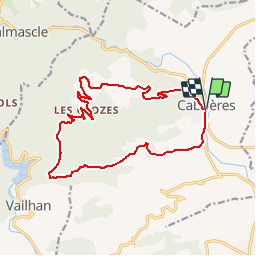
Tocht Mountainbike van 17,2 km beschikbaar op Occitanië, Hérault, Cabrières. Deze tocht wordt voorgesteld door tracegps.

Beschrijving

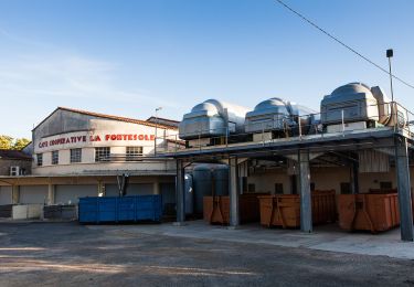
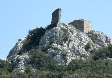
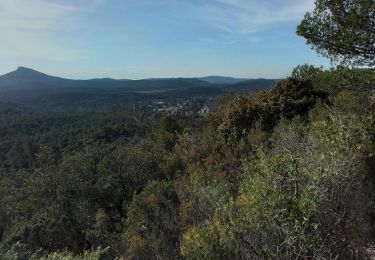
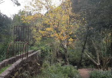
Espace VTT -FFC du Salagou no 51 Circuit labellisé par la Fédération Française de Cyclisme. Les collines situées à l’ouest de Cabrières, très boisées, vous ouvriront les portes des chataigneraies de basse altitude, lieux frais où cohabitent salamandres et champignons. De grandes populations de sangliers y trouvent également refuge…

Hoogteprofiel

Foto's

Plaatsbepaling

Land:
France
Regio :
Occitanië
Departement/Provincie :
Hérault
Gemeente :
Cabrières
Locatie:
Unknown
Vertrek:(Dec)
Vertrek:(UTM)
529385 ; 4824963 (31T) N.

Opmerkingen

Gelieve in te loggen om een commentaar of een beoordeling achter te laten


Merci bcp ce fut un plaisir sortie au top👌🏼🙂


Wandeltochten in de omgeving

Tocht Noords wandelen Lieuran-Cabrières - 2021-02-16_16h31m06_ITILAR034V50GFRQ - Photo
Noords wandelen
mdauzat

Noords wandelen

Gemakkelijk
(1)
Lieuran-Cabrières, Occitanië, Hérault, France
7,9 km | 11,2 km-effort
Onbekend
Ja
Tocht Stappen Vailhan - Vailhan ses ruines, son chateau et sa vierge - Photo
Stappen
mrclic34

Stappen

Heel gemakkelijk
(4)
Vailhan, Occitanië, Hérault, France
9,9 km | 13,6 km-effort
2h 53min
Ja
Tocht Stappen Mourèze - Montagne de Liausson depuis Mourèze - Photo
Stappen
philvidal

Stappen

Moeilijk
(1)
Mourèze, Occitanië, Hérault, France
8,3 km | 13,4 km-effort
2h 45min
Ja
Tocht Te voet Fontès - Fontès - Vignes et Volcans - Le Céressou - Photo
Te voet
PRO

Te voet

Gemakkelijk
Fontès, Occitanië, Hérault, France
11 km | 15,9 km-effort
3h 36min
Ja
Tocht Te voet Cabrières - Sentier du Temple - Photo
Te voet
PRO

Te voet

Gemakkelijk
Cabrières, Occitanië, Hérault, France
9,3 km | 12,9 km-effort
2h 56min
Ja
Tocht Stappen Vailhan - Vailhan - les crozes - Photo
Stappen
hvezinet

Stappen

Medium
(1)
Vailhan, Occitanië, Hérault, France
13 km | 17,7 km-effort
3h 57min
Neen
Tocht Stappen Villeneuvette - Villeneuvette Mourèze - Photo
Stappen
JEANJOSY

Stappen

Moeilijk
Villeneuvette, Occitanië, Hérault, France
12,3 km | 16,6 km-effort
3h 46min
Ja
Tocht Stappen Mourèze - 34 moureze 10.07.23 - Photo
Stappen
himba26100

Stappen

Gemakkelijk
Mourèze, Occitanië, Hérault, France
4,8 km | 6,9 km-effort
2h 5min
Neen
Tocht Noords wandelen Villeneuvette - Villeneuvette - Photo
Noords wandelen
mdauzat

Noords wandelen

Gemakkelijk
(1)
Villeneuvette, Occitanië, Hérault, France
8,2 km | 10,4 km-effort
1h 55min
Ja


Sluiten
Mijn abonnementen