


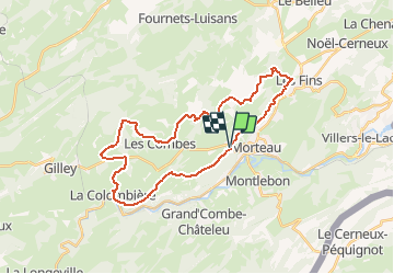
Espace VTT FFC Val de Morteau - Circuit n° 86 - La Motte

tracegps
Gebruiker


3h15
Moeilijkheid : Moeilijk

Gratisgps-wandelapplicatie
 SityTrail
IGN / Geografische instituten
SityTrail Plus
De wereld gaat voor u open
Over ons
Tocht Mountainbike van 31 km beschikbaar op Bourgondië-Franche-Comté, Doubs, Morteau. Deze tocht wordt voorgesteld door tracegps.
Beschrijving
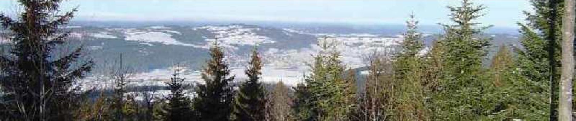
Espace VTT FFC Val de Morteau Circuit labellisé par la Fédération Française de Cyclisme. Parcours assez roulant empruntant alternativement routes, chemins et quelques sentiers plus techniques. A voir, le belvédère du Mont Vouillot dominant le Val de Morteau, les rochers d’escalade de la Corchère, le village de Remonot avec sa grotte chapelle.
Foto's

Plaatsbepaling
Opmerkingen
