


les balcons de l'ibie2 (reduit)

dufland
Gebruiker

Lengte
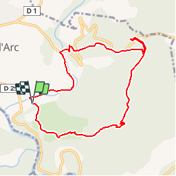
9,4 km

Max. hoogte
331 m

Positief hoogteverschil
318 m
Km-Effort
13,6 km

Min. hoogte
82 m

Negatief hoogteverschil
322 m
Boucle
Ja
Datum van aanmaak :
2019-04-16 12:59:02.232
Laatste wijziging :
2019-04-16 12:59:02.341
2h51
Moeilijkheid : Medium

Gratisgps-wandelapplicatie
 SityTrail
IGN / Geografische instituten
SityTrail Plus
De wereld gaat voor u open
Over ons
Tocht Stappen van 9,4 km beschikbaar op Auvergne-Rhône-Alpes, Ardèche, Vallon-Pont-d'Arc. Deze tocht wordt voorgesteld door dufland.
Beschrijving
origine Visorando
Plaatsbepaling
Land:
France
Regio :
Auvergne-Rhône-Alpes
Departement/Provincie :
Ardèche
Gemeente :
Vallon-Pont-d'Arc
Locatie:
Unknown
Vertrek:(Dec)
Vertrek:(UTM)
612033 ; 4916672 (31T) N.
Opmerkingen