


Chemin de St-Guilhem 4

cron
Gebruiker
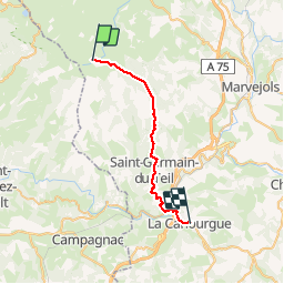

Lengte
26 km

Max. hoogte
1397 m

Positief hoogteverschil
384 m
Km-Effort
34 km

Min. hoogte
523 m

Negatief hoogteverschil
1146 m
Boucle
Neen
Datum van aanmaak :
2019-01-15 16:40:23.905
Laatste wijziging :
2019-01-15 16:40:23.905
6h51
Moeilijkheid : Medium

Gratisgps-wandelapplicatie
 SityTrail
IGN / Geografische instituten
SityTrail Plus
De wereld gaat voor u open
Over ons
Tocht Stappen van 26 km beschikbaar op Occitanië, Lozère, Les Salces. Deze tocht wordt voorgesteld door cron.
Plaatsbepaling
Land:
France
Regio :
Occitanië
Departement/Provincie :
Lozère
Gemeente :
Les Salces
Locatie:
Unknown
Vertrek:(Dec)
Vertrek:(UTM)
507429 ; 4935867 (31T) N.
Opmerkingen