


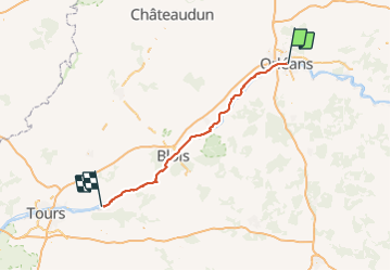
2018-09-29 Orléans - Amboise

Lucquiaud
Gebruiker

Lengte
108 km

Max. hoogte
112 m

Positief hoogteverschil
787 m
Km-Effort
119 km

Min. hoogte
55 m

Negatief hoogteverschil
839 m
Boucle
Neen
Datum van aanmaak :
2019-01-15 16:59:38.798
Laatste wijziging :
2019-01-15 16:59:38.798
8h09
Moeilijkheid : Gemakkelijk

Gratisgps-wandelapplicatie
 SityTrail
IGN / Geografische instituten
SityTrail Plus
De wereld gaat voor u open
Over ons
Tocht Mountainbike van 108 km beschikbaar op Centre-Val de Loire, Loiret, Orléans. Deze tocht wordt voorgesteld door Lucquiaud.
Plaatsbepaling
Land:
France
Regio :
Centre-Val de Loire
Departement/Provincie :
Loiret
Gemeente :
Orléans
Locatie:
Unknown
Vertrek:(Dec)
Vertrek:(UTM)
418975 ; 5305735 (31T) N.
Opmerkingen