Tocht Stappen Villeneuve-les-Corbières - La Récaoufa ou Ste Raphine  - Photo

La Récaoufa ou Ste Raphine

 jcmartin
jcmartin

Gebruiker

© OpenStreetMap contributors
Lengte
Lengte
19 km
Max. hoogte
Max. hoogte
372 m
Positief hoogteverschil
574 m
Km-Effort
Km-Effort  
27 km
Min. hoogte
Min. hoogte
94 m
Negatief hoogteverschil
572 m
Boucle
Boucle
Ja
Datum van aanmaak :
2019-01-15 20:24:06.551
Laatste wijziging :
2019-01-15 20:24:06.551

(1 Bericht)

Stappen
Stappen
5h37
Moeilijkheid : Medium

Scan deze QR-code om de tocht te openen in de SityTrail-applicatie

Gratisgps-wandelapplicatie

Logo SityTrail SityTrail

IGN / Geografische instituten

SityTrail uit de App Store downloaden SityTrail uit Google Play downloaden

Logo SityTrail SityTrail World

De wereld gaat voor u open

SityTrail uit de App Store downloaden SityTrail uit Google Play downloaden SityTrail op Huawei AppGallery downloaden

Over ons

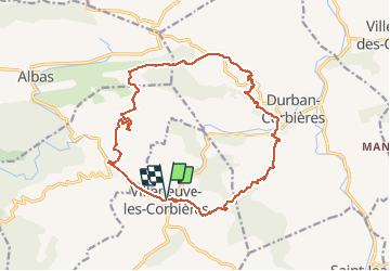
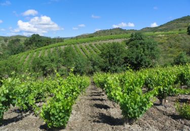
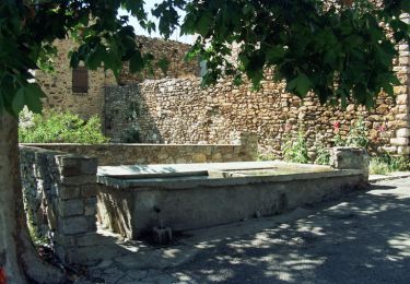
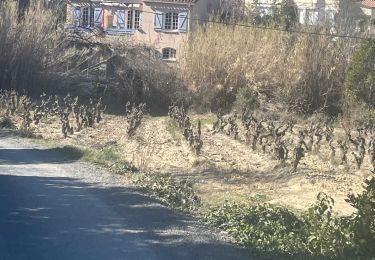
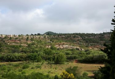
Tocht Stappen van 19 km beschikbaar op Occitanië, Aude, Villeneuve-les-Corbières. Deze tocht wordt voorgesteld door jcmartin.

Beschrijving

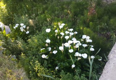
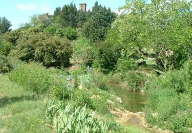
Randonnée en boucle dans les Corbières au départ de Villeneuve des Corbières, Durban Corbières et Cascastel des Corbières

Hoogteprofiel

Foto's

POI's

POI Durban-Corbières - Point 9 - Photo
jcmartin
DURBAN-CORBIÈRES 
POI Cascastel-des-Corbières - Point 13 - Photo
jcmartin
CASCASTEL-DES-CORBIÈRES 
POI Durban-Corbières - Intersection  - Photo
jcmartin
DURBAN-CORBIÈRES 

Plaatsbepaling

Land:
France
Regio :
Occitanië
Departement/Provincie :
Aude
Gemeente :
Villeneuve-les-Corbières
Locatie:
Unknown
Vertrek:(Dec)
Vertrek:(UTM)
481794 ; 4758334 (31T) N.

Opmerkingen

Gelieve in te loggen om een commentaar of een beoordeling achter te laten


Wandeltochten in de omgeving

Tocht Stappen Cascastel-des-Corbières - La Source de la Berre -  Cascastel des Corbières - Photo
Stappen
tracegps

Stappen

Medium
(1)
Cascastel-des-Corbières, Occitanië, Aude, France
16 km | 21 km-effort
4h 30min
Ja
Tocht Stappen Albas - En Corbières - La Ronde au coeur des Corbières - Albas à Quintillan - Photo
Stappen
tracegps

Stappen

Medium
(1)
Albas, Occitanië, Aude, France
10 km | 14,6 km-effort
3h 30min
Neen
Tocht Stappen Embres-et-Castelmaure - Embres et Castelmaure - Photo
Stappen
ombrabella

Stappen

Medium
Embres-et-Castelmaure, Occitanië, Aude, France
11,2 km | 14,6 km-effort
3h 0min
Ja
Tocht Stappen Albas - Albas tour du Bouichas  - Photo
Stappen
jcmartin

Stappen

Gemakkelijk
Albas, Occitanië, Aude, France
9,5 km | 14,2 km-effort
3h 35min
Ja
Tocht Ezelwandeling Durban-Corbières - Cathare 2 de Durban à Tuchan - Photo
Ezelwandeling
jeff2

Ezelwandeling

Medium
Durban-Corbières, Occitanië, Aude, France
28 km | 39 km-effort
6h 50min
Neen
Tocht Stappen Durban-Corbières - M020-Durban Corbières - Photo
Stappen
Polo-31

Stappen

Medium
Durban-Corbières, Occitanië, Aude, France
19,7 km | 28 km-effort
5h 50min
Ja
Tocht Stappen Durban-Corbières - M014-Durban Corbières - Photo
Stappen
Polo-31

Stappen

Medium
Durban-Corbières, Occitanië, Aude, France
13,4 km | 18,1 km-effort
3h 48min
Ja
Tocht Stappen Albas - En Corbières - Autour du Bouichas - Albas - Photo
Stappen
tracegps

Stappen

Medium
Albas, Occitanië, Aude, France
6,7 km | 10,9 km-effort
2h 30min
Neen
Tocht Stappen Albas - Albas Christophe  - Photo
Stappen
GUIDE
Ada11

Stappen

Medium
Albas, Occitanië, Aude, France
17,5 km | 25 km-effort
6h 45min
Ja


Sluiten
Mijn abonnementen